Download
1 / 19
190 likes | 207 Views
This lecture provides an outline of GIS concepts, focusing on ArcCatalog functions, geodatabases, and aerial photography. Topics covered include basic ArcCatalog functions, managing properties and metadata, creating new files, importing and exporting data, georeferencing scanned paper documents, and using orthophotography for accurate representation of distances.

E N D
Outline • ArcCatalog Functions • Geodatabases • Aerial Photography
ArcCatalog • Open ArcCatalog
ArcCatalog basic functions • Copy, paste, rename, etc. • View and edit properties • View and edit metadata • Create new files
View and edit properties • Projections, fields, etc.
Create new files • Geodatabases, shapefiles, tables, etc.
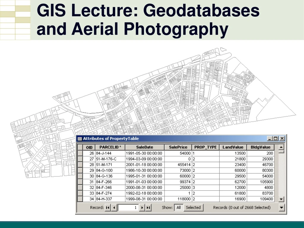
Geodatabases • Manage features, tables, images inside a database management system (DBMS)
Import Data Into Geodatabase • Shapefiles, Excel tables, aerial photos
Orthophotography • Digital imagery in which distortion from the camera angle and topography have been removed, thus equalizing the distances represented on the image
Scanned Paper Documents • Paper (historic) maps • Scanned maps and raster images • Need to be georeferenced • Convert to vector features
Georeferencing • overlay the raster on vector layer(s) • identify common locations • Georeferencing toolbar • add control points • fits your raster to its proper location!
Summary • ArcCatalog Functions • Geodatabases • Aerial Photography