Download
1 / 21
210 likes | 345 Views
An interactive algorithm to nowcast snowfall rates from lake‐effect snow using both satellite and model data. 2013 Great Lakes Operational Meteorology Workshop Chung K K 1 & Guilong. Li 2 1 National Lab for Nowcasting and Remote Sensing Meteorology 2 Atmospheric Science and Application Unit

E N D
An interactive algorithm to nowcast snowfall rates from lake‐effect snow using both satellite and model data 2013 Great Lakes Operational Meteorology Workshop Chung K K1 & Guilong. Li2 1National Lab for Nowcasting and Remote Sensing Meteorology 2Atmospheric Science and Application Unit Meteorological Service of Canada Environment Canada
Objective: To present a computer algorithm to nowcast snowfall rates from lake-effect snow using both satellite and model data Outline: Background The idea Methodology Results Conclusion and Future Works
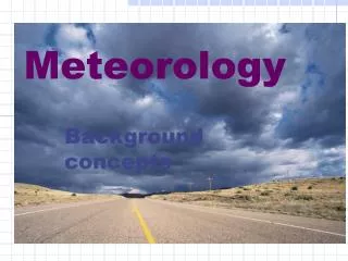
Background Impact of lake-effect snow: • Heavy lake-effect snow bands can pose a significant weather hazard to the public causing airport shutdown and dangerous driving conditions Forecast of lake-effect snow: • NWP model not able to resolve this small scale phenomenon Nowcast of lake-effect snow: • Satellite • Radar • Surface observations The need: A real-time estimation of the actual snowfall rates from snow bands to help alert the public of what is happening Dec 07, 2010 at 4:05 pm London, Ontario From theweathernetwork.com
An interactive algorithm to nowcast snowfall rates from lake-effect snow The algorithm first takes the forecaster’s input on snow bands locations, then the algorithm will use both the model and satellite data to calculate snowfall rates along a snow band. The result is a better nowcast of real-time snowfall rates to help improve warnings and alert the public of heavy snow
The Idea A side view of a snow band • A line of snow squall viewed from a satellite is a snapshot of the time evolution of cumulus from the initial to mature stage. • The dynamic and thermodynamic forcings that generate a lake snow squall are reflected by cloud top cooling rates ( ascent rates) during the developing stage. • How much snow falling out of the snow squall is determined by: air mass ascent rates, available moisture, snow-liquid ratio, the thickness of the clouds, dry air entrainment, and others. -21 °C Cold air mass -18 °C 60 km/hr -12 °C -5 °C 50 km/hr 2 °C Unstable boundary layer
MethodologySteps 1 & 2 Satellite data retrieved: cloud top temperature as a function of distance Step 2: Calculate dT/dx along the developing section of the snow squall Step 1: Forecasters to identify snow squalls Cloud top 56 km/hr dT/dx = -0.26 °C/km Slope is determined using a 5-points running average Cumulus development stage
MethodologyStep 3: Retrieve model sounding data at different points along the line of snow squall • Lake modified air temperature • Lift the parcel to EL (i.e. to • sat-derived cloud top • temperature) • Saturated lapse rate • Cloud thickness • Precipitation liquid • Boundary winds
MethodologyStep 4: Calculations of snow rates • We know temperature gradient dT/dx along the “development section” of the snow squall and so we can calculate the cloud top cooling rates [dT/dt = U * dT/dx]. • We can calculate the mean saturated adiabatic lapse rate within the boundary layer γw from the sounding data. • We can calculate the parcel vertical velocity (ω) by (dT/dt)/γw. • We can calculate cloud condensed water (q in gm-3) from sounding data as well as the vertical moisture fluxes at different points along the snow squall (flux = q * ω). • We can then calculate the snowfall rates at different points along the snow squall up to the shoreline using : snowfall intensity = vertical moisture flux * snow-liquid ratio. • Note: snow to liquid ratio used is 1:15
MethodologyStep 5: Inland snowfall rates modification The snowfall rates at any point (x) inland along the snow band is parameterised by: Point: x Point: o At point o: Snowfall rate = So Cloud top temp = To LCL temp = TLCL At any point x inland: Snowfall rate = Sx Cloud top temp = Tx LCL temp = TLCL o x
Overview Model sounding data (retrieved from CMC) + Program to calculate various parameters + Snowfall rates along the snow band INPUT: (Lat, Long) for squall lines. Forecasters to identify snow squalls program to generate cloud top IR temperatures along the snow band. Output: Tabular/ Graphic Satellite Data
The algorithm is applied to different lake-effect snow cases
Case 1: December 07, 2010 at 1815Z U850 = 56 km/h YXU: 1703-1804Z ~ 1 cm 1804-1905Z = 6 cm WGD: 1706-1807Z ~ 3 cm 1807-1904Z ~ light WGD YXU 6 hour snowfall (18 – 00Z)
Case 2: December 08, 2010 at 1215Z U850 = 46 km/h YXU: 1103-1203Z ~ no snow obs 1203-1303Z ~ 1 cm WGD: 1110-1206Z = ??/SOG2 1206-1308Z ~ 9 cm WGD YXU Higher Layer clouds? 6 hour snowfall (12 – 18Z)
Case 3: January 03, 2012 at 0245Z U850 = 56 km/h Instantaneous snow rate from radar YXU: 0200-0300Z = 4 cm 0300-0400Z = 2 cm WGD: No Obs Note: heaviest echoes not right over YXU
Case 4: January 03, 2012 at 1145Z U850 = 56 km/h YXU: 1100-1200Z = 4 cm 1200-1300Z = 4 cm Instantaneous snow rate from radar WGD: No snow obs Note: heavies echoes right over YXU
Case 5: February 21, 2013 at 0915Z U850 ~ 46 km/h vv ~ 0.3 m/s
Conclusion Forecaster inputs snow band locations • An interactive algorithm is developed to combine forecaster’s input on snow bands locations with model and satellite data to produce a better nowcast of snowfall rates from lake-effect snow. • The algorithm is applied to several snow squall events and produce some “satisfactory” results. • This algorithm helps improve warnings and alert the public of heavy snow Algorithm does the calculations Output Snowfall rates along snow band
Future works • To incorporate a more feasible snow-liquid ratio scheme into the algorithm • To use higher resolution model data • To use more observations for evaluations • Other suggestions? thestar.blogs.com
References Byrd, G.P., and D. Schleede, 1998: Mesocale Model Simulation of the 4-5 January 1995 Lake-Effect Snowstorm. Weather and Forecasting, 13, 893-920. Ellenton, G.E., and M.B. Danard, 1978: Inclusion of Sensible Heating in Convective Parameterization Applied to Lake-Effect Snow. Monthly Weather Review, 107, 551-565. Hjelmfelt, M.R., 1989: Numerical Study of the Influence of Environmental Conditions on Lake-Effect Snowstorms over Lake Michigan. Monthly Weather Review,118, 138-150. Hsu, H.M., 1987: Mesoscale Lake-effect Snowstorms in the Vicinity of Lake Michigan: Linear Theory and Numerical Simulatios. Journal of the Atmospheric Science, 40, 1019-1040. Kidder, Q. S., and T. H. Vander Haar, 1995: Satellite Meteorology. Academic Press Inc. Lavoie, R.L., 1972: A Meteoscale Numerical Model of Lake-Effect Storm. Journal of the Atmospheric Science, 1025-1040. Iribarne, J.V., and W.L. Godson, 1981: Atmospheric Thermodynamics. 2nd Edition. D. Reidel Publishing Compay. Liu, A.Q., and W.K. Moore, 2004: Lake-Effect Snowstorms over Southern Ontario, Canada, and Their Associated Synoptic-Scale Environment. Monthly Weather Review, 132, 2595-2609. Rogers, R.R., 1979: A Short Course in Cloud hysics. 2nd Edition, Pergamon Press Ltd. Questions?
Outline --- this slide will not be shown Objective • To present a computer algorithm to nowcast snowfall rates using both satellite and model data Introduction Opener • Lake-effect snow is a weather hazard to the public • It is very difficult to determine the snowfall rates from these heavy snow bands because they are narrow • Near real-time estimation of the actual snowfall rates from these snow bands help alert the public • Topic • To outline the formulation of this interactive algorithm to nowcast snowfall rates from lake-effect snow • To show a few examples to demonstrate how this algorithm works and how it perform - Thesis (idea convey) Forecasters’ expertise analysis on snow bands locations, combined with model and satellite data, can make a better nowcast of snowfall rates from lake-effect snow. A better nowcast of real-time snowfall rates help improve warnings and alert the public of heavy snow The Body • The idea behind this algorithm • Methodology: step 1 – locate the snow band • Methodology: step 2 – Retrieve cloud top temperature • Methodology: step 3 – Retrieve model sounding data • Methodology: step 4 – Snowfall rates over the lake • Methodology: Step 5 – Snowfall rates modification overland • Overview of the algorithm • Examples Conclusion • Restate the thesis - Same as above + events show how this algorithm works • Action for future works • Need a better snow-liquid ratio scheme • Use higher resolution model data