Download
1 / 21
210 likes | 335 Views
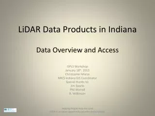
Uses of LiDAR Derived Data Products at WVDEP. West Virginia Association of Geospatial Professionals Conference May 9, 2012. Introduction.

E N D
Uses of LiDAR Derived Data Products at WVDEP West Virginia Association of Geospatial Professionals Conference May 9, 2012
Introduction • WVDEP’s TAGIS Unit established a rigorous in-house QC review and editing workflow and successfully produced derived data products (“deliverables”), including: • Intensity image • Breaklines • Digital elevation model (DEM) • ESRI elevation grid • Hillshade • 100 foot contours • 20foot contours • Slope and aspect datasets • Currently, there are deliverables still under construction, these are: • Contiguous, watershed-size 2 foot contour dataset • Vegetation canopy height dataset may yet be initiated • Building footprints dataset • The .LAS files covering the first deliverable area were provided to West Virginia View where they were recently made available to any interested party for download.
Received Deliverables from NRAC * 3rd 1st 2nd *Natural Resource Analysis Center Three deliverables so far Deliverable are watershed-based
LiDAR Derived Hillshade • Results of completion of the project’s first large, multi-county size hillshade • Expected uses several now confirmed • Subsidence • Portals • Refuse piles • Slips • Unexpected uses only one confirmed but it’s a biggie!
LiDAR Derived Hillshade subsidence 1 1 Related Sinks Major opening 2 3 2 3 Meters
Salt was King before Coal Only 8 miles from WVDEP’s headquarters is the town of Malden, WV. In Colonial America, salt was rare and very expensive. From 1806 to 1808, in present day Malden, David and Joseph Ruffner developed the world's first deep well drilling process. That area became known as the "Kanawha Salines“, a very wealthy industrial region on the frontier.
Salt Created the 1st Market for Coal • It was in connection with the salt industry that the coal industry of the Great Kanawha Valley was started. • John P. Turner, a New Yorker, discovered coal there and opened a mine in 1817 for the purpose of supplying the Kanawha Salines’ furnaces 600,000 bushels of salt were produced in 1814. • Professor William Barton Rogers, University of Virginia, reported in 1840 ninety furnaces along the Kanawha River • They made annually a million bushels of salt and … • consumed five million bushels or two hundred thousand tons of coal.
Coal and River Corridors Coal fired keelboats distributed salt in the Ohio Valley, the Mississippi Valley, and throughout President Jefferson's new Louisiana Territory. Salt was not the only commodity carried on our region's rivers as markets for coal opening up elsewhere resulted in its serious export too.
LiDAR Derived Hillshade portals DEP’s HQ What started it all … info about a nearby pre-Civil War - 1910 mine never located in the field
Hillshade and Suspected Portals … on a Roll Green vectors are West Virginia Geologic and Economic Survey’s coal outcrop dataset
Another Hillshade, Suspected Portals and Coal Outcrop Example
Hillshade and Old Mine Map Alignment Use of the LiDAR derived hillshade to adjust scale and orientation of scanned mine maps was totally unanticapted!
Going a Little Off the Deep End Portal Wise … Within an 8 mile radius of DEP’s Headquarters … more than 800 suspected old portals were found in just a few hours of looking. None are in the AML Inventory.
Hillshade and Traces of the Past Walnut Grove was a pre-civil war plantation owned by the Summer family.
Hillshade, History and Archeology Walnut Grove Area The new hillshade dataset also clearly shows the old trail system used by settlers and Native Americans sometimes called the Mary Ingles Trail. The site of log cabin.
Other Discoveries Using Hillshade Logan Airport Landslides Wildcat mines Underground mine fires
LiDAR Derived Hillshade difference grid Cuts Fills 2009 WVDEP 2003 FEMA Wyoming County has two LiDAR datasets
Public Access to LiDAR and Derived Datasets .LAS files now downloadable by any interested parties from West Virginia View. April roll out of an aggregated hillshade dataset from TAGIS’ Mining Data Tools.
Aggregated Hillshade and WVSAMB WVSAMB photogrammetrically-based hillshade is above and left of green lines. WVDEP’s LiDAR-based hillshade elsewhere