Download
1 / 18
190 likes | 505 Views
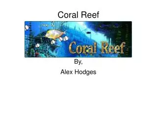
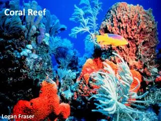
CORAL REEF MAPPING IN THE RED SEA (HURGHADA, EGYPT) BASED ON REMOTE SENSING. Presented by: Justin Prosper s0090444. Presentation outline. Introduction Reflectance model Atmospheric correction Ecological classification in general Study area Data collection

E N D
CORAL REEF MAPPING IN THE RED SEA (HURGHADA, EGYPT) BASED ON REMOTE SENSING Presented by: Justin Prosper s0090444
Presentation outline • Introduction • Reflectance model • Atmospheric correction • Ecological classification in general • Study area • Data collection • Methodologies (pre-processing and classification) • Post classification and results • Discussions and conclusions
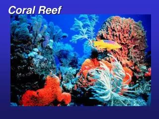
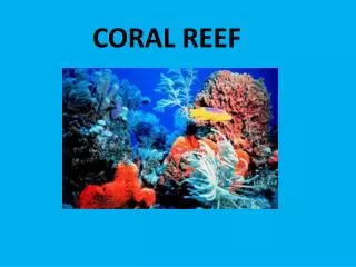
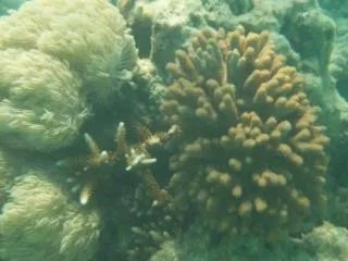
Introduction • Need for monitoring and assessment of coral reefs habitats – for better understanding how they are threatened and how to protect them • Remote sensing can provide information (composition of coral reefs, biophysical parameters of seas and oceans and changes over time) • Concentrate on the identification of bottom types (macro-algae, coral, sea-grass and corals on reef systems in the Red Sea using Lansat7 ETM.
Pre-classification (reflectance model) Before bottom type classification Li = Lsi + (ai * Rbi )e -f ki z (whereLi: Radiance at sensor) Lsi : Deep water radiance ai : Wavelength-dependent constant accounting for atmospheric effects and water surface reflection Rbi : Bottom reflectance f : Geometric factor accounting for path length trough water Ki : Effective attenuation coefficient of water for band i, accounting for absorption by water, phytoplankton, suspended particulates and DOM, and for scattering due to turbidity Z: Depth • Intensity of light decreases exp with depth • The attenuation is wavelength dependent (increasing with longer wavelength) • So if depth increases, the signal will be more attenuated and the distinction between classes will decrease. • Spectral radiance recorded at sensor will be dependent on reflectance and depth Source: (Vaderstraete et al, 2004)
Water column • Most important effect on signals for bottom type classification is the interaction with water column • Technique used for water column correction – depth invariant bottom index • Each pair of water penetrating bands has its index calculated and combined to form basis for classification • This method works only in clear water – coral reef in red sea occur in clear nutrient-poor waters
Classifications • The most appropriate method of classification for remote sensing in tropical areas was agreed to be a combination of both geomorphological and ecological • For ecological, only a coarse classification is necessary. This is based on 3 depth-invariant bottom indices. Texture layers to be added to improve classification (distinction between corals and sea grasses) • Geomorphological classification is based on visual digitising of different features • Low resolution of Landsat leads to misclassification • Contextual editing applied to improve accuracy (decision rules based on literature on corals classification worldwide) • The maps are then combined following a hierarchical classification scheme
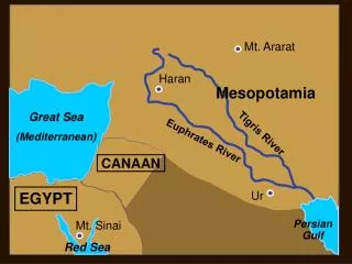
Study Area Source: (Vaderstraete et al, 2004)
Data collection Field surveys • 2 field surveys were previously carried out • 420 observations were made at sea with emphasis on depth measurements, and bottom type observations Coordinates of observations made using GPS Satellite imagery • Landsat ETM (2000) Geo-referencing • ILWIS (21 points collected during field survey used)
Pre-processing Atmospheric correction • The atmospheric correction is applied to the image before the depth-invariant bottom index is applied. • In deep water most light is absorbed. The signal received at sensor is almost made up of atmospheric path radiance and surface reflection. • The mean deep water radiance at sensor can be used to remove atmospheric effect and surface reflectance (assuming uniformity in atmosphere and reflectance) • An area where the depth is known to be more than 50m is selected to determine the MDW radiance
Pre-processing Water column • Formula is linearised by transforming the atmospherically corrected radiance using natural log (pixel value/depth) • Manipulation of newly obtained formula to obtain bottom reflectance • The unknown variables are obtained from the data itself. Sandy bottom type is used as it can be easily be identified by interpreter. Saturation and total absorption in one band should also be avoided upon pixel selection (shallow and deep water not used) • Selected pixel radiance plotted on bi-plot whereby slope gives the relative amount of attenuation in each band • Bottom types represented on such a bi-plot would have a similar slope with the y-intersect used as an index of bottom type independent of depth
Classification Ecological classification • Coarse resolution – coarse level classification • Supervised, maximum classification performed Source: (Vaderstraete et al, 2004)
Classification Geomorphological classification Source: (Vaderstraete et al, 2004)
Post classification Contextual editing • 3 decision rules applied to improve ecological classification • For e.g.: If the ecological class “sea grass dominated” occurs on the geomorphological class “fore reef”, it is replaced by the ecology class “coral dominated” Masks • As for misclassification on both land and in water, two masks were applied • Land: same as one as used for calculating the depth invariant bottom indices • Deep water: defined during geomorphological classification by areas with no significant reflection of the sea bed were noticed.
Results-Effects of water column • Comparisons of the graphs shows the effects of the water column correction • Exponential relationship is observed between depth and raw radiance • Depth is however almost independent with DIB indices Source: (Vaderstraete et al, 2004)
Geomorphological classification Ecological classification before contextual editing Ecological classification after contextual editing Hierarchical classification Source: (Vaderstraete et al, 2004)
Discussion • When water column correction is applied, map accuracy is improved significantly for Landsat TM bottom type classification • Texture layers combined with depth-invariant bottom indices improves the resulting classification map • Accuracy can be improved by using independent set observations concentrating on bottom types • Classification of bottom types cannot be 100% accurate due to the complexity of bottom types and unclear ecological habitat boundary lines • Main problems include limitation of classification accuracy due to slope and aspect of benthic topography, the benthic community having remarkable spectral similarities and time between field surveys. Source: (Vaderstraete et al, 2004)
Conclusion • Constraints with classification when using Landsat7 ETM and datasets include assumptions made depending on methods used, low resolution of sensor and similarity on spectral characteristics of bottom types. • Possibility of making coarse level ecological and geomorphological classification of the coral reefs. • Improvement of classification by applying water column correction technique, integration of texture layers in supervised classification and finally by doing post classification contextual editing. • The integration of both afore mentioned classification can be merged into a hierarchical classification scheme giving a higher descriptive resolution. Source: (Vaderstraete et al, 2004)
References Main reference Vanderstaete. T, Goossens. R and Ghabour. T. (2004). Coral reef Habitat mapping in the Red Sea (Hurghada, Egypt) based on remote sensing. EARSeL eProceedings. pp 191 – 207. Photo http://reflet.via.ecp.fr/~plongee/photos/photos.php?lieu=Photos%20de%20karine&year=Mer%20rouge%202005 THANK U FOR LISTENING – QUESTIONS?