Download
1 / 12
120 likes | 258 Views
Improvements to Statistical Forecast Models and the Satellite Proving Ground for 2013. Mark DeMaria , John Knaff, NOAA/NESDIS/STAR John Kaplan, Jason Dunion , NOAA/HRD Andrea Schumacher, Kate Musgrave, CIRA/CSU Buck Sampson, NRL

E N D
Improvements to Statistical Forecast Models and the Satellite Proving Ground for 2013 Mark DeMaria, John Knaff, NOAA/NESDIS/STAR John Kaplan, Jason Dunion, NOAA/HRD Andrea Schumacher, Kate Musgrave, CIRA/CSU Buck Sampson, NRL Chris Rozoff, Chris Velden, Sarah Monette, UW/CIMSS Kevin Feuell, NASA/SPoRT Informal Briefing to NHC August20, 2013
Outline • SHIPS/LGEM • Updates for 2013 • Experimental versions (SPICE and 7-day LGEM) • Wind speed probabilities • Rapid Intensification Index • Operational and experimental versions • JHT TCGI – Tropical Cyclone Genesis Index • The 2013 GOES-R proving ground • Continuation of 2012 products • Possible new products for 2013 • Modifications to lightning RII and Tropical Overshooting Tops
SHIPS/LGEM Updates • Only minor changes in 2013 • Moved to WCOSS (not minor in practice) • Includes some small bug fixes to OHC data, and improved IR databases • TC database from HURDAT2 • 2012 cases added • Also includes Storm Type, RII, SEF, AHI • Suffering from the “Siege to Time”? • SHIPS sample 1982-2012
Variance Reduction • Vobs = V(t) – V(0) • Verr = Vfcst - Vobs = Vfcst-Vobs • so2 = Var(Vobs) • se2= Var(Verr ) • Variance Red. = 100(1-se2/so2)
SHIPS/LGEM Development • JHT • Utilize new NCEP climate forecast reanalysis • Better dependent, worse independent test results • 7 day and Gulf-specific LGEM • Significant reformulation of LGEM with new MPI • Some real time tests expected in 2013 • New baseline models • Trajectory CLIPER (track, intensity to 10 days) • OCD5 – Decay SHIFOR in real time (WCOSS) • Intensity Guidance on Guidance
SHIPS/LGEM Development • HFIP • SPICE Model • SHIPS/LGEM run off GFS, GFDL, HWRF, (COTI) • SHIPS/LGEM run off GFS Ensemble • SHIPS/LGEM with ECMWF input • GOES-R • Storm size prediction • With storm type, provides complete intensity/structure forecast
Wind Speed Probability Model • Transitioned to WCOSS • Significant effort by TSB and RAMMB • Standardized code between NHC operational machines and ATCF • All code now includes 2008-2012 and same version of model • Hybrid version with global ensemble tracks, MC intensity/structure (HFIP products page) • Revive Hurricane Landfall Probability Applications (HuLPA)
Hurricane Landfall Probability Application (HuLPA) • User interface written for product testing • Hurricane Landfall Probability Applications (HuLPA) • Java program as ATCF prototype • Applications • Landfall timing/intensity distributions • Time of arrival/departure distributions of 34, 50 and 64 kt winds • Integrated coastal probabilities • Automated guidance for watches/warnings • Plots of all 1000 realizations Updated version is compatible with Redhat 5, has been provided to M. Brennan at NHC
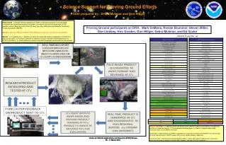
5. GOES-R Proving Ground • Aug 1-Nov 30, 2013 • Start with same basic products as 2012 • Hurricane Intensity Estimate (HIE) • Super Rapid Scan Operations – Research imagery from GOES-14 • RGB air mass, Dust, SAL • Natural Color, Pseudo Natural Color • Lightning Based RII (updated algorithm) • Tropical Overshooting Tops (updated algorithm) • Phase in 3 new products • MSG Convection and cloud top microphysics RGBs • S-NPP Day-Night Band • J. Beven, M. Brennan, H. Cobb, NHC focal points • M. DeMaria and M. Folmercoordinators • Same web-based evaluation form as in 2013
Acknowledgments • Joint Hurricane Testbed • GOES Program Office • GIMPAP, GOES-R • JPSS Program Office • Hurricane Forecast Improvement Project • Naval Research Laboratory • NOAA/NESDIS and NOAA/OAR