Download
1 / 16
160 likes | 280 Views
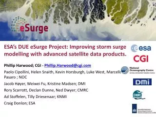
ESA ’ s DUE eSurge Project: Improving storm surge modelling with advanced satellite data products. Phillip Harwood; CGI - Phillip.Harwood@cgi.com Paolo Cipollini, Helen Snaith, Kevin Horsburgh, Luke West, Marcello Pasaro ; NOC Jacob Høyer, Weiwei Fu, Kristine Madsen; DMI

E N D
ESA’s DUE eSurge Project: Improving storm surge modelling with advanced satellite data products. • Phillip Harwood; CGI - Phillip.Harwood@cgi.com • Paolo Cipollini, Helen Snaith, Kevin Horsburgh, Luke West, Marcello Pasaro ; NOC • Jacob Høyer, Weiwei Fu, Kristine Madsen; DMI • Rory Scarrott, Declan Dunne, Ned Dwyer; CMRC • Ad Stoffelen, Tilly Driesenaar; KNMI • Craig Donlon; ESA
User consultation meeting held 2009, asking what users wanted from a storm surge project. This was the basis of the subsequent ITT for eSurge.
is the ESA Storm Surge Demonstration Project. Its mission is: To support storm surge systems, their services, engineers and scientists by facilitating the widespread user uptake and application of advanced information products from ESA and other Earth Observation missions. It is funded under ESA’s Data User Element (DUE) programme, and is being undertaken by a consortium of CGI (formerly Logica), NOC, DMI, CMRC, KNMI. It is currently in its operational phase, making a variety of satellite and other data available for historic and live surge events.
Satellite data already play a critical role in storm forecasting. However the modeling and forecasting of surges could be improved by use of newer types of satellite products. METOP-A image of Sandy from Eumetsat • Coastal altimetry. • High resolution and near-coast winds from scatterometry. These can be used: For validating model results after an event. As inputs to NRT models during an event.
Replace in-situ data where infrastructure is lacking Better input data (esp. wind fields) Ensemble pruning Post event model reassessment
To support storm surge systems, their services, engineers and scientists by facilitating the widespread user uptake and application of advanced information products from ESA and other Earth Observation missions.
To support storm surge systems, their services, engineers and scientists by facilitating the widespread user uptake and application of advanced information products from ESA and other Earth Observation missions. 1) Make it easier to access relevant satellite data www.storm-surge.info
To support storm surge systems, their services, engineers and scientists by facilitating the widespread user uptake and application of advanced information products from ESA and other Earth Observation missions. 2) Provide new types of satellite data especially suited to storm surge applications
To support storm surge systems, their services, engineers and scientists by facilitating the widespread user uptake and application of advanced information products from ESA and other Earth Observation missions. 3) Perform experiments to prove the value of the data
To support storm surge systems, their services, engineers and scientists by facilitating the widespread user uptake and application of advanced information products from ESA and other Earth Observation missions. 4) Provide training to help new users start working with satellite data and surge models Training course (right): deadline for applications December 6th. Online training: ask for demo tomorrow.
To support storm surge systems, their services, engineers and scientists by facilitating the widespread user uptake and application of advanced information products from ESA and other Earth Observation missions. 5) Help build a community where satellite data providers and storm surge researchers can engage and interact. This is the second of three meetings we will organise – the third will be in summer 2014 at a venue TBC.
There have been many recent events showing the importance of being able to accurately predict storm surges.
It is not just the big storms that count …. … Outer Hebrides, 11-12 January 2005. • 2m storm surge • 5 lives lost • €20m infrastructure damage • Loss of electricity • Broken transport links • Loss of communications
What are we aiming to get out of this meeting? Understand the problems faced by storm surge forecasters, modellers, planners and others who need to deal with practical consequences. Present recent work on new satellite data and how it can be used for improving storm surge modelling. Try to make a synthesis to understand how the available data can best be applied to real needs. Have an open discussion about what else can be done in the field.
Open discussion between everyone is important…. … so jump in and get your feet wet..