Download
1 / 20
200 likes | 221 Views
Dive into the concepts of latitude, longitude, and climate zones to enhance your geographical knowledge. Explore imaginary lines like the equator and Prime Meridian, understanding how they intersect and form a grid system. Discover different climate zones based on latitude and elevation, and learn about important vocabulary related to geography.

E N D
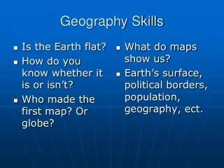
Where am I? The imaginary lines around the earth are measured in degrees. (˚)
A. Lines of Latitude • Circle the globe east and west • Also called parallels • Central line at 0˚ is the equator • Locations north and south of the equator have latitudes between 0˚ and 90˚ north and south
B. Lines of Longitude • Circle the globe from the north to the south pole • Also called meridians • Central line at 0˚ is the Prime Meridian which passes through Greenwich, England • Locations east and west of the Prime Meridian have longitudes between 0˚ and 180˚ east and west
“Hemi” “sphere” round - half the Earth Hemisphere
Northern Hemisphere Equator Southern Hemisphere
PRIME MERIDIAN Eastern Hemisphere Western Hemisphere
a. Eastern Hemisphere b. Southern Hemisphere d. Northern Hemisphere c. Western Hemisphere
When lines of latitude and longitude intersect they form a grid. The two directions together are called coordinates.
South America Indian Ocean • 20˚ S, 60 ˚W _______________ b. 10˚S, 80˚E ________________ • c. 35˚ N, 120˚E _______________ d. 40˚ N, 100˚ W _______________ • e. 80˚ N, 140˚W _______________ f. 80˚ S, 117˚ E ________________ Asia North America Antarctica Arctic Ocean
Climate - the weather patterns of an area over a long period of time 1. Precipitation 2. Temperature
The World: Climate Zones Arctic Circle 66 ½ N Tropic of Cancer 23 ½ N Equator 0 Tropic of Capricorn 23 ½ S 66 ½ S Antarctic Circle Tropical Climates/ Low Latitudes/ Warm Polar Climates/ High Latitudes/ Cold Temperate Climates/ Middle Latitudes/Mix
B. Let’s split! • The parallel that splits the earth into hemispheres is the ___________. • The meridian at 0˚ is the __________ ____________. • Which lines affect climate? ________ 1. _______________ Prime Meridian equator 2. _______________ equator Prime Meridian meridians 3. _______________ parallels latitude 4. _______________
4 1 2 5 3 1. 4. 2. 5. 3. 60˚ N, 120˚W 60˚ N, 60˚E 30˚ N, 150˚E 30˚ S, 60˚E 60˚ S, 30˚W
Basic Geography Skills Part II – Vocabulary – Alphabetically • Antarctic Circle 12. longitude • Arctic Circle 13. meridians • Climate 14. parallels • Coordinates 15. Polar Climate • Currents 16. precipitation • Degrees 17. Prime Meridian • Elevation 18. Temperate Climate • Equator 19. temperature • Grid 20. Tropic of Cancer • Hemisphere 21. Tropic of Capricorn • Latitude 22. Tropical Climate