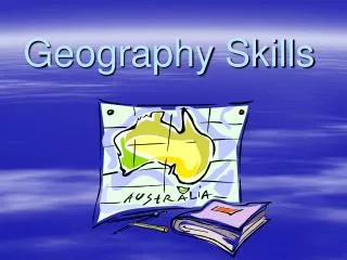
Geography Skills
Geography Skills. Is the Earth flat? How do you know whether it is or isn’t? Who made the first map? Or globe?. What do maps show us? Earth’s surface, political borders, population, geography, ect . . Geography. Latitude and Longitude. How is the Earth Broken Down?. Hemispheres

Geography Skills
E N D
Presentation Transcript
Geography Skills • Is the Earth flat? • How do you know whether it is or isn’t? • Who made the first map? Or globe? • What do maps show us? • Earth’s surface, political borders, population, geography, ect.
Geography Latitude and Longitude
How is the Earth Broken Down? • Hemispheres • What is a hemisphere? • How many? • What are they? • Which oceans are located in the Western? • Imaginary lines to divide the Earth into sections. • Hemi=half • Sphere=circle
LatitudeThe starting point for measuring latitude is the equator • Latitude lines are also known as parallels. • Latitude lines are measured north and south from the equator, which is located at 0 degrees.
Latitude • There are 90 degrees from the equator to the North Pole and 90 degrees from equator to the South Pole. • If latitudinal lines range from 0-90 how do they increase? Discuss with your group.
Lines of Latitude or Parallels • Lines of latitude or parallels go around the globe. • These lines are sometimes referred to as “flatitudes” because these lines lay flat on the map or globe. • The equator is the “earth’s belt”.
Longitude • The staring point for measuring longitude is the Prime Meridian
Longitude • Longitude lines are also known as meridians. • Lines of longitude are measured in degrees (east and west) of the Prime Meridian, which is 0 degrees longitude. • When travelers cross this line they change the date ahead or back. What line is it?
Lines of Longitude • Lines of Longitude or meridians go up and down the globe. • They go they go the “long way” (“long”-itude). • How do longitudinal lines increase?
More Notes • We use Latitude (parallels that go around the globe) and Longitude (meridians that go up and down the “long” way to find specific places in the world. These places are called exact locations.
Exact Locations • When we write exact locations or points, we always write latitude first!! • We always write either a N or a S to show direction from the equator. • Remember LA- Latitude comes before LO- Longitude. • Longitude is written second we write E or W to show direction from the Prime Meridian.
30 S, 120 E 60 N, 90 E 0 , 60 W 30 N, 150 W 0, 0 Where are these locations? Practice Exact Locations
Map Skills • 1. Cardinal Directions- North, South, East and West • 2. Intermediate Directions- NE, SW, NW and SE • 3. Compass Rose- drawing that shows direction • 4. Label compass rose • Create your own compass rose for homework.
Map Skills • 5. A map Scaletells how much smaller the distance on a map is compared to the actual distance. • 6. Symbol- stands for something else • 7. A map Key tells what they symbol on a map stands for. • 8. Some maps use locators to show where the subject area of the main map. • Let’s practice in your book.
Types of Maps • 9. Political Maps- shows information such as countries, states and cities. • 10. Physical Maps- shows Earth’s natural features • Elevation maps show the height of land above sea level. • Relief maps show changes in elevation
12. A Historical Map shows information about the past or where past events took place 13. Distribution map shows how things such as language, religion etc. are distributed throughout an area. These are also called special purpose or thematic maps. Types of Maps
Maps What do we mainly use today? List as many uses for these “new maps”. Disadvantages as well. Be ready to list and explain. Be able to identify all aspects of a map, find map scale, and types of maps. You will use these skills all year long.
HOMEWORK Find latitude and longitude on the map provided.