Download
1 / 22
220 likes | 447 Views
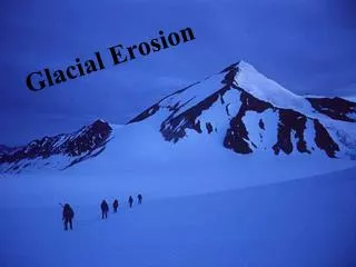
Monitoring Glacial Advance and Retreat of the Skaftafellsjökull Glacier, Iceland. Team Members: Mr. Bryce Carmichael Ms. Amber Smith Mentors: Dr. Sridhar Anandakrishnan Mr. Peter Burkett. Overview. Introduction Importance Proposal Background Information The Skaftafellsjökull Glacier

E N D
Monitoring Glacial Advance and Retreat of the Skaftafellsjökull Glacier, Iceland Team Members: Mr. Bryce Carmichael Ms. Amber Smith Mentors: Dr. Sridhar Anandakrishnan Mr. Peter Burkett
Overview • Introduction • Importance • Proposal • Background Information • The Skaftafellsjökull Glacier • gPhoto2 • Linux ts7300 Board • Nikon D50 SLR camera • Methodology • Crontab • Shell script • Preliminary Findings • Results • Discussion • Future Work • References • Acknowledgments
Introduction Center for Remote Sensing of Ice Sheets (CReSIS) • Science and technology center instituted by the National Science Foundation (NSF) in 2005 • Lead institution located at the University of Kansas in Lawrence, Kansas • Main focus is to understand the role of polar ice sheets in global climate
Importance • Expensive to fly to all the glaciers and conduct drill ice cores all the way to the bed. • Harsh weather conditions make extended on-site field work difficult • Limited equipment prevents monitoring all glaciers at the same time
Importance • Melting of polar ice-sheets can initiate sea-level rise. This means more coastal flooding, which in turn causes an increase in property damage and population dislocation • Monitoring outlet glaciers for advance and retreat can give an indication of ice-sheet behavior and contributions to sea-level
Sea Level Rise Maps of the Southeast region of the United States (Haskell Indian Nations University - CReSIS)
Proposal • Create an autonomous image capturing device that will monitor the movement of the Skaftafellsjökull Glacier, Iceland • The device will be able to withstand all weather conditions • Images of the glacier will be sent back to Penn State where they will be displayed in the Earth and Mineral Science museum
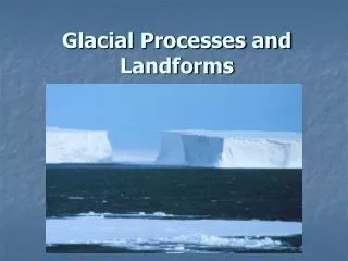
Background Information The Skaftafellsjökull Glacier • Located in Iceland • First explored in 1754 • 1446 meters above sea level • Situated along an active volcano • Has retreated rapidly in the past few years
Background Information gPhoto2: • The successor of gPhoto • Uses as a set of software applications and libraries • Retrieves images from cameras and has the ability to upload the images to remote computers
Background Information Linux ts7300 Board • The system's utilities and libraries usually come from the GNU operating system • Used for a wide variety of computer hardware, video game systems, arcade games, and embedded devices
Background Information Nikon D50 SLR • 6.1 Megapixels • Size: 5.2 × 4 × 3" • Weight: 1 lb and 3 oz (540g) • 2 inch LCD Screen • Storage: SD/MMC Card
Methodology • The first step was to power up the ts7300 and connect it to the Mac • The terminal was opened, and all necessary files and folders were created on the Linux board • The user must log on to the Linux board by typing “ssh root@192.168.0.51” and the respective password • A separate directory called “Images,” was required to be made by using the “mkdir” command • Type “vi” at the command line in the home shell, followed by the name of the script that is being created
Methodology • Download and unzip the installation files of GPhoto2 onto the Linux board • Command, “gPhoto2 --list-ports,” checked and listed all active ports of the ts7300 • Connected camera located using the command, “gPhoto2 --auto-detect”, • Periodically remove images by adding an “rm” line to the gPhoto2 shell script to make room for new images
Cronjob • A linux utility which allows tasks to be scheduled and run at specified times • Run by the cron daemon
Shell Script • Created using the vi editor • Tells Crontab what operations to perform
Preliminary Findings • The autonomous image-capturing device was created successfully • Captures, uploads, and removes photographs from the camera’s central memory to the ts7300 Linux board • For testing, camera was programmed to capture images every minute for an entire hour
Discussion • Use the newest version of gPhoto2 or find a more reliable software that is capable of performing all the functions needed • Instead of the vi editor, possibly use a different script editor, such as Emacs • A Linux board that has more memory
Future Work • Incorporate a wireless device into this system to reduce the wired connections and ease communication • Attach the all-weather case to the tripod • Build additional autonomous imaging devices to place at other glaciers
References • "Crontab - Quick Reference." Admin's Choice. 2007. 14 June 2008 <http://www.adminschoice.com/docs/crontab.htm>. • Hekman, Jessica Perry. Linux in a Nutshell: A Desktop Quick Reference. 1st ed. Sebastopol: O'Reilly and Associates, Inc., 1997. 1-160. • Kochan, Stephen G., and Patrick H. Wood. Unix Shell Programming.Revised ed. Hayden Books, 1990. 5-148. • Ray, Deborah S., and Eric J. Ray. Unix. 2nd ed. Berkeley: Peachpit P, 2003. 9-56. • "Sea Level Rise Maps and GIS Data > Southeast USA." CReSIS. Haskell Indian Nations University. 23 July 2008 <https://www.cresis.ku.edu/research/data/sea_level_rise/h_southeast-usa.html>. • "Skaftafellsjokull." 14 July 2008 <http://www.mit.edu/~pjsugi/skaftafellsjokull.html>. • "The SnæFellsjöKull Glacier." UMHVERFISSTOFNUN. 18 Feb. 2004. 14 July 2008 <http://english.ust.is/Snaefellsjokullnationalpark/TheGlacier/>. • The UNIX Forum. 13 Jan. 2008. 10 June 2008 <http://www.unix.com>. • Waugh, Tim, Hans U. Niedermann, and Michael J. Rensing. "The GPhoto2 Manual." GPhoto. 28 Mar. 2008. GNU. 9 June 2008 <http://www.gphoto.org/>.
Acknowledgments • The Center for Remote Sensing of Ice Sheets (CReSIS) • Dr. Sridhar Anandakrishnan • Mr. Peter G. Burkett • Dr. Linda B. Hayden • Summer Research Opportunity Program (SROP) 2008 • The Pennsylvania State University • Penn State College of Earth and Mineral Sciences Office of Graduate Equity – Dr. Lyons • The National Science Foundation (NSF) • National Aeronautics and Space Administration (NASA)
Questions? Contact Information: Bryce L. Carmichael: blcarmichael@mail.ecsu.edu Amber E. Smith: asmith89@mail.nccu.edu