Download

1 / 31
310 likes | 601 Views
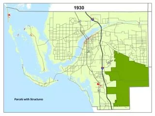
Wed, July 13, 2011. Editing Parcels With ArcGIS. Christine Leslie, Jason Camerano. Editing parcels with ArcGIS. Based on an optimized model for parcel storage Parcel fabric Parcel Editor toolbar Tools for streamlined parcel editing workflows Maintain and improve Topological integrity

E N D
Wed, July 13, 2011 Editing Parcels With ArcGIS Christine Leslie, Jason Camerano
Editing parcels with ArcGIS • Based on an optimized model for parcel storage • Parcel fabric • Parcel Editor toolbar • Tools for streamlined parcel editing workflows • Maintain and improve • Topological integrity • Positional accuracy of parcels
What is a parcel fabric? • Set of related tables and feature classes stored in a geodatabase • Connected parcel groups • Forms a parcel boundary network • Explicit topology • defined by common parcel corners, no overlaps and gaps between neighboring parcels
Parcel fabric data model Plans 1 1-M Parcels 1 1 1-M Lines Points 1 1-M 2-1 1 0-1 0-1 Line Points Control 0-M
Parcel fabric data model • Parcels Lines have related From and To points Parcel polygon has related lines
Parcel fabric data model • Parcel lines store (COGO) dimensions • Each parcel has its own set of related lines • End points are common • Topological integrity 91 90 88 89
Parcel fabric data model • Plans • Store manage plans, plats, legal records… • Parcels created in and grouped by their associated legal record
Parcel fabric data model • Line points preserve data integrity • A line point is a parcel corner point that sits on an adjacent boundary line but does not split it
Parcel fabric data model • Curves • True, parametric curves • Radial lines
Parcel fabric data model • Supports: • Overlapping parcels • Natural boundaries • Donut/island and multipart parcels • Historic parcels
Data migration • Load topology geoprocessing tool • Loads a clean, validated topology into a parcel fabric • Line feature class, polygon feature class • Topology is validated against a required set of rules
Parcel editing • Parcel traverse • Parcel division • Split by area • Split using construction lines • Parcel merge • Parcel remainder • COGO tools • Bearing, distance, tangent curve, intersection, parallel, perpendicular, etc • Snake tool for parcel naming/numbering • Parcel joining
Streamlined workflows – parcel division • Divide by area
Streamlined workflows – parcel merge • Maintain interior, historic lot lines
Streamlined workflows – parcel remainder • Create remainder parcels from overlapping parcels
Streamlined workflows – parcel remainder • “Snake” tool
Tracking parcel edits • Jobs keep track of edits • Date/time of edit, type of edit and user • Optionally create and manage your own jobs
Data Integrity • Parcel layer is topologically correct • Parcel joining enforces connectivity during incorporation • Land records from plans/deeds are integrated into a continuous, topologically correct parcel layer • No slivers and gaps
Data integrity • Parcel dimensions are correct
Data Integrity - spatial accuracy • Fabric least-squares adjustment uses control points and COGO dimensions to recalculate/update parcel coordinates • Fabric feature adjustment aligns layers from other sources to adjusted parcel boundaries Least-squares adjustment Feature adjustment
Fabric least-squares adjustment • Parcel network is adjusted to control network • COGO dimensions used to recalculate coordinates • Parcel point coordinates are updated, dimensions are not changed • Finds mistakes/blunders in parcel data • Parcel data should be correct • Topologically clean • Correct dimensions
Fabric least-squares adjustment • Accuracy categories on parcels and lines affect the outcome of the adjustment • Parcels/lines with high accuracy category adjust less than parcels/lines with low accuracy category • Accuracy categories act as weights in adjustment
Fabric least-squares adjustment • Least –squares adjustment will be successful if: • Parcel network fits/transforms well to control network • Good connectivity in parcel network • No blunders in COGO dimensions
Fabric feature adjustment • Coordinates changes from fabric adjustment are stored as vectors • Vectors are used in a feature adjustment to adjust and align overlaying layers
Other sessions • ArcGIS for Land Records - Parcel Maintenance Solution • Tue, Jul 12, 3:15PM - 4:30PM • ArcGIS for Land Records Implementation Examples • Wed, Jul 13, 8:30AM - 9:45AM • ArcGIS for Land Records: Migrating your Data • Wed, Jul 13, 10:15AM - 11:30AM • Migrating Coverages to the Parcel Fabric • Wed, Jul 13, 3:15PM - 3:35PM
Other sessions • Integrating CAD Data with the Parcel Fabric • Thu, Jul 14, 11:05AM - 11:25AM • ArcGIS for Land Records - Improving Data Quality • Thu, Jul 14, 4:05PM - 4:25PM