Conquest
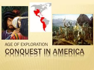
Conquest. The game of Tribal Domination. CONQUEST. The game of tribal domination. Round 1: Each team gets 1 uncontested “freebie”. There are a total of ----- continents on Earth. SEVEN. ---- is the largest continent in both size and population. ASIA.


Conquest
E N D
Presentation Transcript
Conquest The game of Tribal Domination
CONQUEST The game of tribal domination
---- is the largest continent in both size and population. ASIA
---------- is the name of the continent with NO permanent residents. ANTARCTICA
The earliest human bones were found on the continent of ------. AFRICA
Round 2:5 “Toss Up” questions(as an individual for your team, you may ONLY answer one of these)
What term refersto the HEIGHT of LAND above SEA LEVEL? #1 ELEVATION
How many DEGREES are both the Tropic of Cancer and Tropic of Capricorn from the Equator? #2 23 ½
If 1 inch on a map’s scale bar equals 300 miles, how many miles would you travel if it measures 3 inches? #3 900 miles
Which important line of LONGITUDE divides the earth into the eastern and western hemispheres? #4 PRIME MERIDIAN
#5 Which TYPE of map would a road map, weather map, store map, population density map ALL be? SPECIAL PURPOSE/THEMATIC
The ------ Ocean is found to the east of Africa, to the south of Asia, and to the northwest of Australia. INDIAN
The -------- Ocean was the most recent to be recognized as a separate body of water. SOUTHERN
The ------- Ocean covers about 46% of the earth’s water surface. PACIFIC
The SECOND largest body of water on earth is the -------- Ocean. ATLANTIC
Name the CARDINAL DIRECTIONS…. NORTH, SOUTH, EAST, WEST
Which MAP TOOL shows both the CARDINAL and INTERMEDIATE Directions? COMPASS ROSE
What is the number of DEGREES of both the Arctic and Antarctic Circle? 66 ½
Which MAP TOOL explains what the colors and symbols on a map represent? KEY or LEGEND
3 TOSS UP Questions!!!! EACH TEAM STAND UP THEIR 2 “STRONGEST” PLAYERS TO COMPETE FOR THE TEAM….
Each TIME ZONE is marked off by HOW MANY DEGREES of LONGITUDE? 15 degrees
Which MAP TOOL is used to calculate the number of miles from one point to another? SCALE BAR
Which type of GENERAL PURPOSE MAP shows mountains, rivers, deserts, plateaus, valleys, etc.? PHYSICAL MAPS
10 Toss Up Questions…you may ONLY answer 1 for your team! A correct answer allows you to back up ANY team 1 space! An incorrect answer backs your team up 1 space!!!
What CONTINENT is located at 30 degrees SOUTH Latitude and 60 degree WEST Longitude?
What line of LATITUDE creates the Northern & Southern Hemispheresby dividing the Earth in half? EQUATOR
TYPES OF MAPS: Political Physical Thematic/Special Purpose What TYPE of map would a shopping mall map be?
Northwest South Northeast Southwest Which of the following is NOT an INTERMEDIATE direction?
180 At what DEGREE LONGITUDE is the International Dateline?
What climate regions are located north of the Arctic Circle and south of the Antarctic Circle? POLAR REGION
NORTHERN EVERYTHING above the EQUATOR is found in which HEMISPHERE?
PARALLELS What is another name for lines of LATITUDE?
Arctic Circle What important line of latitude is shown here?
Which CLIMATE REGION is shown on the map below? THE TROPICS
If it is 1 pm in your time zone, what time is it 30 degrees WEST of your location? 11 am
When looking at a map’s scale bar, you notice that 1 inch equals 400 miles. How many miles would you travel if your trip measures 3 ½ inches? 1400 miles
Final Round! The RACE to the finish line
In which DIRECTION around the globe do lines of LATITUDE run? EAST TO WEST