Download
1 / 65
650 likes | 745 Views
Dive into the world of shores and coasts, from beach dynamics to tidal phenomena. Learn about erosion, landforms, and protective structures in coastal environments. Discover how waves shape our coastlines and the effects of tides on shorelines.

E N D
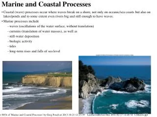
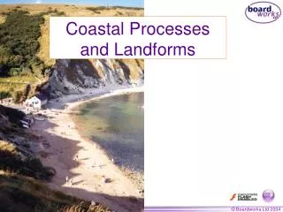
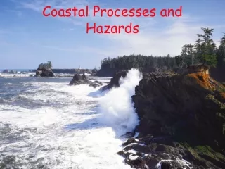
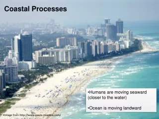
Shores and Coastal Processes • Shorelines are places where bodies of water meet dry land • Coasts are landward of ocean shorelines • Beach: a narrow strip of land, washed by waves or tides . • Ordinary Waves are caused by WIND • Waves are produced when wind drag causes the surface water of oceans/lakes to rise and fall - Waves get refracted on approaching shoreline
Waves are caused by _____________? Parts of A Wave Fetch – Southern Ocean, Straits of Magellan
Oscillatory and Translatory Motion Translatory motion re-suspends sediment
Wave Refraction Still a small ‘longshore component swash backwash Kids at the beach
Shores and Coastal Processes • Longshore current is produced as water flows parallel to coastline • Rip Currents are produced when water piles up in surf zones and flows seaward, generally perpendicular to the coast.
Rip Currents Cut inBar Sand Bar Sand bars are big ripples storms cut them, causing a rip channel
Tides – Mostly the Moon • Daily rise/fall of surfaces of oceans/lakes due to gravitational pull of the Moon/Sun on the Earth– also due to force created as Earth spins on its axis • Flood tides- elevate sea surface that cause shoreline to move inland • Ebb Tides- low sea surface that cause shoreline to move seaward
Tidal Bulges Affect of the Sun Much less
The Effect of Tides On Shorelines Tides mostly caused by the Moon
Large Tidal Extremes • Bay of Fundy tides reach16 m (about 53 ft) at the head of the bay. The 12.4 hour period of the twice daily lunar tides is close to the natural back and forth sloshing period of the bay.
The Effect of Tides On Shorelines – River Hebert in Nova Scotia Tidal Bore Anecdote: local tidal bore Source:Clyde H. Smith/Peter Arnold, Inc.
Low Tide at Bay of Fundy Source:William E. Ferguson
Rising Tide at Bay of Fundy Maximum Source:William E. Ferguson
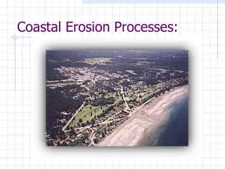
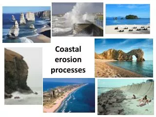
Coastal Erosional Features • Wave erosion occurs when deep water waves hit the shore with full force • Air and water are forced into cracks at high pressure
Crashing Surf, Oregon Coast Source: Criag Tuttle/The Stock Market
Coastal Erosion Source:Paul Sequeira/Photo Researchers, Inc.
Lighthouse at Morris Island, SC Source:Donald Carter
Coastal Erosion Structures • Headlands- cliffs that jut seaward • Wave-cut bench is produced when waves undercut headland • Sea Caves are produced when waves are refracted against the side of headland • Sea Arch forms when two Sea Caves erode completely through the headland • Sea Stack is formed when Sea Arches collapse
Erosional Coastal Landforms Submerged Shallow Area Bends Waves
Sea Caves on Cape Kildare, Prince Edward Island, Canada Source:John Elk/Bruce Coleman
A Tombolo Landward of A Sea Stack – Big Sur, California Source:Cliff Wassmann
Coastal Protection • Riprap/Seawall- protect shore lines • Groin – stabilizes beaches • Jetty – keep inlets clear • Breakwater – protect a harbor
Beach-Protection Structures - Riprap Source:Jack Dermid /Photo Researchers, Inc.
Beach-Protection Structures –Seawall Along the Gulf Coast of Louisiana Source:Martin Miller
Groins off Cape May, New Jersey Source:John S. Shelton
Jetty in Miami Beach, Florida Note how it is much narrower than the original inlet. Smaller cross-sectional area therefore higher velocity, more erosion in the new channel, keeps the channel deep. Source:Townsend P. Dickinson
Components of A Typical Beach How to tell a berm from a sand dune • Small notes for Prof. Smart to repeat previous slides: • Beach a narrow strip of land washed by waves or tides • Foreshore is the area between low tide and high tide • Backshore is the area between high tide and sea cliff or inland vegetation line • Beach face is the steepest part of Foreshore • Berm is a horizontal bench of storm sediment
Volcanic Black Sand Beach Detrital sediments are classified with particle sizes. Sand is a size, not one specific mineral Source:Breck P. Kent Beach sediments usually quartz, but sometimes mafic minerals
Transport and Depositional Features • Longshore Drift causes deposits: • Spit is a finger-like ridge of sand deposited where Longshore drift encounters deeper water • Hook is a curved spit • Baymouth is a spit that covers the access to a bay – the area behind it fills with sediment
Filling of Tidal Inlets Cheesequake Park Shawangunk Formation
A Spit at Cape Henlopen, Delaware Source:Cliff Wassmann
Baymouth Bars on Martha’s Vineyard, MA Source:John S. Shelton
Sea Level Change 1. Glaciers • Glaciers lower sea-level slowly • They melt quickly – sea level rises 2. Mid Ocean Ridges (MOR’s) • Mid Ocean Ridge raises sea level if large and active • Lowers sea level if activity slows - becomes smaller • Sit in the bath tub – water level rises
Coast Types I Primary Coasts – Mostly Non-Marine • Coast types formed mainly from non-marine processes such as glaciation (Long Island) , stream deposition (deltas) , fluctuating sea levels • Also Organic Coasts - reefs, mangroves
Combined changes to coastlines • Tectonic uplift and sea-level changes • Postglacial Isostatic rebound and sea-level changes • Mid-ocean Ridge grows/wanes and sea-level changes
Organic Coasts • Fringing Reef- initially surround land, grow seaward • Barrier Reef- separated from coast by a lagoon • Atoll- circular structure from great depth that encloses shallow lagoon • Mangroves
Evolution of Carbonate Reefs Charles Darwin coral larvae are planktonic
Wake Island, a Coral Atoll Source:William E. Ferguson
Biological Processes - Mangroves “Make you own island”
Typical Mangrove Coast, Florida Everglades Source:S. J. Krasemann/Peter Arnold, Inc.