Download
1 / 37
370 likes | 390 Views
Explore Eratosthenes' geodesy study, Earth's oblate spheroid shape, geodetic datums, map projections, and choosing the right one to minimize distortion in GIS mapping.

E N D
May 17, 2007 Refer to: Krygier & Wood, pages 92-119 Monmonier, pages 5-18 Coordinate Systems, Projections & Introduction to Choropleth Maps
First: Rapid Review - Concepts Labs 1 & 3: Illustrator • Pen Tool - Generalize • Closed Path Shapes • Fill, Stroke (simple) • Gradient Fill • Layers • Advanced Methods *
ArcMap Layout Element placement • Map Layout • Neatline • Title/Subtitle • North Arrow • Scale * • Legend
Comments from last week Type use: In cartography, using decorative type is not desirable. Distracts from features of importance Difficult to read Legend May or may not have a title, frame, may include useful information for understanding the map Feature symbology Adopt consistent conventions
Measuring the Earth ?? Around 2300 BP Eratosthenes' Map
Erotosthenes' Calculation Estimate – 40,500 km (25,170 mi) Actual – 40,075 km (24,960 mi) Not bad....there is of course dispute: 1. Disagreement on units (500 mi is itself an estimate for stadia, the unit he used) 2. Syene (Cyene) is not exactly on the same meridian as Alexandira 3. Although measured on the solstice, the sun's rays were not exactly parallel because Syene is not on the northern Tropical latitude. Historically significant best guess... Angle calc on summer solstice, noon
Eratosthenes' Calculation The first acknowledged study in geodesy: the determination of the figure and dimensions of the earth Eratosthenes also did not realize that the Earth is NOT a perfect sphere. Until the 1600's this assumption was not in question (Newton, centrifugal forces). A dispute ensued (Newton vs Decartes), and after two major expeditions (Lapland, Ecuador) and nine years, it was proven to be an oblate spheroid, bulging at the equatorial region. Read: Whitaker, R., (2004). The Mapmaker's Wife
Geodesy & The Reference Ellipsoid • The oblate spheroid has a semimajor (a) and semiminor axis (b) • The idea of an ellipsoid describes the shape and size of the Earth • Over 30 ellipsoids exist, depending where on Earth
But what ARE they? They are local measurements The ellipsoids you will encounter in the GIS world, most likely are: WGS 84, GRS 1980 and Clark 1866
Somewhat abstract • The « Geoid » is a concept that has emerged after the advent of satellite technologies (post 1950's) • The Earth's surface varies – determine using spherical harmonics Geoid
Geodetic Datums (or Data) • A reference point from which measurements are made. Determined by a coincident point between geoid and reference ellipsoid • Example: Clarke 1866 with single point in Kansas as reference comprises the NAD 27 (North American Datum of 1927 )
The Bottom Line These are nice things to know, but what is actually relevant or important to GIS? Satellite technology found that NAD 27 is quite erroneous, so a new reference ellipsoid, GRS 80 (Geodetic Reference System of 1980), was created Using that ellipsoid, NAD 83 was implemented.
And? These differences are often visually negligible in terms of thematic mapping Geodesy is more important to navigation, distance and directional applications However, these terms will come up repeatedly as you enter GIS positions and it is important to know from where they came and what they mean (generally)
Tired? BREAK Be back in 5 minutes
Definition: Map Projection DEFINITION a: systematic presentation of intersecting coordinate lines on a flat surface upon which features from the curved surface of the earth or the celestial sphere may be mapped b: the process or technique of reproducing a spatial object upon a plane or curved surface or a line by projecting its points; also a graph or figure so formed…. In other words…transformation of a curved surface to a flat one. Image borrowed from the Harvard GSD Website http://www.gsd.harvard.edu/geo/manual/projections/fundamentals/index.htm#history
Projection Classes • There are three classes of projection: • Planar (flattened) • Conic • Cylindrical
There are two cases The 'tangent' case The 'secant' case
Consequences of Projection DISTORTION
DISTORTION You can never preserve all of these at once, but you can try. • Distance - Equidistant • Areas – Equal Area • Angles - Conformal • Shapes - Equivalent • Direction - Azimuthal
How do I choose a projection!? A set of guidelines was developed by Snyder (1987) to help choosing a projection, depending on what you want to preserve in your map U.S. Geological Survey Professional Paper 1453 John P. Snyder
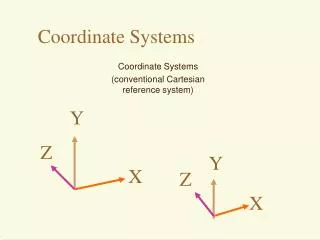
Planar Geometry • The x and y axes are the drawing space for a planar map • Typically, you read units in (x,y) • The analogous Earth system is longitude and latitude
Earth's Geometric Grid • Latitude, Longitude • Northing, Easting • Northing is distance north or south from the Equator in meters • Easting is the distance from an arbitrary reference line (500,000 m west of the Prime Meridian)
State Plane System – used often • State plane systems were developed in order to provide local reference systems that were tied to a national datum. • They can be a challenge if you are crossing regions while working
Another break Be back in 5 minutes
Scale Just a quick review Representative Fraction Not tied to units Visual/Graphical Statement of Equivalency
Finally... Introduction to Lab #4 Will span 2 weeks (due May 31st) Choropleth Maps (lecture, next week) ArcMap data management
Choropleth Maps • Very common • Sometimes not well • May be used to illustrate change • Highly data dependent • Color scheme is important
More examples??? Next week, lecture will focus on Choropleth Maps, Color Choices, and more cartographic examples