Map Projections and Coordinate Systems
Map Projections and Coordinate Systems. Jan-Van Sickle Khang-tsung Chang ESRI Using ArcMap. Coordinate Systems. The location of a known point (Youghall, Colorado Mountains) is known on the ground Coordinates: 1937 : lat 40 ° 25’ 33.504’’N; Long 108 ° 45’ 55.378’’W

Map Projections and Coordinate Systems
E N D
Presentation Transcript
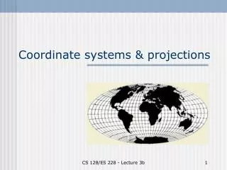
Map Projections and Coordinate Systems Jan-Van Sickle Khang-tsung Chang ESRI Using ArcMap
Coordinate Systems The location of a known point (Youghall, Colorado Mountains) is known on the ground Coordinates: 1937: lat 40° 25’ 33.504’’N; Long 108° 45’ 55.378’’W 1997: lat 40° 25’ 33.39258’’N; Long 108° 45’ 57.78374’’W Elevation: 1937: 2658.2 m 1997: 2659.6 m
How did this happen? Datum changed • In 1937, the lat, long, elevation were based on the North American Datum 1927 (NAD27) • In 1997, the lat, long, elevation it became based on the North American Datum 1983 (NAD83)
The example highlights the importance of: • Choice of Datum: • On what surface (ellipsoid) points lies • From what datum (ellipsoid) heights are measured? • Choice of Coordinate System
Datum A datum (spheroid) approximates the shape & size of the Earth in the examined area Five Parameters were needed to define a datum (e.g., NAD27): • Latitude of initial point (Mead’s Ranch)(39° 13’ 26.686’’) • Longitude of initial point (Mead’s Ranch)(98 32’ 30.506’’) • Semi-major axis for Clarke 1866 ellipsoid (6,378,206.4 m) • Semi-minor axis for Clarke 1866 ellipsoid (6, 356,5836.6 m) • An azimuth (75° 28’ 09.64’’) from the initial point to a reference point (Waldo station)
Old – New datums • Old datum: fixing the best suited ellipsoid to a region using a single point on Earth Problems: • Center of the datum did not coincide with center of Earth • Old datum(s) (ellipsoid) work well regionally, but not globally • New datum (WGS84): uses space-based geodesy (satellite measurements) to get precise measurements of distances to surface of the Earth and ultimately define a geocentric datum (center of ellipsoid coincides with center of Earth)
Examples • NAD27 (North American Datum of 1927) • Spheroid: • equatorial radius: 6,378,206.4 m; • polar radius 6,356,583.8m; • Flattening: 1/294.979 • Origin: Meades ranch in Kansas
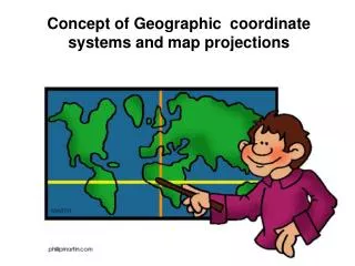
Geographic Coordinate Systems • Based on angles, not distances • Positions on the Earth surface are represented by latitudes & longitudes • Latitude-Longitude • Degree-Minute-Second (DMS) • 1 deg = 60 min • 1 min = 60 sec • Decimal Degrees (DD) • 45°52’30’’= 45.875
Meridians - Parallels • Meridians: Lines of equal longitude • Prime Meridian passes through Greenwich, England and has a reading of 0° • Using prime meridian as reference, we measure longitude of a point on Earth’s surface as 0° to 180° east or west of the prime meridian • Similarly N to S directions are measured using parallels (Equator = 0° parallel).
Longitude - Latitude • Longitude: Angle between two planes plane passing by Prime Meridian and another Meridian passing by point of interest • Latitude: Angle between a plane passing by Equator and a line joining point of interest to center of Earth
Meridians - Parallels • Meridians converge • Parallels do not
Note • As the poles are approached: • A degree in longitude shrinks (red) • A degree of latitude expands slightly
Cartesian Coordinates (3-D) • Basic X-Y-Z orthogonal coordinate system; distances measured from an origin • 3 Orthogonal Dimensions
Polar Coordinates (3-D) • Allows 3-D representations • 2 orthogonal angles and a distance • The North or the East could be used as reference directions
Moving from 3-D to 2-D • Location of spatial features on the globe are based on geographic coordinate systems (latitude and longitude) Whereas, locations of map features are based on plane coordinate system (x and y coordinates)
Cartesian Coordinate System • Based on distances • Basic X-Y coordinate system; distances measured from an origin on a flat surface • Two-dimensional Cartesian Coordinates are important elements in the vast majority of Coordinate Systems (e.g., UTM, state plane coordinates)
Conventions: • Based on Right Angle coordinates • X & Y axes: similar units • X axis: east (+ve) • Y axis: north (+ve)
Question Does a flat Cartesian datum with two axes represent the real world (Earth) well?
Answer Only, if the Earth was flat Thus, across small areas, this approximation works well. If the area gets to be large, distortions will be problematic
Question • Given the coordinates of two points (state Plane Coordinates: Colorado North Zone): • Youghall • Northing = Y1 = 2,414,754.47 ft • Easting = X1 = 2,090,924.62 ft • Karns • Northing = Y2 = 1,418,088.47 ft • Easting = X2 = 2,091,064.07 ft Find the distance between them
Answer Distance = ((X1-X2)2 + (Y1-Y2)2)1/2 Distance = 3336.91 ft
Polar Coordinates • Based on angles (measured counterclockwise), and distance from center point (origin) • An origin has to be defined • The North or the East could be used as reference directions
Representation Angle measured from Polar Axis Example (100,120)
Differences in Representation Cartesian only one pair can represent a point Polar • A point can be represented in many ways
Two Coordinate Systems (SPCS) • Map Projections represent a portion of the actual Earth on a plane • Can you flatten an Orange peel?
Only if • The portion is very small • A map on an orange peel will be distorted if attempts are made to flatten it
Examples • State Plane Coordinate Systems (SPCS); Local Coordinate Systems • Flat surface with Cartesian Axes • Measured positions expressed in northings and eastings • Tangent planes to the Earth surface • Small section of the earth as with a small section of an orange conforms so nearly to a plane & distortions are minimal
Can we peace together the small areas? • Each plane has a unique coordinate system • For each system, the scale & orientation of axes is different • Joining the peaces together will cause overlaps & gaps • Tangent plane map projections have no larger use
How can we work on regional & global scales? • We use media that can be flattened (2) Use one tangent plane
(1) Media that can be flattened: Cylindrical Media Start with a surface that is not deformed upon flattening