Download
1 / 19
190 likes | 311 Views
Discover Greenland's geological marvels, from its Precambrian shield to Quaternary ice formations. Learn about Project Sermi's research on glacier dynamics and seismic activity. Explore the island's rich history, culture, and modern adaptations.

E N D
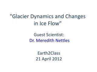
"Glacier Dynamics and Changes in Ice Flow" Guest Scientist: Dr. Meredith Nettles Earth2Class21 April 2012
Where is Greenland? http://www.worldatlas.com/webimage/countrys/namerica/gl.htm
Part of Denmark • Home Rule in 1979 • Self Rule as of 2009 • Greenlandic official language http://leesviewfinder.com/galleries/index.php?option=com_rsgallery2&page=inline&gid=14&limit=1&Itemid=2&limitstart=1
Brief History of Greenland • Waves of immigration from Canada beginning 4 – 5,000 years ago • Most of population descended from Thule culture (9th century AD) • Erick the Red and Norse Vikings arrived in 982 (Norse sagas) • Norse settlers disappeared around 1450; no known reasons, but much speculation • Whalers traded with Inuits (glass beads in native costumes) • Missionary (1721) converted Inuits to Lutherans
“Tradition and Renewal” • qujaq (Greenland sea kayak) and ulo (knife) enabled Inuits to survive for centuries in harsh conditions by and from the sea • dogsleds are traditional transportation • Modern Greenland, however, depends also on snowmobiles, and cell phones and Internet have become ubiquitous • http://www.greenland.com/en/
Geologic map created by GEUS/ Geologic Survey of Denmark & Greenland http://www.geus.dk/program-areas/raw-materials-greenl-map/greenland/gr-map/kost_1-uk.htm
Geology of Greenland, in brief • Spans 4 Ga from earliest Archaean to Quaternary • Largest island in world (2,166,000 sq km), but only c. 410,000 sq km are exposed bedrock • Inland ice cap reaching over 3 km covers vast majority of the island • Offshore shelf areas include c. 825,000 sq km
Rocks of Greenland • Precambrian shield crystalline rocks dominant • Formed during Archaean and early Proterozoic orogenic events, as part of Laurentian shield Photo by Jo Roach http://www.flickr.com/photos/the-open-university/5616036461/sizes/z/in/photostream/
Shield consists of 3 distinct basement provinces: • Archaean rocks (3100 – 2600 Ma), almost unaffected by later orogenic activity • Archaean terranes reworked during early Proterozoic (1850 Ma) • Terranes mainly composed of early Proterozoic rocks (2000 – 1750 Ma)
Oldest known oceanic crust 3.8 Ga? National Geographic News (Mar 22, 2007) http://news.nationalgeographic.com/news/2007/03/070322-oldest-crust.html
After 1600 Ma, geologic developments was mostly along margins of Shield • Later Proterozoic & Phanerozoic – sedimentary basins in North and Northeast Greenland; 10 – 15 km thick • Paleozoic orogenic belts (Ellesmerian fold belt in North Greenland, East Greenland Caledonides)
Upper Paleozoic & Mesozoic sedimentary basins in North, West, and East Greenland, both onshore and offshore Continental break-up and formation of rift basins—opening of North Atlantic Ocean Extrusion of Tertiary plateau basalts in central West and East Greenland http://leesviewfinder.com/galleries/images/rsgallery/display/39-Greenland-Geology.jpg.jpg
Quaternary Ice • Almost completely covered by ice sheets during Quaternary • Present Inland Ice relic of Pleistocene ice ages • Vast amounts of glacially eroded detritus deposited on coastal shelves
Studies of Earthquakes and Rapid Motions of Ice (Project SERMI):An investigation of glacial earthquakes and glacier dynamics http://www.ldeo.columbia.edu/~nettles/projects/glaciers/Sermi/
Project Sermi • International, interdisciplinary collaboration to understand dynamics of large outlet glaciers on glacier earthquakes • 90% in Greenland • Focuses on East Greenland’s Helheim and Kangerdlugssuaq glaciers • State-of-the-art data collection through geodetic, geophysical, and seismic techniques