Download
1 / 19
200 likes | 378 Views
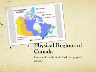
Physical Geo of N. America & Canada. SSWG8a. Describe the location of major physical features and their impact on Canada and the United States. . Mountains/Highlands. Rockies, Appalachians, Cascade, Alaska, Brooks, Coastal Range, Sierra Nevadas

E N D
Physical Geo of N. America & Canada SSWG8a. Describe the location of major physical features and their impact on Canada and the United States.
Mountains/Highlands • Rockies, Appalachians, Cascade, Alaska, Brooks, Coastal Range, Sierra Nevadas • Rockies in US & Canada and divided into 5 sections & 2000 miles long • Appalachian Mts. created by tectonic plates • California Mountains along fault lines • Alaska Range contains Mt. McKinley—highest in the United States
Appalachian vs. Rockies Appalachian Rockies Relatively young, only 80 million years old Less erosion More rugged and higher peaks Extends from Alaska to New Mexico • More than 400 million years old • More rolling hills and gentle slopes • Shorter peaks • Extends from Newfoundland to Alabama
Mountains/Highlands Cascade Range Appalachian Mountains
Mountains/Highlands Coastal Range Sierra Nevada
Plains • Major Features: Great Plains • Gently rolling hills • Breadbasket of America growing corn, wheat, etc. • Because of the landscape, area is a magnet for tornadoes
Plains Farming on the Plains Great Plains Bison
Rivers • Major Features: Mississippi, Missouri, Colorado, Rio Grande, St. Lawrence • Mississippi begins in Minnesota and flows into the Gulf of Mexico • Missouri flows into Mississippi and begins in the Rockies • Many dams on Colorado River—Hoover Dam • St. Lawrence River is main river of Canada and feeds Great Lakes
Rivers Colorado River Mississippi River
Lakes • Major Features: Huron, Ontario, Michigan, Erie, Superior (HOMES), Great Salt Lake • Great Lakes created because of glaciers • Lake Michigan only Great Lake completely in US • Great Salt Lake has no fish, but brine shrimp • 7x as salty as ocean water
Lakes Great Salt Lake Lake Michigan
Additional Water Features • Main Features: Bering Sea, Gulf of Mexico, Labrador Sea, Hudson Bay, Atlantic Ocean, Pacific Ocean • Hudson Bay is large inlet that is mostly unpopulated—used mostly for shipping. • Bering Sea near Alaska and was used for commercial fishing
Additional Water Features Bering Sea Hudson Bay
Deserts/Valleys • Main Features: Death Valley, Mojave Desert • Both are found in California • Death Valley called this because during the California gold rush, people tried to take it as a shortcut and died. • Highest temperature in America in Death Valley (134F in 1913) • Mojave between Sierra Nevada & Colorado River
Deserts/Valleys Death Valley Mojave Desert
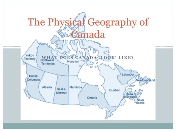
Additional Land Features • Major features: Canadian Shield, Grand Canyon, Aleutian Islands, Hawaii • Canadian Shield has exposed shield & buried shield—rugged land not good for agriculture • Caused by glaciers • Grand Canyon carved by the Colorado River • Aleutian Islands & Hawaii are archipelagoes of the US
Additional Land Features Canadian Shield Grand Canyon Skywalk