Download
1 / 18
190 likes | 385 Views
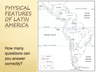
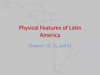
Physical Features of Latin America. Chapters 10, 11, and 12. Yucatan Peninsula. Historic home to the Mayan people Major tourist center for Mexico (ex. Cancun) Famous for its sinkholes (known locally as cenotes ). Gulf of Mexico. Ninth largest body of water in the world

E N D
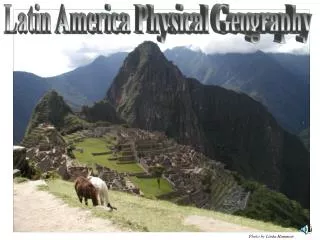
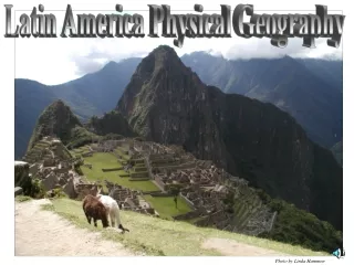
Physical Features of Latin America Chapters 10, 11, and 12
Yucatan Peninsula • Historic home to the Mayan people • Major tourist center for Mexico (ex. Cancun) • Famous for its sinkholes (known locally as cenotes)
Gulf of Mexico • Ninth largest body of water in the world • Filled with petroleum—Mexico’s most valuable natural resource
Isthmus of Panama • An isthmus is a narrow strip of land connecting two larger land areas • Connects North and South America
Andes • Stretches over 7 countries • World’s longest continental mountain range (4,300 miles long) • Part of the Ring of Fire
Atacama Desert • Driest desert in the world (average rainfall is .04 inches of rain each year) • Formed by the rain shadow of the Chilean Coast Range and the Andes • 600 miles long
Llanos • Means “Plains” in Spanish • Large tropical grassland that covers Colombia and Venezuela
Pampas • Fertile South American grasslands • Cattle ranching • Densely populated
Patagonia • Semiarid steppelike plains • Stretches from Pampas to Tierra del Fuego (across Argentina and Chile)
Tierra del Fuego • An archipelago is a group of islands near each other • Spanish for “Land of Fire” • Split between Argentina and Chile
Strait of Magellan • Strait between Atlantic and Pacific Oceans • Difficult to navigate through • Named after Ferdinand Magellan, the first European to sail through it
Cape Horn • A cape is a body of land that extends into water • Most southerly point of South America
Amazon River • 2nd longest in the world (4,200 miles) • Depths of the river range from 60 to 300 feet • Every year it floods the forests around it
Amazon Basin • Drained by the Amazon River and its tributaries • Covered by largest rain forest in the world (8, 235, 430 sq. kilometers)
Rio de la Plata • Spanish for “River of silver” • Formed by the Uruguay and Parana Rivers • Acts like an estuary
Angel Falls • World’s highest waterfall (3,212 feet) • Located in Venezuela • Starts off of a tepui—table top mountain
Climate • Major factors of climate in Latin America include: • Elevation • Latitude • Tropical wet and dry climates are both common in Latin America • During El Nino years—Pacific is warmer and climate is wetter • During La Nina years—Pacific is colder than usual
Natural Resources • Petroleum is a major source of wealth • Warm and sunny climates (important for tourism) • Bauxite (ore that is used to make aluminum) • Gold and silver