Download
1 / 23
230 likes | 345 Views
Community Surface Dynamics Modelling System (CSDMS) 2014 Annual Meeting Uncertainty and Sensitivity in Surface Dynamics Modeling May 20 - 22, 2014, Boulder Colorado, USA.

E N D
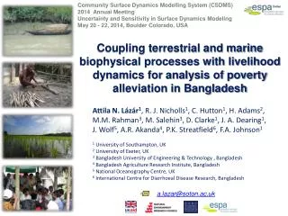
Community Surface Dynamics Modelling System (CSDMS) 2014 Annual Meeting Uncertainty and Sensitivity in Surface Dynamics Modeling May 20 - 22, 2014, Boulder Colorado, USA Coupling terrestrial and marine biophysical processes with livelihood dynamics for analysis of poverty alleviation in Bangladesh Attila N. Lázár1, R. J. Nicholls1, C. Hutton1, H. Adams2, M.M. Rahman3, M. Salehin3, D. Clarke1, J. A. Dearing1, J. Wolf5, A.R. Akanda4, P.K. Streatfield6, F.A. Johnson1 1University of Southampton, UK 2University of Exeter, UK 3Bangladesh University of Engineering & Technology , Bangladesh 4Bangladesh Agriculture Research Institute, Bangladesh 5 National Oceanography Centre, UK 6International Centre for Diarrhoeal Disease Research, Bangladesh a.lazar@soton.ac.uk
Presentation overview • The ESPA Deltas project • Integration (aim & concept) • Some preliminary results • Handling uncertainty / model testing • Summary
The ESPA Deltas project(http://www.espadeltas.net/) (2012-16) Overarching aim: to provide the Bangladeshi policy makers with the knowledge and tools that enable them to evaluate the effects of policy decisions on people's livelihoods Consortium: UK (7), Bangladesh (11), India (4) Lead partner: University of Southampton
Scales and project elements Endogenous governance (BD policies, laws, subsidies, flood protection, education system, …) agriculture char land Land use / Land Cover aquaculture security (financial, environmental) markets livelihood & poverty settlements demography incl. migration Sundarbans inland fisheries Livelihood & land use Morphodynamics GBM River Basin off-shore fisheries Bay of Bengal Exogenous drivers (upstream flow diversion, climate change, macro-economics, …)
Project elements GCM/ RCM Laws, policies Temp, rainfall Catchment Models: GWAVA / INCA MODFLOW HydroTrend Gaps, Conflicts, Implementation efficiencies Sea level, SLP, SST, winds Key issues, Scenarios Governance research Water, sediment, nutrients Crop Model: CROPWAT Qualitative survey relationship b/t environment & social behaviour Delta Model FVCOM, Delft3D Morphology & Land Cover Aquaculture Model Knowledge integration / Scenarios Land Use Water flow, level, salinity, temp, sediment, nutrients Quantitative survey (consumption, assets, employment, migration, health, poverty, …) Surge level Mangrove Model Process understanding for each socio-ecological group + quantified behaviour Coastal Fisheries Model Size- & Species-based models Bay Bengal Model GCOMS Primary productivity, T,S,O2, currents Spatial associative model b/t land use and poverty Population projections Inland Fisheries Model Demographics, economics & poverty Quantitative Physical/Ecological Models
Aim of integration work • Special focus: support & dependence of the rural poor on ecosystems • The Aim of this work is to quantify ecosystem provisions with an integrated model (ΔDIEM) • The model will be used to explore the impacts of changes in • climate and sea level rise • environmental change (e.g. salinization) • land use changes (e.g. rice to shrimp farming) • external influences (e.g. water and nutrient changes in rivers) • etc. • The outputs will enable decision makers to identify the likely key driversof change andtheimpacts of policy decisions
Project (integration) approaches 1. Chain of existing models 2. Chain of simple models & Bayesian emulators Climate model Hydrological model(s) Climate model Marine / Coastal / Estuarine model(s) Hydrological model(s) Marine / Coastal / Estuarine emulators Social analysis & modelling Fisheries model Livelihood and land use model Fisheries emulator Mangrove model Agriculture model Mangrove emulator Agriculture model • Pros: • existing models / methods • process understanding • Cons: • slow running time • limited no of scenarios • no feedback • Pros: • builds on calibrated models • quick running time • forward stepping feedback • estimated uncertainty • Cons: • simplification • boundary condition changes
The ΔDIEM model • Delta Dynamic Integrated Emulator Model - ΔDIEM • a holistic tool to capture the trends and emergent properties of a system: • bio-physical environment (upstream, coastal/marine and local environments), • social behaviour and livelihood • governance • a metamodelthat enables the efficient run of different models in a harmonised and systematic way • model elements working on different spatial and temporal scales: • statistical relationships, • deterministic models, • probabilistic emulators, • agent-based type model
The ΔDIEM models feedback feedback Hybrid model Environmental changes Livelihood poverty Land use / Land cover Spatial (statistical) association Demography Governance Crop yield Fish catches Household-level livelihood model Cultured fish/shrimp Forest resources (more) Process-based model ….. Not all model elements and relationships are shown!
The Hybrid ΔDIEM Poverty index Poorer Better-off • Searching for associative relationships amongst: • land use/land cover, • environmental quality and • Poverty (based on Census data) • considers spatial dependence and spatial heterogeneity • uses a variety of techniques: • Spatial autocorrelation techniques • Multivariate logistic regression models • Bayesian GeoadditiveSemiparametric (BGS) logistic regression model 100 75 50 25 0 % irrigated land Poverty index Poorer Better-off % mangrove area Relative poverty
Upstream hydrology / sediment transport The process-based ΔDIEM Coastal flow and inundation emulator Coastal salinity emulator Land cover & land use ‘model’ Bay of Bengal Productivity models (crop, fish, resources, ..) Household-level livelihood model Human well-being & poverty indicators Demography model
Some early results - demographic changes -20% -15% -10 - -5% 4 - 38% 78% Barisal (decrease) The model suggests decreasing population over time in many districts (land fragmentation, salinization, migration) These are not final results!
Some early results – crop suitability - yield (t/ha) scenario: no irrigation & Salinity increases by 5dS/m from 2010 to 2050 2015 2050 1981 Changes are necessary: - Crop diversification + value addition - Better management - multiple jobs These are not final results! Rice (Aman) Wheat Maize
1.0 0.8 0.6 0.4 0.2 0 Some early results - Profit Margin (fraction) the fraction of revenue that remains in the pocket of the households after all the costs paid When fraction is around zero, loan is necessary or multiple jobs Large Land Owners Small Land Owners Sharecroppers Landless Labourers Khulna 1980 1990 2000 2010 2020 2030 2040 2050 1.0 0.8 0.6 0.4 0.2 0 • Farming is increasingly difficult over time • These are not final results! Barisal 1980 1990 2000 2010 2020 2030 2040 2050 1.0 0.8 0.6 0.4 0.2 0 Barguna 1980 1990 2000 2010 2020 2030 2040 2050
Livelihood, poverty and health • Livelihoods: • Income using different Ecosystem Services • Income/expenditure ratio • Health: • Nutritional status: Calorie/protein intake • Blood pressure and hypertension • BMI nutrition • Poverty: • $1.25 Headcount (monetary poverty) • Food insecurity / Hunger periods • Multi-dimensional poverty index % of farmers living under the $1.25 Poverty line 2050 • Indicators are being developed. • Poverty levels are high. • These are not final results!
Uncertainty estimation in ΔDIEM (accuracy & precision) 1. Formal sensitivity analysis of process-based models 2. Process-based models – built-in Monte Carlo sequence (mean, ±1 stddev) Bayesian emulators – uncertainty automatically calculated Accounting uncertainties all the way along the model chain.
Model testing & validation Oreskes, Shrader-Frechette, Belitz Verification, Validation, and Confirmation of Numerical Models in the Earth Sciences Science 4 February 1994: Vol. 263 no. 5147 pp. 641-646 DOI: 10.1126/science.263.5147.641 Naomi Oreskes
Model testing & validation 1. Debugging the code by comparing model results with outputs of the real model(s) 2. Testing of individual elements(with observed data from 1981-2013) E.g. population numbers, water depths / discharges , farmers’ yield, fish catches, etc. 3. Testing of entire model (with observed from 1981-2013) E.g. land cover, poverty levels, extent of flooding after an event, migration patterns, etc. 4. Compare Hybrid and (more) process-based results and discuss with stakeholders Boro rice yield (2009) – t/ha Source: BARC (2012) Land Suitability Assessment and Crop Zoning of Bangladesh
So what can we capture? – a few examples We will not give accurate ‘weather’ forecasts - only trends, likelihoods, robustness • What will be the extent of inland flooding following a hypothetical cyclone event? • Where will the isoline for threshold (wheat, rice) salinity lie? • What will be the effect of changing climate, river regime and salinity on agricultural, fisheries and aquaculture and thus poverty? • What happens if there is a massive decline in GBM river flow and sediment transport? • Where will the ability to derive any livelihood drop below an acceptable level thus driving migration? • To what extent would subsidies or remittances offset the poverty increases or losses of livelihood in rural areas? • What would be the effect on farmers and ecosystem services of a rapidly increasing trend in global commodity prices (eg rice)?
Summary • A generic, holistic approach • To understand the importance of the environment on livelihood, poverty and health • Ongoing in-depth research & integrative model development/testing • First comprehensive simulation results are expected in November 2014
Thank you for your attention! a.lazar@soton.ac.uk http://www.espadeltas.net