Download
1 / 22
220 likes | 242 Views
This study presents the development and validation of a compact airborne coherent wind lidar utilizing all-fiber technology with high pulse energy for measuring wind profiles. Experiment results from airborne campaigns in Weihai and Huayin are detailed, with successful validation against ground-based and balloon measurements. The lidar system, operating in the 1.5μm wavelength range, demonstrates high accuracy and sensitivity, making it suitable for airborne platforms. Further UAV experiments are planned for 2018. The lidar could potentially serve as a validation instrument for ALADIN wind lidar in China.

E N D
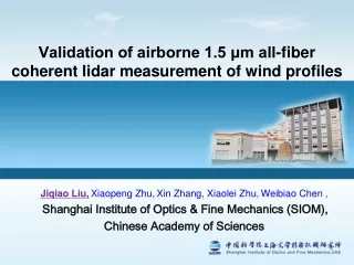
Validation of airborne 1.5 μm all-fiber coherent lidar measurement of wind profiles Jiqiao Liu,Xiaopeng Zhu,Xin Zhang, Xiaolei Zhu,Weibiao Chen , Shanghai Institute of Optics & Fine Mechanics (SIOM), Chinese Academy of Sciences
Outline Motivation Airborne coherent lidar development Experiment results Summary
1. Motivation • In lower atmospheric troposphere, coherent Doppler lidar shows more advantages: • High accuracy • High spatial and temporal resolution • High sensitivity and insensitive to solar background • A compact coherent lidar is required to measure wind profiles to almost 3 km altitude. • The lidar can meet airborne platform condition. All-fiber pulsed coherent lidar is the best choice!
2. Airborne coherent lidar development 1.5 µm Fiber laser is selected • high efficiency • robust and low weight • fiber components and detector maturity • Lidar consists of three parts: • High Power fiber laser • Telescope and scanner • Detector Electronics and Power supply • Power supply≤600W
Wind vector measurement LOS wind profile Scanning Multiple LOS • VAD combined Wind vector (Horizontal wind speed, direction and vertical wind speed)
Coherent wind lidar on airborne platform VAD scanning: 8 azimuth LOS within 15s LOS wind speed of VAD scanning • 100mm Lens scanner • 20° deflection angle • Position ,attitude and velocity are measured from GPS/INS
Airborne wind speeds retrieval LOS wind speeds correction in airborne platform • Wind speeds vector retrieval-nonlinear fit equation
1.5μmall-fiber single frequency laser configuration • Seeder laser+modulater+MOPA(amplifier)
1.5μmall-fiber single frequency laser source High energy source of 500 μJ 470ns >500μJ OSNR>30dB M2:1.10/1.17
Developed airborne coherent Doppler lidar 2017,1.5μm, 35kg (Airborne prototype II) 2015,1.5μm, 45kg (Airborne prototype I) UAV platform Harsh environment endurance : • Wide operation temperature range: -40℃-+55℃ • Shock: 20g (@10ms)/ Sine vibration: 2g
3. Experiment results Airborne campaign I in Weihai, Shandong (2015) • Airborne campaign II in Huayin, Shanxi (2017) (UAV platform)
Airborne campaign in Weihai, Shandong Wind lidar GPS/INS Jan.7-19, 2015 Successful validation for Airborne coherent wind lidar
Airborne campaign in Weihai, Shandong Flight track Altitude:2km Ground validation instruments:Balloon +Ground-based wind lidar
Airborne campaign in Weihai, Shandong Horizontal wind speeds Ocean Land/Ocean • Horizontal wind directions
Airborne campaign in Weihai, Shandong Wind speeds comparison -Airborne wind lidar、Balloon and Ground based wind lidar • Airborne VS Balloon • Airborne VS Balloon • Airborne VS Ground • Airborne VS Ground
Airborne campaign in Huayin, Shanxi Preliminary experiment on Mar.29, 2017 UAV Flight altitude:3~4km Close to Huashan Mountain • Ground Validationinstruments • GPS Balloon • Ground-based wind lidar (Airborne prototype I) Flight trace Ground wind Lidar Mountain height >1600m GPS balloon & Drift path Mountain height >1700m
UAV platform altitude and attitude during flight Pitch Flight altitude Climb Climb cruise Roll Yaw
Airborne campaign in Huayin, Shanxi Horizontal wind speeds • Horizontal wind directions
Airborne campaign in Huayin, Shanxi • Vertical wind speeds • Relative signal amplitude -Jan.19,2015 • Range corrected signal Cloud
Airborne campaign in Huayin, Shanxi Wind speeds and directions comparisons - Airborne wind lidar、Balloon and Ground based wind lidar 1700m~3700m • Airborne VS Balloon • Airborne VS Balloon • Balloon VS Ground • Balloon VS Ground
Summary The compact airborne coherent wind lidar prototypes with high pulse energy are developed. Airborne campaign experiments are implemented successfully to validate the performance. Further UAV experiments are scheduled in 2018. The airborne wind lidar could also be acted as validation instrument in China for ALADIN wind lidar in future.