Understanding Natural Hazards: Risks, Impact, and Urban Vulnerability
450 likes | 570 Views
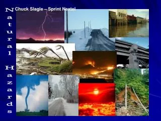
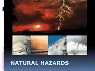
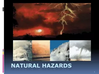
Natural hazards, such as hurricanes, earthquakes, and floods, pose significant risks to urban populations. These disasters can result in property damage, economic loss, injuries, and even loss of life. As population density increases in cities, the associated hazards often escalate due to proximity to natural threat zones like coastlines and fault lines. By studying various types of natural hazards and understanding the concept of risk, we can better prepare and mitigate potential disasters, ensuring safer communities and effective emergency planning.

Understanding Natural Hazards: Risks, Impact, and Urban Vulnerability
E N D
Presentation Transcript
The photo above is a satellite image of a hurricane. • A hurricane is one of the most devastating natural disasters. • This storm consists of high speed spiralling winds and intense rainfall. • Hurricanes form over oceans and eventually move over land. • Property destruction, flooding, injuries, and death are common consequences of major hurricanes.
City: Subject to hazard • Life is full of risks and hazards. • Hazard: lack of predictability which usually involves danger. • People deal with hazards and risks on a daily basis. • However, people go to extraordinary lengths to reduce hazards. • For example: people install alarm systems and smoke detectors
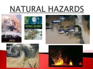
Cities can also be subject to hazards. • This is when the population is exposed to various types of threats. • Natural (earthquakes, hurricanes, etc) • Socio-economic (war, despression) • Technical (computer failure, explosion at a factory) • Biological (increase in insect or vermin infestation) • Some cities may have to deal with one or more of these threats.
All of these threats can result in property damage, economic loss, environmental damage and death. • The larger the population of a city, the larger the hazard is. • There are several types of hazards. • For our course we will study natural hazards. • Natural hazards such as; seismic activity (earthquake), volcanoes, cyclones, and floods.
Terms to remember • Natural phenomenon: is anything that happens in nature, away from a human population • Risk: is when natural phenomenon threatens a population • Issue: is population or property which is threatened. • Natural disaster: occurs when property or a population is not sufficiently protected against a risk.
Degrees of Risk • As mentioned above risks are all around us. • There are different organizations that analyze risk of damage or death due to a natural or human phenomenon. • For example: dying from smoking 10 cigarettes a day, 1 in 200 • Ex: Dying from the flu 1 in 5000 • Ex: Dying during an earthquake in California 1 in 2 000 000
Risk-free Territories • Many of the world’s major cities are located in risk prone zones. • Current estimates place the earth’s population at roughly 7 billion. • Most of the earth’s population live on coastlines, fault lines, or in close proximity to volcanoes.
Natural hazards are not equally distributed throughout the world. • There are some areas that experience higher threats than others. • For Example: Montreal has flood risks only, whereas most European countries have several hazards. • Almost all territories on earth have natural hazards. • Most of these hazards are not constant but all areas have experienced some form of disaster.
Comparison of big cities subject to hazard • Beijing, CHINA – Earthquake, extreme cold http://media.thestate.com/smedia/2009/09/27/13/766-China_Earthquake.sff.standalone.prod_affiliate.74.jpg http://www.javno.com/slike/slike_3/r1/g2008/m12/y189180479431174.jpg http://www.udel.edu/PR/UDaily/2007/jun/southpole11lg.jpg
Calcutta, India – cyclone, flood http://www.movingtheworld.org/files/images/refugee_camp_NGO_Bharat.jpg http://www.worldproutassembly.org/cyclone.jpg http://nimg.sulekha.com/Others/original700/india-cyclone-2009-5-27-10-21-30.jpg
Jakarta, Indonesia - Earthquake, volcanic eruption http://graphics8.nytimes.com/images/2006/05/13/world/volcano2.large.jpg
Los Angeles, USA – Earthquake, flood, forest fire, drought http://sustain.cs.washington.edu/blog/wp-content/uploads/2009/05/drought-pix.jpg http://images-2.redbubble.net/img/art/size:large/view:main/2279848-2-drought-breakers.jpg http://www.sustainabilityninja.com/wp-content/uploads/2009/02/wildfire.jpg
http://www.helibuilder.net/Pictures/Montana%20Wild%20Fire.jpghttp://www.helibuilder.net/Pictures/Montana%20Wild%20Fire.jpg http://upload.wikimedia.org/wikipedia/commons/d/d6/Wildfire_California_Santa_Clarita_(square).jpg http://a.abcnews.com/images/US/rt_ca_wildfires_02_090830_ssh.jpg
Manila, PHILIPPINES – Cyclone, flood, volcanic eruption, earthquake http://www.tdbimg.com/files/2009/09/28/img-hp-main---manila-flood_143455907176.jpg http://1.bp.blogspot.com/_YbUi51_e9IY/SsBLcACSinI/AAAAAAAACaY/MyU4_cJoxQo/s400/electric.jpg
Mexico, MEXICO – Earthquake, flood, landslide http://graphics8.nytimes.com/images/2007/11/06/world/06mexico3-600.jpg http://www.geo.mtu.edu/~jaherric/Documents/ElSalvador_Landslide2.jpg
http://newsimg.bbc.co.uk/media/images/42446000/jpg/_42446725_image5_afp416.jpghttp://newsimg.bbc.co.uk/media/images/42446000/jpg/_42446725_image5_afp416.jpg Sao Paulo, BRAZIL – Flood, landslide http://www.redskynews.com/images/SantaCatarinaFloods.jpg
Why do people live in high risk areas? • The area is favourable to human activities. (navigation, mines, etc) • People are attached to an area. They have a sense of belonging to a territory. • People don’t have the means (transportation or funds) to leave. • Most territories have some degree of risk.
Inequality and Natural Hazards • Different areas will cope with hazards differently. • Furthermore, living conditions, lifestyles, income, and education will increase or decrease the level of risk. • These factors will determine the vulnerability of a community. • Vulnerability: the ability of the population to deal with the threat of disaster.
Perception of Risks • Every territory will see hazards and risks in different ways. • Perception: how something is seen. • Perception of a risk will depend on an territory’s level of development. • Natural hazards will have different impact on a territory that is extensively developed • Ex: Florida vs. Karachi (Northern Pakistan)
Karachi, Pakistan is threatened by; earthquakes, floods, and landslides • Florida is also threatened by floods, as well as hurricanes. • In Florida, governments have invested millions into flood prevention and hurricane warning systems. • In Karachi, very little has been done to prevent any of these natural disasters from occurring. • Karachi invest time and money into other problems like; poverty, hunger, and housing
Why do you think there is such a difference between these areas? • Pakistan does not perceive natural hazards as a priority. • In Pakistan poverty, hunger, housing and disease is perceived as a top priority. • There are many areas like Pakistan that perceive natural hazards as less important than other issues. • Ex: Poverty, hunger, disease
In Florida providing basic needs and fighting disease is not a priority. • This is due to the fact that the United States is far more developed. • Since Florida does not have to invest money in basic needs. • This means that they can invest more money into prevention of natural disasters.
Living Close to a Natural Hazard • There are many places all over the world that must deal with natural hazards. • Some examples are: • San Francisco has earthquakes • Manila has earthquakes, volcanoes, typhoons, and floods. • Quito has volcanoes.
The image above is Pichincha. A very active volcano in Ecuador. • Quito is located right at the bottom of Pichincha. • Quito is Ecuador’s largest city and its capital. • Pichincha’s most recent eruption was in 1999. • Furthermore, 35 km away from Quito sits Cotopaxi another very active volcano. Its last eruption was about 100 years ago.
Quito: The Basics • Quito is the capital of Ecuador as well as the largest city. • Ecuador is a small country with a population of roughly 14 million. • Quito is located in the Andes mountains. • Quito sits at 2800m which makes it the second highest capital city in the world.
Most of the population of Ecuador lives in Quito, Guayaquil, and Cuenca. • These cities struggle with overcrowding, poverty, and air pollution, and polluted water supplies. • Ecuador’s economy is based on agriculture (bananas, cocoa, sugar, coffee) and fishing. • However, in recent years, large oil and pharmaceutical companies have set up in the major cities.
Volcano Avenue • The Andes Mountains run through Ecuador. • In 1802, Alexander von Humbolt named the area around the mountains “Volcano Avenue” • Quito is in the center of Volcano Avenue. • Quito is actually built on the slope of Pichincha. A volcano that has erupted 59 times since the 16th century.