FUTURE
The MyMARACOOS Fishing App: An IOOS Success Story of User- Driven Product Development and Strong Institutional Partnerships. Dr. Gerhard F. Kuska 1 , Dr. Carolyn A. Thoroughgood 1 , Peter Moore 1, Melanie Schroeder Gearon 2 , Charlton Galvarino 3

FUTURE
E N D
Presentation Transcript
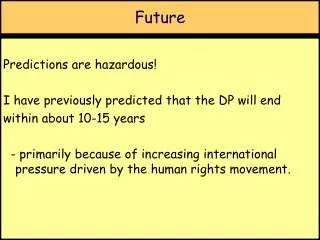
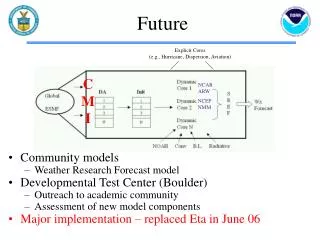
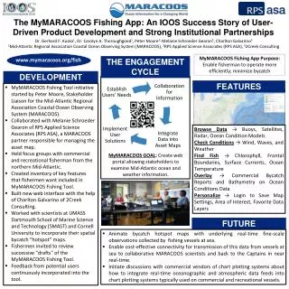
The MyMARACOOS Fishing App: An IOOS Success Story of User- Driven Product Development and Strong Institutional Partnerships Dr. Gerhard F. Kuska1, Dr. Carolyn A. Thoroughgood1, Peter Moore1,Melanie Schroeder Gearon2, Charlton Galvarino3 1Mid-Atlantic Regional Association Coastal Ocean Observing System (MARACOOS), 2RPS Applied Science Associates (RPS ASA), 32Creek Consulting MyMARACOOS Fishing App Purpose: Enable fisherman to operate more efficiently; minimize bycatch www.mymaracoos.org/fish THE ENGAGEMENT CYCLE DEVELOPMENT • MyMARACOOS Fishing Tool initiative started by Peter Moore, Stakeholder Liaison for the Mid-Atlantic Regional Association Coastal Ocean Observing System (MARACOOS). • Collaborated with Melanie Schroeder Gearon of RPS Applied Science Associates (RPS ASA), a MARACOOS partner responsible for managing the asset map. • Held focus groups with commercial and recreational fisherman from the northern Mid-Atlantic. • Created inventory of key features that fishermen want included in MyMARACOOS Fishing Tool. • Built new web interface with the help of Charlton Galvarino of 2Creek Consulting. • Worked with scientists at UMASS Dartmouth School of Marine Science and Technology (SMAST) and Cornell University to incorporate their spatial bycatch "hotspot" maps. • Fishermen invited to review successive "drafts" of the MyMARACOOS Fishing Tool. • Feedback from potential users continuously incorporated into the tool. FEATURES Browse Data → Buoys, Satellites, Radar, Ocean Condition Models Check Conditions → Wind, Waves, and Weather Find Fish → Chlorophyll, Frontal Boundaries, Surface Currents, Ocean Temperature Overlay → Commercial Bycatch Reports and Bathymetry on Ocean Conditions Data Personalize → Login to Save Map Settings, Area of Interest, Favorite Data Layers MyMARACOOS GOAL: Create web portal allowing stakeholders to examine Mid-Atlantic ocean and weather information. FUTURE • Animate bycatch hotspot maps with underlying real-time fine-scale observations collected by fishing vessels at sea. • Enable cost-effective connectivity for transmission of this data from vessels at sea to collaborative MARACOOS scientists and back to the Captains in near real-time. • Initiate discussions with commercial vendors of chart plotting systems about how to integrate real-time oceanographic and atmospheric data feeds into chart plotting systems typically used on commercial and recreational vessels.