Download
1 / 28
280 likes | 434 Views
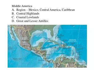
Mexico and Central America. Christina Gonzalez and Reynel Oliva. Physical Coordinates of Mexico. 23 00 N, 102 00 W Mexico is located in North America.

E N D
Mexico and Central America Christina Gonzalez and Reynel Oliva
Physical Coordinates of Mexico • 23 00 N, 102 00 W • Mexico is located in North America. • It borders the United States to the north, the Pacific Ocean to the west and south, and the Gulf of Mexico and the Caribbean Sea to the east; also Guatemala and Belize to the south. • Mexico's total area covers 1,972,550 square kilometers, including approximately 6,000 square kilometers of islands in the Pacific Ocean, Gulf of Mexico, Caribbean Sea, and Gulf of California.
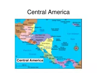
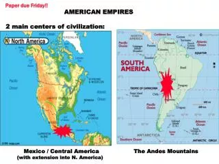
Physical Coordinates of Central America • Central America is the central geographic portion of the Americas. • It is a narrow neck of land which contains Panama, Guatemala, Honduras, Belize, Nicaragua, El Salvador, and Costa Rica • 592,000 square kilometers. • The Pacific Ocean lies to the southwest, the Caribbean sea lies to the northeast, and the Gulf of Mexico lies to the north.
Length Variation of Days and Nights of Mexico • During the Autumnal Equinox, days and nights are of equal length. • During the Vernal Equinox, days vary within minutes. • March 17- 12 hours of day and night. March 18- 12 hours 3 minutes of day, 12 hours 5 minutes of night.
Length Variation of Days and Nights of Central America • During the Autumnal Equinox, both day and night are of equal length • During the Vernal Equinox, hours vary in terms of minutes • March 17-Sunrise 6am Sunset 6pm. March 18, Sunrise 6:04am Sunset 6:05 pm • 12 hours of day and night in all equinox, except the vernal (spring) equinox
Time Zones for Mexico • Mexico uses three time zones. • Central Standard Time-most of the country uses this. • Mountain Standard Time- states of Chihuahua, Nayarit, Sonora, Sinaloa and Baja California Sur. • Pacific Standard Time- Baja California Norte. • Daylight Saving Time begins at 2:00 a.m. local time on the first Sunday in April. On the last Sunday in October areas on Daylight Saving Time fall back to Standard Time at 2:00 a.m. The names in each time zone change along with Daylight Saving Time. Central Standard Time (CST) becomes Central Daylight Time (CDT), and so forth. The state of Sonora does not observe Daylight Saving Time. • Mexico has a Central Standard Time with the UTC of 6 subtracted hours and 5 daylight savings time hours, based on the mean solar time of the 90th degree meridian west of the Greenwich Observatory.
Time Zones for Central America • Central America has a Central Standard Time • Subtraction of 6 hours from the Coordinated Universal Time, and 5 hours during daylight savings time • The clock time in this zone is based on the mean solar time of the 90th degree meridian west of the Greenwich Observatory
Locations for Mexico and Central America • Tropic of Cancer- directly separates Central America from Mexico. • Tropic of Capricorn-Central America lies south of it, and Mexico lies north of it, also lies west of the Prime Meridian. • Equator-Both are north of the equator.
Rocks and Minerals for Mexico Apatitie Amethyst Rosasite Legrandite Danburite Grossular Boleite Acanthite Mimetite Arsenopyrite Topaz Wulfenite & Barite
Rocks and Minerals for Central America • In Central America we have many calcites and crystals like Red Opal, Blue Opal, Pink Opal, and spikes. • Elements, Oxides, carbonates
Plate Tectonics for Mexico • North American plate- Most of the Mexican landmass rests on this westward moving plate. • Cocos plate- The Pacific Ocean floor off southern Mexico is being carried northeast by the underlying motion of this plate. • Pacific plate- Areas of Mexico's coastline on the Gulf of California, including the Baja California Peninsula, are riding northwestward on this plate.
Plate Tectonics for Mexico and Central America • The Plate Tectonics of both Mexico and Central America are intertwined. • This means that the possibility of volcanoes erupting is plausible. • Earthquakes are created by these eruptions and tsunamis are triggered as well.
Physical Features of Mexico • Ocean floor material is relatively dense; when it strikes the lighter granite of the Mexican landmass, the ocean floor is forced under the landmass, creating the deep Middle America Trench that lies off Mexico's southern coast. • The westward moving land atop the North American plate is slowed and crumpled where it meets the Cocos plate, creating the mountain ranges of southern Mexico. • Mexico is crossed from north to south by two mountain ranges known as Sierra Madre Oriental and Sierra Madre Occidental, which are the extension of the Rocky Mountains from northern North America. From east to west at the center, the country is crossed by the Trans-Mexican Volcanic Belt also known as the Sierra Nevada. A fourth mountain range, the Sierra Madre del Sur, runs from Michoacán to Oaxaca. As such, the majority of the Mexican central and northern territories are located at high altitudes, and the highest elevations are found at the Trans-Mexican Volcanic Belt: Pico de Orizaba (5,700 m), Popocatépetl(5,462 m) and Iztaccíhuatl(5,286 m) and the Nevado de Toluca (4,577 m). Three major urban agglomerations are located in the valleys between these four elevations: Toluca, Greater Mexico City and Puebla. • The subduction of the Cocos plate accounts for the frequency of earthquakes near Mexico's southern coast. As the rocks constituting the ocean floor are forced down, they melt, and the molten material is forced up through weaknesses in the surface rock, creating the volcanoes in the Cordillera Neovolcánica across central Mexico. • Rather than one plate subducting, the Pacific and North American plates grind past each other, creating a slip fault that is the southern extension of the San Andreas fault in California. Motion along this fault in the past pulled Baja California away from the coast, creating the Gulf of California. Continued motion along this fault is the source of earthquakes in western Mexico.
Physical Features of both Mexico and Central America • Mountain ranges vary from big to small like any other place in the world that contains mountains. Mountains like Epicztal and Topectzal. • All of the volcanoes are located on the eastern side of Central America; among them are Santa Maria, Fuego, Arenal, Terica, Casita, etc. • No glaciers, however in terms of lakes and rivers we have the San Juan Lake, Marion, Putnam, Osceola, among others. In terms of Rivers we have Rio Lempa and Rio Grande (Mexico border) also Veracruz. • The possibility of earthquakes is moderate since volcanoes are present, but calm (sleeping). Tsunamis can also be created by these earthquakes due to both geographic parts of the world.
Atmospheric Pressure in Mexico • Since atmospheric pressure results from the weight of the overlying air, it is less at higher altitudes. • According to the formula given above, the atmospheric pressure in Mexico City is 764 atm. Keeping in mind that oxygen makes up 21% of the atmospheric constituents, the partial pressure of oxygen (O2) in 2240 m altitude is roughly 160 atm, compared to the 213 atm at sea level.
Atmospheric Pressure in Central America • The mercury level at a high atmospheric pressure in Central America is somewhere between 20-25 inch of mercury. Its low points are between 12-15 inches of mercury
Carbon Dioxide Levels in Mexico and Central America • In the western cities of Central America and Mexico we have a moderate concentrated amount of carbon dioxide. • Both Central America and Mexico do not contribute as much to Global Warming as other places due to shortage of technology. • In the countryside, ironically the level of carbon dioxide is higher. • There are too many volcanoes located to the eastern portion of both geographic places, as a matter of fact, all of them are there. • High amounts of both carbon dioxide and carbon monoxide. This corrected chart shows carbon dioxide emissions for Mexico. They are expressed in total metric tons, metric tons per capita and metric tons per $1,000 of gross national product. Carbon Dioxide emissions chart
Wind Patterns – Latitude Reference for Mexico • The surface wind speed, zonal and meridional wind and the surface pressure averaged over 93W - 97W. • Winds tend to blow across the city from the northeast, where a slight opening in the mountains allows moisture and winds from the Gulf of Mexico to enter the basin. These winds blow pollution from the region of heaviest industrial development towards downtown and the residential areas southwest of the city are pressed against the southern mountain chain.
Wind Patterns – Latitude Reference for Central America • Wind patterns tend to vary from cold fronts to warm fronts. • (Not Miami weather) this means that when it is summer it is hot, and when it is winter it’s cold, no variance. • Mostly in all directions, however south of the equator, wind tends to blow eastward.
Humidity Levels for Mexico and Central America • Mexico-The rainy season of the interior Mexico falls during the Summer. However, since the major part of the interior is on a high elevation, the temperature and humidity are fairly moderate. • Central America- this applies too, however certain differences can be noted; during winter the humidity levels are extremely high, and on low elevations it is quite “dry”.
Climate Zones for Mexico and Central America • A)The Tropic of Cancer effectively divides the country into temperate and tropical zones. Land north of the twenty-fourth parallel experiences cooler temperatures during the winter months. South of the twenty-fourth parallel, temperatures are fairly constant year round and vary solely as a function of elevation. • B) This high-elevation region exhibits a huge difference between Summer and Winter. Summer generally covers the period from June to October, but it may rain in the central and southern regions while the north remains relatively dry. Winter is traditionally the tourist season and December is by default the busiest month for the big beach resorts. • During Winter, it is not surprising for snow bed to cover the upper regions from December through February. The temperatures can drop to ten degrees and highs to sixty degrees. On the other hand, Summer rim temperatures can be in the eighties whereas deep in the canyons it can reach a hundred twenty or higher.
Climate Zones for Central America • C) Maritime climates are fairly moderate and “soothing” during summer seasons and Continental climates vary, but it is mostly dry in cities, the countryside is humid, this is due to humid climates among mountain ranges like Sierra Madre. • D) Results show a marked seasonal variation of q (humidity) from around 7·9 g kg-1 during the dry months to 10 g kg-1 in the wet season (May-October) on both urban and suburban sites. • E) Vegetation is diverse due to microclimates among other factors that are involved.
Oceans and Seas bordering Mexico and Central America • Both Central America and Mexico are surrounded by the Pacific Ocean and the Caribbean sea. • The Gulf of Mexico is located northeast of Central America, and east of Mexico • Salinity varies in terms of latitude. The water near the equator is less salty than that found in the mid-latitudes because of abundant equatorial precipitation throughout the year. In terms of poles the temperate latitudes salinity is also low, because little evaporation of seawater takes place in these frigid areas.
http://www.reuters.com/article/latestCrisis/idUSN27394059 Weather Disturbances in Mexico • Mexico lies squarely within the hurricane belt, and all regions of both coasts are susceptible to these storms from June through November. Hurricanes on the Pacific coast are less frequent and often less violent than those affecting Mexico's eastern coastline. Several hurricanes per year strike the Caribbean and Gulf of Mexico coastline, however, and these storms bring high winds, heavy rain, extensive damage, and occasional loss of life. • Situated atop three of the large tectonic plates that constitute the earth's surface, Mexico is one of the most seismologically active regions on earth. The motion of these plates causes earthquakes and volcanic activity.
Weather Disturbances in Central America • Everything ranging from severe thunderstorms to major hurricanes and typhoons • Volcanic Eruptions • Earthquakes • Tsunamis (triggered by these earthquakes)
Biomes in Mexico and Central America • Desert • Aquatic (in low amounts) • Forests • Grasslands • Tundra • Tropical Rainforest • Both contain all of these, however Mexico does not have many aquatic biomes
Population Distribution in Mexico and Central America • Population density ranks among the top most reproductive populations, which amounts to 4.4 people per square smile. • This has lead to exponential growth in terms of immigration. • Large-scale immigration from Mexico is a very recent phenomenon. In 1970, the Mexican immigrant population was less than 800,000, compared to nearly 8 million in 2000. • In a 2008 study, it was shown that 12.7 million Mexicans migrated.
Resources • Chapter 19 and 20 PSC1515 Science book • Chapter 24 • www.wikipidia.com • http://www.lib.utexas.edu/maps/historical/central_america_1892.jpg • www.britannica.com (encyclopedia) • http://www.atmos-chem-phys.org/6/1249/2006/acp-6-1249-2006.html • http://www.timetemperature.com/tzmx/mexico_time_zone.shtml • http://cdiac.ornl.gov/trends/emis/tre_mex.htm • http://www.asp.bnl.gov/MAX-Mex.html • http://www.physicsforums.com/showthread.php?t=30049 • http://www.sbg.ac.at/ipk/avstudio/pierofun/mexico/air.htm • http://www3.interscience.wiley.com/journal/12453/abstract?CRETRY=1&SRETRY=0