Download
1 / 28
290 likes | 413 Views
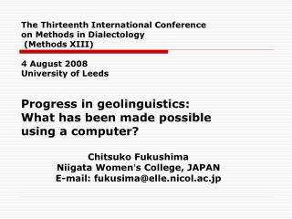
Progress in geolinguistics: What has been made possible using a computer? Chitsuko Fukushima Niigata Women ’ s College, JAPAN E-mail: fukusima@elle.nicol.ac.jp.

E N D
Progress in geolinguistics: What has been made possible using a computer? Chitsuko Fukushima Niigata Women’s College, JAPAN E-mail: fukusima@elle.nicol.ac.jp The Thirteenth International Conference on Methods in Dialectology (Methods XIII)4 August 2008University of Leeds
Inspired by lectures at an international symposium • The National Institute for Japanese Language held its 14th international symposium, for the first time on dialectology, entitled as “Geolinguistics around the World”, on August 22-23, 2007 in Tokyo. • Current Trends in Geolinguistics around the World (Day 1) and Application Techniques of Linguistic Atlases (Day 2) • Lectures by Asian and western geolinguists
Invited speakers and topics at the symposium • Japanese Geolinguistics: Takuichiro Onishi (The National Institute for Japanese Language) • Korean Geolinguistics: Lee Sang Gyu (The National Institute of the Korean Language) • Chinese Geolinguistics: Iwata Ray (Kanazawa University) • German Geolinguistics: Joachim Herrgen (The University of Marburg) • English Geolinguistics: Heinrich Ramisch (The University of Bamberg) • Catalan Geolinguistics: Maria-Pilar Perea (The University of Barcelona) • Glottograms: Shinji Sanada (Osaka University) • Dialectometry: Hans Goebl (University of Salzburg) • Comments: Chitsuko Fukushima (Niigata Women’s College) and David Heap (The University of Western Ontario) Cf. Chitsuko Fukushima and David Heap 2008
Aims of making linguistic maps and various techniques • The geolinguistic surveys around the world vary partly due to the differences of aims or reasons to make linguistic maps. • Two main aims: • To decide a dialect boundary or demarcate the area • To read a history from geographical distributions on a map • Linguistic maps have been made for either reason or a combination of both.
From computers to information technology • The beginning: • Computer-assisted map making • GLAPS 1978, SEAL 1983 • Correct, fast and easy to reanalyze data; later, graphically more beautiful, sophisticated maps • The present: • The main asset of using a computer: linguistic data as a “linguistic database” or “language corpus” • Using map images to upload to the web and write a paper • Drawing and publishing maps and data online
Four steps in the map-making process using a computer • 1) Electronic data making • 2) Sorting and mapping data • 3) Comparing, integrating, superimposing, and linking data • 4) Publishing linguistic maps
Ways to make linguistic mapsusing a computer • Using original software • Using off-the-shelf software • Using GIS software • Drawing isoglosses • Making symbol maps • Making hatchedmaps • Doing statistics
1) Electronic data making • New features: • Geolinguistic data = database or data corpus • Reusable data for different software • On-the-spot data input and map-making just after the survey • Making data from not only new surveys but also older surveys* *German: DiWA English: CLAE, English Dialect Dictionary Catalan: Antoni M. Alcover’s data Japanese: LAJ
2) Sorting and mapping data • Mapping data = Making a model based on an interpretation of data《Onishi》 • “A new generation of linguistic atlases has come into existence which is profoundly influenced by modern computing. Two aspects seem to be particularly noteworthy in this context. First, it is possible to record and to store large amounts of data in the form of databases. Secondly, the data can be searched automatically, be processed and be visualized effectively by computer cartography. “《Ramisch》 • “the mapping techniques used with data from corpora” 《Perea》
3) Comparing, integrating, superimposing, and linking data • A. Synthesizing linguistic maps: Cumulative identity maps ・Diffusion maps by SEAL Analysis of 1st person pronoun in Tokunoshima (C. Fukushima 2003)
3) Comparing, integrating, superimposing, and linking data • A. Synthesizing linguistic maps: Cumulative identity maps ・Integrated diffusion maps by SEAL Analysis of phonetic variations in Tokunoshima (C. Fukushima 2000)
3) Comparing, integrating, superimposing, and linking data • A. Synthesizing linguistic maps: Cumulative identity maps ・Contrast maps by SEAL Analysis of phonetic variations in Tokunoshima (C. Fukushima 2000)
Integrated diffusion mapsby SEAL Examples from C. Fukushima 1997 (CLAE2) Integrating linguistic maps to show the variation of the standardization process in the morphological data of CLAE 1&2
Integrated diffusion mapsby SEAL Examples from C. Fukushima 1997 (CLAE2)
3) Comparing, integrating, superimposing, and linking data • B. superimposing maps • The Digital Wenker Atlas (DiWA) Exact splicing of the three individual map sheets into a single map;Superimposing a Wenker map over any other cartographic representation in electronic form and directly compare the two using a transparency function. 《Herrgen》 • Grammatical Atlas of Japanese (GAJ) Superimposing a GAJ map and another map of geographical information using the GIS. 《Onishi》(Onishi at Methods XII)
3) Comparing, integrating, superimposing, and linking data • C. Comparing maps from different surveys • Old materials and new materials • Comparison between The Digital Wenker Atlas (DiWA) and the contemporay two-generation maps 《Herrgen》 • Comparison between Antoni M. Alcover’s data and the Corpus Oral Dialectal (COD) 《Perea 》
3) Comparing, integrating, superimposing, and linking data • Superimposing GAJ maps with maps of students’ dialect by SEAL
3) Comparing, integrating, superimposing, and linking data • D. Link with multimedia information • The Digital Wenker Atlas (DiWA) Locations are clickable and linked with biographic information, digitalized copies of the original questionnaires, and with sound recordings. 《Herrgen》 • CLAE with PCMAP and MS Word With an ODBC it is equally possible to connect localities with other Windows applications to display text files or to play audio files (thus a ‘speaking’ atlas). 《Ramisch》 • Speaking Atlas by Kibe, Kishie, Nakai et al. (2005 at Methods XII) • The Atlas of North American English: Phonetics, Phonology and Sound Change (2006)by William Labov, Sharon Ash, and Charles Boberg
3) Comparing, integrating, superimposing, and linking data • E. Doing statistics: • Dialectometry 《Goebl》 • Combination of multivariate analysis and map-making 《CLAE: Inoue and Fukushima 1997》
Combination of multivariate analysis andmap-making 《CLAE: Inoue and Fukushima 1997》
Combination of multivariate analysis and map-making 《CLAE: Inoue and Fukushima 1997》
4) Publishing linguistic maps • Trend 1: Publishing not only maps but linguistic data • Trend 2: Publishing on the web as well as on a CD-ROM or DVD-ROM • Trend 3: Interactive map-making: letting viewers make custom-mademaps or supply their data • LAMSAS • BBC VoicesProject • Yahoo! Japan Gotouchi Banzai
From Yahoo! Japan Gotouchi Banzai 特集:ご当地万歳 What do you call MacDonald’s? makku makudo Information was collected and maps were published on the web. http://local.yahoo.co.jp/gotouchi/map/map.html?mapid=miscedit02localogk971604804ac1ede7a1
Tasks of Gelinguistics • 1. Sharing and integrating the data • The Atlas Linguarum Europae • JDNet(Japanese Dialect Network) 《Onishi》 • Circle of East Eurasian Geolinguitics (A project by Japanese scholars that has just started)
Tasks of Gelinguistics • 2. Publishing Linguistic data • Media • Publishing original data • Linking with multimedia information • Civilian participation: interactive interface • Personal information
Bibliography • Chitsuko Fukushima 1997 “Standardization in England on the Morphological Data of CLAE.”The Computer Developed Linguistic Atlas of England 2. Max Niemeyer Verlag: Tübingen. • Chitsuko Fukushima 2000 “ Calculating and Mapping Regional Speech Variation in Tokunoshima. ” The Bulletin of Niigata Women’s College 37, pp.79-87. • Chitsuko Fukushima 2003 “ Linguistic Innovation Born in the Paradigm: Interpretation of Linguistic Maps. ” Proceedings of 3rd International Congress of Dialectologists and Geolinguists, Lublin 2000. Maria Curie- Skłodowska University Press: Lublin. Vol.1 pp.194-207. • Chitsuko Fukushima 2007 “Superimposing Linguistic Maps to Trace Linguistic Changes.”Linguistica Atlantica 27-28 2006-2007, pp.40-45.
Bibliography 2 • Chitsuko Fukushima and David Heap 2008 “A Report on the International Conference: Geolinguistics around the World.” Web Journal Dialectologia Number 1, pp. 135-156. http://www.publicacions.ub.es/revistes/dialectologia1/ • Fumio Inoue and Chitsuko Fukushima 1997 “A Quantitative Approach to English Dialect Distribution: Analyses of CLAE Morphological Data.” The Computer Developed Linguistic Atlas of England 2. Max Niemeyer Verlag: Tübingen.