Download
1 / 8
80 likes | 239 Views
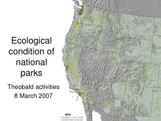
Ecological condition of national parks. Theobald activities 8 March 2007. Objective #1. Landscape-level indicators and ecologically-relevant boundaries Engaged in discussion with ROMN through ROMO/FLFO WCA about indicators Follow up to needs assessment with ROMN group Landscape dynamics

E N D
Ecological condition of national parks Theobald activities 8 March 2007
Objective #1 Landscape-level indicators and ecologically-relevant boundaries • Engaged in discussion with ROMN through ROMO/FLFO WCA about indicators • Follow up to needs assessment with ROMN group • Landscape dynamics • Land use change • Fragmentation/connectivity indices • Modification of land cover and fragmentation from land use dynamics SYNERGISTIC (w/Hansen, Goetz, Melton) • ?Opportunity to provide “primer” on relevant landscape metrics • ?Recommendation of “core” national-level indicators
Preliminary selected indicators for ROMO/FLFO WCA I. Landscape condition • Vegetation composition, structure & soils • Landscape dynamics (broader land use changes) II. Biotic condition • freshwater, wetland communities (watershed-scale) • Beaver dams, habitat suitability model III. Chemical & physical characteristics • Wet & dry deposition (N) • Water chemistry IV. Ecological processes • Invasive plants • Invasive aquatic biota (lower priority) V. Hydrology & geomorphology • Surface water dynamics VI. Natural disturbance regimes • Fire regime (wildfire, beetle outbreak) • Avalanche paths VII. Social-ecological systems • Visitor use (accessibility) • Institutional (integrative complexity)
Objective #2 Integration of RS products with NPS DSS • US Census data, accessibility • SYNERGISTIC activity with TOPS
Objective #3 Analyses and forecasts • Development of metrics • Land cover and use, SERGoM model • Links to % impervious surface, % canopy, miles of roads, invasives, etc. (SYNERGISTIC w/Goetz) • Biodiversity & habitat models (FunConn graph theory) • Trends and forecasts • Ecoregional context of parks (graphs) • Link housing trends to develop forecasts of other metrics
Objective #4 Integration into NPS DSS • Spatially explicit models allow relative indices at decision-relevant scales • Development of ArcGIS ModelBuilder tools • worked datasets • worked examples • user manuals • training sessions
n x n Matrix Habitat Modeling Toolset Land use/cover Create Habitat Quality Define Functional Patches Land cover w/ disturbance Landscape Network.mdb* Build Landscape Network Resource quality reclass table Functional Patches Habitat Quality Patch structure reclass table Land cover w/ disturbance Minimum patch size Edges Disturbance reclass table Cost surface (optional) Patch/foraging radius Nodes Resource quality threshold Permeability reclass table Linkages Core habitat percentage Minimum patch size Aggregation factor Corridors Resource quality threshold Aggregation factor Resource quality threshold Resource quality threshold *The landscape network resulting from the Habitat Modeling processes can be analyzed in the Landscape Networks/Analysis Toolset. KEY Tool Parameter table User-defined parameter Raster Dataset Shapefile Landscape Network Element FunConn v1 (ArcGIS v9.1 toolbox)
n x n Matrix FunConn v1 (ArcGIS v9.1 toolbox) Landscape Networks Toolset Analysis Tools Minimum Spanning Tree Selected Set Processing Tools Edge Calculator Points to Landscape Network Point features Calculated Field Node Calculator Calculated Field Landscape Network.mdb Edges Polygon to Landscape Network Neighborhood Selection Polygon features Selected Set Nodes Shortest Paths Table in Land. Network Polyline to Landscape Network Export Tools Polyline features Node-edge- Node distance Matrix n x n Matrix KEY Node-path- Node distance Matrix Tool Parameter table Shapefile Landscape Network Element n x n ASCII Matrix