Download
1 / 30
320 likes | 518 Views
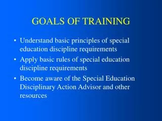
Day 2 Tables Query & Analysis Simple Editing Feature Creation Tools Labels and Annotation. Day 1 Review of Tier 2 Introduction Browse Data Layers & Layouts ArcToolbox. ArcGIS Training Outline Goals. Part 1 Goals for the Morning. Introduction to ArcGIS: Applications Data Model

E N D
Day 2 Tables Query & AnalysisSimple EditingFeature Creation ToolsLabels and Annotation Day 1 Review of Tier 2IntroductionBrowse DataLayers & LayoutsArcToolbox ArcGIS Training Outline Goals
Part 1 Goals for the Morning • Introduction to ArcGIS: • Applications • Data Model • ArcCatalog: Browse Data
ArcGIS • ArcGIS license levels • ArcView • ArcEditor • ArcInfo • Server applications (not part of ArcGIS) • ArcSDE • ArcIMS • ArcGIS Server
Grid CAD Tin Shapefile Coverage Image ArcGIS Model ArcView ArcEditor ArcInfo Clients RDBMS (GeoDatabase) Data pGDB
ArcGIS • ArcView • ArcEditor • ArcInfo • All share the same applications • ArcMap • ArcCatalog • ArcToolbox
ArcView: • ArcMap • ArcCatalog • ArcToolbox • ArcEditor = ArcView + • Enterprise geodatabase editing and management • Create and edit features with behavior • Geometric networks • Feature-linked annotation • Subtypes • Relationship classes • ArcInfo = ArcEditor + • Advanced ArcToolbox • Workstation ArcInfo: Arc, ArcEdit, ArcPlot, GRID, TIN, ... ArcGIS Application: Functionality
ArcCatalog • Browse your data • Graphical or textual • Manage and define your data • Set and view metadata
ArcMap • Perform map-based tasks • Mapping • Editing • Queries • Analysis • Graphing • Reporting
ArcGIS Extensions • Applications that extend ArcMap, ArcCatalog • 3D Analyst • ArcScan • Data Interoperability • Geostatistical Analyst • Publisher • Schematics • Spatial Analyst • Survey Analyst • Tracking Analyst • Same in ArcInfo, ArcEditor, and ArcView
Browsing Data Goals • Use ArcCatalog • Catalog tree • Connecting to folders • Viewing different types of data • Three views of your data • ArcCatalog options • Working with layer files • Work with metadata in ArcCatalog
Using ArcCatalog • Provides a uniform view of all your data • Modify table and feature class definitions • Fields, Subtypes, Domains, Relationships, and so on • Manage data: Copy, Rename, Delete
Title bar: Shows path to selected item Toolbars:Tear-off and dockable Catalog tree:Navigate to folders and databases;tear-off and dockable Contents panel: Three views on data; pulldown changes Context menus:Right-click items Status bar: Describes selected tools and menu items The user interface
The Catalog tree • Similar to Windows Explorer • Icons and content panel identify data types • Supports drag and drop • To ArcToolbox • To ArcMap
Connecting to folders • Connect to any folder in your network • Connect through Network Neighborhood to store a Uniform Naming Convention (UNC) path • Use UNC in layer files or map documents • Disconnect from folders
Searching for data • Search by • Name and Location • Geography • Date • Metadata • Results • Located in the Catalog tree • Shortcuts point to the data • Can be used anywhere data is used
Shapefiles and coverages • Shapefiles are feature classes • Coverages are a collection of feature classes • Feature classes are grouped together to store topology • Layers reference spatial data sources (shapefiles, coverages)
The geodatabase • Stores feature classes and feature datasets • Feature datasets perform the same function as coverages • Collection of feature classes • Feature classes can exist inside or outside a feature dataset
Accessing the geodatabase with ArcInfo • Personal geodatabase • Stored in an MDB file • No connection needed • Multiuser geodatabase • Stored in RDBMS • Must connect ArcGIS No connect ArcSDE connect Direct connect ArcSDE Personal geodatabase Multiuser geodatabase
Other data formats • CAD • Collection of feature classes • Drawing • ARC GRID • Image • TIN • Tables • INFO • dBASE • Geodatabase • Text files CAD ARC GRID Image TIN Table
Three ways to view data • Contents • Preview • Metadata A
The Contents tab • Large icons • List • Details • Thumbnails • Data • Layers • Maps
The Preview tab • Geography or Table view • Choose from pulldown menu • Build custom views
General options • Turn all data types on or off • Turn off data types you do not use to speed up performance • Not using a special icon for folders containing GIS data radically speeds up browsing
Working with layer files • Created in ArcCatalog or ArcMap • Also stores a thumbnail • Stored in a LYR file • In ArcCatalog • Create layer file • Set properties • Create thumbnail • Layer files allow you to share layer properties Group Layer Single Layer
Log-in to ArcGIS • Let’s start ArcGIS. (demo) just type “dts” in your Explorer browser ( https://dts.gov.bc.ca/ ) • Let’s try some exercises to learn how to navigate around.
Exercise 1 • Try the following: • ArcCatalog: Preview these datasets: Regional and Provincial lyr files are stored here: P:\corp\layer_library 2005 Layerfiles are stored here: W:\srm\vic\imb\Workarea\Layerfiles\Dev\ArcLib\LocalLayerFileSubmissions\sry
This is your PC located Anywhere in BC Infrastructure located in Victoria Victoria LRDW - Corporate SDE Other Corporate Databases Access Corporate Data Commands are sent from your local PC to the terminal server remote session Your PC Terminal Server Screen refreshes are sent from the terminal server to your local PC Copy Data between your PC and W:\drive Access & Store Your Data W:\ Drive - Data storage Let’s go over some basics
Some more basics • There are two web pages that access this service, • internalHTTPS:\\DTS.BCGOV • externalHTTPS:\\DTS.GOV.BC.CA
Congratulations, we’re done Part 1! • Questions, then time for lunch. • Up next this afternoon: • Part 2: • Layers & Layouts • ArcToolbox