Download
1 / 18
180 likes | 324 Views
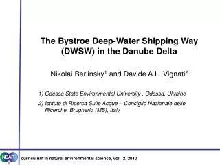
The Bystroe Deep-Water Shipping Way (DWSW) in the Danube Delta Nikolai Berlinsky 1 and Davide A.L. Vignati 2 1) Odessa State Environmental University , Odessa, Ukraine 2) Istituto di Ricerca Sulle Acque – Consiglio Nazionale delle Ricerche , Brugherio (MB), Italy.

E N D
The Bystroe Deep-Water Shipping Way (DWSW) in the Danube Delta Nikolai Berlinsky1 and Davide A.L. Vignati2 1) Odessa State EnvironmentalUniversity , Odessa, Ukraine 2) Istituto di RicercaSulleAcque – ConsiglioNazionale delle Ricerche, Brugherio (MB), Italy curriculumin natural environmental science, vol. 2, 2010
Historical background of the Bystroe DWSW For approx. ten years, there were strong discussions about the better alternative for a DWSW in the Ukrainian part of the Danube Delta. Ukrainian specialists, Western experts, NGOs, mass media etc. were involved in the process. The best option should combine economic advisability, ease of organization, maintenance and use of the DWSW and minimum of anthropogenic impacts on the environment. The Bystroe DWSW was selected among a range of possible alternatives.
Main environmental issues • All possible alternatives of a shipping way in the Ukrainian Danube Delta cross the area of the Danube Biosphere Reserve. • All kinds of alternatives need dredging works in the adjacent coastal area – precisely at the river mouth sediment bar and its neighbouring zone, in order to maintain the requested navigation depths. • The environmental impacts of dredging the shipping way are, at least partly, of transboundary nature and raise international controversies.
Danube Biosphere Reserve (Ukrainian part) UNESCO Strictly protected zones Reserve zone Zone of management Buffer zone Zone of anthropogenic landscape
Alternatives for a Deep Water Shipping Way Black Sea – Danube 1. Danube – liman Sasik 2. by engineer Chekhovich (1904) 3. Solomonov arm – Zhebriyany bay 4. Prorva arm 5. Connecting canal 6.Ochakov arm – port of Ust-Dunaysk 7. Bystroe arm 8. Tsiganka arm 9. Starostambulsky arm
1. The Danube – liman Sasyk Improvement of canal built in the 80s between the Danube and Sasik liman. Problems: • Dredging to increase depth from 3 to 8.5 m (huge works) • Jetty reconstruction between the sea and liman • huge bridge to guarantee connection between Vilkovo town and mainland • Water discharge redistribution
2.Alternative of engineer P.S. Chekhovich The project was conceived by engineer P.S. Chekhovich in 1904. Problems: • New artificial canal • Similar issues as for alternative 1 (dredging, bridge, water redistribution)
3. Solomonov branch – Zhebriany bay Project proposed by engineer V.P. Zizak in 2000. Problems: • New artificial canal • Similar issues as for alternative 1 (dredging, bridge, water redistribution) Comparative advantages with respect to 1 and 2: - water discharge redistribution less important
Alternatives 1 to 3: summary of problems • Construction of artificial canals. • Building of a new port with railway connection in Zhebriany bay and of a bridge to keep the town of Vilkovo connected to mainland. • Redistribution of water runoff (with decreasing in the lower Chilia delta.
Other issues with alternatives 1 to 3 Shallow water in Zhebriany Bay: • Need for a long marine canal (more dredging) • Higher risk of silting of the canal (also more dredging) • More dredging makes exploitation economically less attractive Marine canal New port
Other issues with alternatives 1 to 3 • Penetration of a saline wedge into the (new) artificial canals: • surplus of water in the artificial canals re-directed to wetlands, • altered hydrological and hydrochemical balance in the wetlands and subsequent degradation. • Increased freshwater input to Zhebriany bay: • Zhebriany bay is a place for sturgeon’s feeding, • changing of salinity regime degrades its quality as a forage zone for the sturgeon.
Alternatives 4 to 6. Ochakovsky system • These alternatives imply works in the strict protection zone of the biosphere reserve • The Ochakovsky system is a • “dying off” system from • geological and hydrological • point of view. • - Works cause discharge • redistribution between • Ochakovsky and • Starostambulsky.
Alternatives 7 to 9. Starostambulsky system • Alternative 8 (Tsyganka branch) passes through the second Strict Protection UNESCO zone in the Biosphere Reserve. - More than 90% “Redbook” birds habitat is in this part of delta. • Alternative 9 (Starostambulsky branch) also passes through the UNESCO Strict Protection zone. Bystroe arm Tsiganka arm UNESCO zone Starostambulsky arm
Alternatives 7 and 8. Dumping problems. - Use riverine and marine dumping for dredged bottom sediments. - General direction of sea currents in this area is from North to the South. - Strong likelihood of transboundary effect of dredging and dumping activities: • Operation of Sulina canal • Siltation of Musura Bay Starostambulsky arm Canal Dumping UNESCO zone
Alternative 7. Bystroe arm • natural canal. • natural depth of 12 – 14 m. • 3 km long bar zone to be dredged at the Bystroe mouth. • Construction of a protection jetty at the canal entrance.
Conclusions • All shipping ways in Ukrainian Danube delta cross the Biosphere reserve. • The Bystroe channel was the alternative requiring less dredging (but major flood can rapidly replenish dredged volumes) • The construction of a protection jetty represents another factor whose effects should be followed in the future.