Download
1 / 10
100 likes | 205 Views
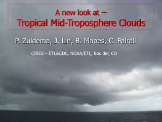
A new look at – Tropical Mid-Troposphere Clouds. P. Zuidema, J. Lin, B. Mapes, C. Fairall. CIRES – ETL&CDC, NOAA/ETL, Boulder, CO. TOGA COARE: attention drawn to a 3rd cloud population w/ cloud top heights between 5-9 km. Linked to: - melting-level stable layers

E N D
A new look at – Tropical Mid-Troposphere Clouds P. Zuidema, J. Lin, B. Mapes, C. Fairall CIRES – ETL&CDC, NOAA/ETL, Boulder, CO
TOGA COARE: attention drawn to a 3rd cloud population w/ cloud top heights between 5-9 km. Linked to: - melting-level stable layers - dry air intrusions from extratropics Johnson et al, 1999: Trimodal characteristics of convection Cloud vertical structure inferred indirectly (precip radar & sondes)
JASMINE-convective EPIC 14 10 Height (km) 6 2 0 Melting-level outflow More recent campaigns have included a cloud radar: - Eastern Pacific Investigation of Climate (EPIC) Sept. 2001, 10N&95W - Joint Air-Sea Monsoon Interaction Experiment (JASMINE) May 1999 Bay of Bengal Cloud Radar: provides direct observations of cloud vertical structure * sensitive to -46 dBZ @ 5 km, -40 dBZ @ 10 km, -34 dBZ @ 15 km * 35 GHz f (8.66 mm) => attenuates with height from precip, liquid * vertically-pointing => point measurement * one-minute time resolution, 45 m height resolution
Time series of coincident sonde RH at 95W, 10N Hurricane Juliette RHB leaves 10N, arrives 5N
large-scale (~50 km range) divergence calculated from precipitation radar shown in blue (solid line=divergence, dotted line=convergence) • 8-14 km anvil cloud resides above dry layer (suggests sublimation) • Sublimation supported by • precipitation radar divergence • profile ! • Surface-based convection mitigated • by both 3-5 km and 6-7 km dryness Surface Rainfall rates Sept. 21: pronounced 6-7 km dry air layer, south-south-westerly winds with easterly winds above
0-3 UTC: rain aloft evaporates into onion sounding 5-10 UTC: cloud tops of surface-based convection defined by sharp relative Humidity gradient above; onion sounding eroded from below. 11-13 UTC: deep convection, cloud radar attenuation, classic deep convective Divergence profile (11utc), depressed cloud radar bright band 17-24 UTC: all rain evaporates above surface
Most mid-tropospheric dry layers related to the southerly phase of the easterly waves EPIC meridional wind Most backtrajectories come From east SSMI WVP, Sept. 20 RH < 30%, 4-8km Strong southerly Or Weak northerly component zonal Plot courtesy of Gary Wick, NOAA/ETL meridional
southerly mid-tropospheric advection of dry air consistent w/ climatology Vertical-meridional x-section @95W&110W, all-time TAO ship sounding average NCEP 1990-2000 Sept. mean RH & V along 110 W Zhang et al., 2004
SUMMARY & CONCLUSIONS: Many direct observations of the interactions of surface-based convection w/ dry layers above Remarkable consistency between surface rainfall rates, vertically-pointing cloud radar, and large-scale calculated precipitation radar divergences; (full EPIC and JASMINE time series posted at http://www.etl.noaa.gov/~pzuidema) New mechanism noted by which dry air intrusions influence tropical cloud vertical structure: sublimation of existing cloud 6-8 km dry air intrusions may be a climatological feature of the Eastern ITCZ, originating from near the equator The dry air intrusions help explain the observed low heights of the high-cloud tops of the eastern ITCZ Background JASMINE cloud images courtesy of U. of Washington JASMINE webpage