Download
1 / 23
230 likes | 365 Views
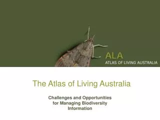
The Atlas of Living Australia. Challenges and Opportunities for Managing Biodiversity Information. Huntsman spider Holconia montana. Tagasaste (tree lucerne) Chamaecytisus palmensis. Braconidae - ? Chaoilta sp. Parasitises. Feeds upon. Preys upon.

E N D
The Atlas of Living Australia Challenges and Opportunities for Managing Biodiversity Information
Huntsman spider Holconia montana Tagasaste (tree lucerne) Chamaecytisus palmensis Braconidae - ? Chaoilta sp. Parasitises Feeds upon Preys upon Uresiphita ornithopteralis (Guenée, 1854) Biology and ecology = Mecyna ornithopteralis Guenée, 1854 Identified as English: tree lucerne moth Kingdom: Animalia Phylum: Arthropoda Class: Insecta Order: Lepidoptera Family: Crambidae Subfamily: Pyraustinae Tribe: Pyraustini Genus: Uresiphita Hübner, 1825 Fact sheets Molecular biology Locality: Reid, ACT GPS: 35.280S 149.138E Date: 1 January 2008 Distribution Biodiversity information
Uses: Biosecurity • Questions • What is this organism? • What does it eat? • Does it carry disease? • Could it spread in Australia? • How can it be controlled? • Information needed • Names and classification • Identification keys • Images • Distribution data • Food webs • Literature (biology and control)
Uses: Land-use planning • Questions • What species are found here? • Are they threatened? • What are their needs? • How can impacts be minimised? • How can habitats be restored? • Information needed • Names and classification • Distribution data • Food webs • Literature (biology and control)
Uses: Conservation and climate change • Questions • Which species will be affected? • How will their ranges be affected? • Can they colonise more favourable regions? • Will pest species benefit? • Information needed • Names and classification • Climate change models • Distribution data • Environmental niche models • Food webs • Literature (conservation and biology)
Other uses • Crop improvement • Sustainable use • Health and medicine • Biomaterials • Forensics • Taxonomy
Sources of biodiversity information • Natural history collections and herbaria • Living collections • Field studies • Literature • Molecular research • Images and multimedia • Experts
Atlas of Living Australia • Government-funded (NCRIS) project to June 2011 • Mission: • To develop an authoritative, freely accessible, distributed and federated biodiversity data management system that links Australia’s biological knowledge with its scientific reference collections and other custodians of biological information • Participants • The University of Adelaide • DAFF • DEWHA • CHAH • CHAFC • CHAEC • AMRRN • CSIRO • The Australian Museum • Museum Victoria • Queensland Museum • The Tasmanian Museum and Art Gallery • Southern Cross University
Timing of Atlas • Builds on other national and global projects • Australian Virtual Herbarium • Online Zoological Collections of Australian Museums • Australian Biological Resources Study • Global Biodiversity Information Facility • Oceanographic Biogeographic Information System • Encyclopedia of Life • Many more
Challenges: Digitising information • Important information in non-digital forms: • History of printed descriptions and other literature • Specimen labels (estimated 1.5 billion globally) • Field notebooks • Many millions of dollars required to make all of this information fully accessible • Work shared with GBIF and other projects ScientificName: Imbophorus pallidus Family: Pterophoridae Locality: Stirling Range State: WA DateCollected: 1963-09-15 Latitude: -34.3 Longitude: 118.0 CoordinatePrecision: 10000 CoordinateMethod: Google Earth TypeStatus: Paratypus
Challenges: Digitising literature • An example: • BUGS - Bibliography of New Zealand terrestrial invertebrates 1775-1985 • BUGZ online http://entdocs.landcareresearch.co.nz • Scanned entomological literature • Searchable text • Downloadable PDFs • Result: • A significant body of literature more accessible and better managed than ever before
Challenges: Standardising data • Need structured data for machine use • Need agreed standard data elements • ScientificName • DecimalLatitude, Decimal Longitude • CoordinatePrecision • Need standard formats for data values • New South Wales vs. NSW vs. N.S.W. • Australia vs. Australien vs. AU • 2008-05-15 vs. 05/15/2008 vs. 15 May 2008 • Specimen vs. S vs. Voucher • Standards allow data to be combined and reused • Biodiversity Information Standards (TDWG)
Challenges: Detecting errors • Misspellings: • Ornithorynchus or Ornithorhynchus? • Mount Tambourine or Mount Tamborine? • Coordinate problems: • Positive values for South or West • Latitude and Longitude transposed • Coordinates not near Locality • Unknown precision • Other issues: • Same record shared through different routes • Missing information on collecting strategy
Challenges: Handling taxonomy • 250-year history of seeking to interpret biodiversity • Many names for the same species • Ornithorhynchus anatinus vs. Ornithorhynchus paradoxus • Species described more than once • Species moved to new genus • Split into multiple species concepts • Merge into one species concepts • Common names • Alternative opinions on higher classification • Result: • Related information found under different names
Developing the ALA • User needs analysis • Document how users find biodiversity information today • Collaborative software development • Reuse code from GBIF data portal • Share components with Encyclopedia of Life, OBIS, etc. • Develop taxonomic tools with ABRS and ANBG • Work with other Australian infrastructure projects • NCRIS Platforms for Collaboration • NCRIS Australian Phenomics Network • NCRIS Australian Plant Phenomics Network • NCRIS Australian Biosecurity Information Network • Start with general purpose tools • In future develop portals for specific user groups
ALA: Metadata Repository • Metadata: information about data resources • Describe all relevant resources, including: • Collection databases • Ecological and observational databases • Images and image libraries • Online bibliographies and literature • Sequence data • International networks • Metadata includes: • Description • Ownership and access details • Terms from vocabularies, gazetteers, ontologies…
ALA: Taxonomic authorities • Australian authority lists: • APNI – Australian Plant Name Index • APC – Australian Plant Census • AFD – Australian Faunal Directory • International projects: • International Plant Name Index • Index Fungorum • ZooBank • Catalogue of Life • World Register of Marine Species • Other checklists: • Red lists, CITES, regional species lists, new taxonomic revisions • Build tools to bring these resources together
ALA: “Yellow Pages” for species • Pages for every species (and higher taxon) • Links to all information resources • Organised by major category • Image thumbnails • Literature links • Links to GIS mapping • Dynamically generated from index of data • Provide links to original resources • Web services • Allow other sites to embed ALA content
ALA: Regional biodiversity atlas • All georeferenced data for Australian biota • Specimen records • Observations • Ecological data sets • Integrated GIS layers • Climate, geology, soil, vegetation, etc. • Indexed by regions • Local government areas • Water catchment areas • IBRA regions • National parks • Fact sheets/species lists for each region
ALA: Annotating data • Need tools to store comments on any record • User-suggested errors or corrections • Corrections from automated validation tools • Comments or structured corrections • Links to further information • Responses from data providers (conversation threads) • Services to retrieve comments via record identifier • Allow any tool or web site to see comments • Allow data providers to import comments
ALA: Putting it all together Yellow Pages Regional Atlas Biosecurity Portal Annotation Tools Name Index Occurrence Index Metadata repository Metadata Data
Thank you Donald Hobern Director, Atlas of Living Australia Phone: (02) 6246 4352 Email: Donald.Hobern@csiro.au Web: http://www.ala.org.au/ ALA