Download

1 / 22
220 likes | 239 Views
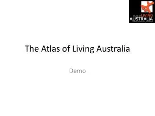
The Atlas of Living Australia Sharing biodiversity knowledge to shape our future. Donald Hobern, Director, Atlas of Living Australia 22 October 2008. Biodiversity information. Tagasaste (tree lucerne) Chamaecytisus palmensis. Braconidae - ? Chaoilta sp. Huntsman spider Holconia montana.

E N D
The Atlas of Living AustraliaSharing biodiversity knowledge to shape our future Donald Hobern, Director, Atlas of Living Australia 22 October 2008
Biodiversity information Tagasaste (tree lucerne) Chamaecytisus palmensis Braconidae - ? Chaoilta sp. Huntsman spider Holconia montana Parasitises Feeds upon Preys upon Uresiphita ornithopteralis (Guenée, 1854) Biology and ecology = Mecyna ornithopteralis Guenée, 1854 Identified as English: tree lucerne moth Kingdom: Animalia Phylum: Arthropoda Class: Insecta Order: Lepidoptera Family: Crambidae Subfamily: Pyraustinae Tribe: Pyraustini Genus: Uresiphita Hübner, 1825 Fact sheets Molecular biology Locality: Reid, ACT GPS: 35.280S 149.138E Date: 1 January 2008 Distribution
Uses: Biosecurity • Questions • What is this organism? • Is it a pest? • Does it carry or cause disease? • Could it spread in Australia? • How can it be controlled? • Information needed • Names and classification • Identification keys • Images • Distribution data • Food webs • Literature (biology and control)
Uses: Land-use planning • Questions • What species are found here? • Are they threatened? • What are their needs? • How can impacts be minimised? • How can habitats be restored? • Information needed • Names and classification • Distribution data • Food webs • Literature (biology and control)
Uses: Conservation and climate change • Questions • Which species will be affected? • How will their ranges be affected? • Can they colonise more favourable regions? • Will pest species benefit? • Information needed • Names and classification • Climate change models • Distribution data • Environmental niche models • Food webs • Literature (conservation and biology)
Other uses • Crop improvement • Sustainable use • Health and medicine • Biomaterials • Forensics • Taxonomy • Leisure
Sources of biodiversity information • Natural history collections and herbaria • Living collections • Field studies • Literature • Molecular research • Images and multimedia • Experts
Atlas of Living Australia • Government-funded (NCRIS) project to June 2011 • Mission: • To develop an authoritative, freely accessible, distributed and federated biodiversity data management system that links Australia’s biological knowledge with its scientific reference collections and other custodians of biological information • To share biodiversity knowledge to shape our future • Participants • The University of Adelaide • DAFF • DEWHA • CHAH • CHAFC • CHAEC • AMRRN • CSIRO • The Australian Museum • Museum Victoria • Queensland Museum • The Tasmanian Museum and Art Gallery • Southern Cross University
Challenges: Digitising information • Important information in non-digital forms: • History of printed descriptions and other literature • Specimen labels (estimated 1.5 billion globally) • Field notebooks • Many millions of dollars required to make all of this information fully accessible • Work shared with GBIF and other projects ScientificName: Imbophorus pallidus Family: Pterophoridae Locality: Stirling Range State: WA DateCollected: 1963-09-15 Latitude: -34.3 Longitude: 118.0 CoordinatePrecision: 10000 CoordinateMethod: Google Earth TypeStatus: Paratypus
Challenges: Standardising data • Need structured data for machine use • Need agreed standard data elements • ScientificName • DecimalLatitude, Decimal Longitude • CoordinatePrecision • Need standard formats for data values • New South Wales vs. NSW vs. N.S.W. • Australia vs. Australien vs. AU • 2008-05-15 vs. 05/15/2008 vs. 15 May 2008 • Specimen vs. S vs. Voucher • Standards allow data to be combined and reused • ALA to use TDWG standards and architecture wherever applicable
Challenges: Detecting errors • Misspellings: • Ornithorynchus / Ornithorhynchus? • Mt. Tambourine / Mt. Tamborine? • Coordinate problems: • Positive values for South or West • Latitude / Longitude transposed • Coordinates not near Locality • Unknown precision • Other issues: • Same record shared through different routes • Unknown collecting strategy • ALA to use GBIF portal software and user annotations to improve data quality GBIF data for “Australia” intersecting Australian continent GBIF data for “Australia” not intersecting Australian continent
Challenges: Handling taxonomy • 250-year history of seeking to interpret biodiversity • Many names for the same species • Ornithorhynchus anatinus vs. Ornithorhynchus paradoxus • Species described more than once • Species moved to new genus • Split into multiple species concepts • Merge into one species concept • Common names • Alternative higher classifications • Result: Related information found under different names • ALA working with Australian Biological Resources Study and Australian National Botanic Garden to wrap services around: • Australian Faunal Directory • Australian Plant Name Index/Australian Plant Census
Challenges: Restricted data • Presuppositions • Some data will not be fully public (Sensitive data, unpublished research) • Data integration should be seamless • Each user should see all data for which they have authorisation • This may include both public and restricted data sets • Tools for visualisation and analysis should combine all these data • Efficient data integration requires a view of the data to integrate • Distributing requests across many data sets is expensive • Central data indexes facilitate rapid search and integration • Need to integrate restricted data without compromising security • ALA to work with Australian Access Federation
Developing the ALA • User needs analysis • Document how users find biodiversity information today • Collaborative software development • Reuse code from GBIF data portal • Support Australian data networks (AVH, OZCAM, APPD, AMRIN) • Share components with Encyclopedia of Life, OBIS, etc. • Develop taxonomic tools with ABRS and ANBG • Work with other Australian infrastructure projects • NCRIS Platforms for Collaboration • NCRIS Integrated Biological Systems • NCRIS Terrestrial Ecological Research Network • NCRIS Australian Biosecurity Information Network • Start with general purpose tools • In future develop portals for specific user groups
Components: Metadata Repository • Metadata: information about data resources • Describe all resources, including: • Collection databases • Ecological/observational databases • Images and image libraries • Online bibliographies and literature • Sequence data • International networks • Metadata includes: • Description • Ownership and access details • Terms from vocabularies, gazetteers, ontologies…
Components: “Yellow Pages” for species • Pages for every species (and higher taxon) • Links to all information resources • Organised by major category • Image thumbnails • Literature links • Links to GIS mapping • Access to research data sets • Dynamically generated • Direct users to original resources • Web services • Enable other sites and tools directly to link content
Components: Regional biodiversity atlas • All georeferenced data for Australian biota • Specimen records • Observations • Ecological data sets • Integrated GIS layers • Climate, geology, soil, vegetation, etc. • Indexed by regions • Local government areas • Water catchment areas • IBRA regions • National parks • Fact sheets/species lists for each region • Collaborate with existing networks: • Australian Virtual Herbarium • Online Zoological Collections of Australian Museums • Australian Plant Pest Database
Components: Annotating data • Tools to store comments on any record • User-suggested errors or corrections • Corrections from automated validation tools • Comments or structured corrections • Links to further information • Small structured data records • Taxon interactions (trophic relationships, etc.) • Associating species with character states • Simple occurrence records • Responses from data providers (conversation threads) • Services to retrieve comments via record identifier • Allow any tool or web site to see comments • Allow data providers to import comments
ALA: Putting it all together Yellow Pages Regional Atlas Biosecurity Portal Annotation Tools Name Index Occurrence Index Metadata repository Metadata Data
Metadata repository Harvest data OA I OA I OA I Ontology Data Provider Register Sp Refers to Found in Geospatial cache Data resources Resource Species Region Discover Sp AFD Sp Sp Sp OA I OA I OA I OA I Harvest Harvest APNI/APC Harvest reports Sp Sp Sp Sp Sp Sp Sp Sp Sp Sp Sp Sp Sp Harvest reports Sp Sp Sp Sp Sp Sp Protected area DB OA I OA I OA I OA I Harvest reports TAPIR, Darwin Core, ABCD, etc. Metadata Repository Dublin Core, EML, etc. Taxonomy Services Metadata Taxon Concept Schema Annotation Server Web Feature Service
Thank you Donald Hobern Director, Atlas of Living Australia Phone: (02) 6246 4352 Email: Donald.Hobern@csiro.au Web: http://www.ala.org.au/