Download
1 / 27
270 likes | 300 Views
Explore the hydrology, land use, and strategies to address non-point source pollution from agriculture, junkyards, and suburban areas in the Stanislaus River watershed.

E N D
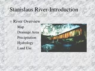
Stanislaus River-Introduction • River Overview • Map • Drainage Area • Precipitation • Hydrology • Land Use
Stanislaus River-Introduction (cont.) • Beneficial Uses • Non-Point Source Pollution • Junkyards • Agriculture • Suburban • Management of Non-Point Source Pollution Strategies
Upper Stanislaus Drainage Area • Land Use-991 mi2 • 0% urban • 64% forest • 7% crop • Precipitation • Average annual 47.1 inches
Lower Stanislaus River Overview • Extends from Goodwin Dam to the San Joaquin River • 59 Miles • Regulated by releases from New Melones Dam and Tulloch Reservoir
Stanislaus River Overview (cont.) • Precipitation • Average annual 12.84 inches • Channel capacity • 8000 cfs
Stanislaus River-Hydrology • Typical Flows • Annual average-1288 cfs • Dry weather-1816 cfs • .34 inches • Typical wet weather-2226 cfs • 7.33 inches • Flood levels-6385 cfs • 12.29 inches
Stanislaus River-Estimated Land Use (cont.) • Area Estimation • Scanned in quad maps • Scanned in AAA maps • Delineated 3 mile sections of the river • Added up area • Crossed reference with land use information for Middle San Joaquin-Lower Merced-Lower Stanislaus Watershed
Beneficial Uses • Recreation • Rafting • Swimming • Fishing • Fish Habitat • Trout • Steel Head • Salmon • Planting
Beneficial Uses (cont.) • Irrigation Water • Local water districts • Drinking Water • Local communities
Non-Point Source Pollution • Junkyards • Agriculture • Crops/field • Livestock • Suburban • Housing • Illegal dumping
Non-Point Source-Junkyards • Several vehicles underwater • Engine parts • Drums/tires
Non-Point Source-Junkyards (cont.) • Oil/Gas/Grease • Solids • Erosion around vehicles
Non-Point Source-Agriculture • Crops • Pesticides • Erosion • Biomass • Livestock • Manure • Erosion • Excess feed
Non-Point Source-Agriculture Example: Vineyard • Plowed Area on side of hill • Several hundred acres • Rain • Runoff across street into river
Non-Point Source-Donkey Farm (cont.) • Effects • Vegetation loss leading to increased erosion • Manure leads to increased nutrients • nitrogen • phosphorus • Stimulates plant growth
Non-Point Source-Suburban • Trailers and mobile homes line river • commonly inundated
Non-Point Source-Suburban (cont.) • Homes also line river within flowage easement • again, area surrounding house commonly inundated
Non-Point Source-Suburban (cont.) • Effects • Household trash in flow area • Overflow onto lawns • pesticides/fertilizers/grass clipping
Non-Point Source Pollution-Management Strategies • Agriculture • Junkyards • Suburban-household debris
Management of Non-Point Source-Agriculture • Depending on size, require small detention basin • Manure collection • Ensure feed is placed in feed bins to limit runoff • Requirements for animals per acre
Management of Non-Point Source-Junkyards • Require areas to be out of flow stream • Require removal of POLs’ from vehicles prior to storage
Management of Non-Point Source-Suburban • Require houses/mobile homes/trailers to be built out of the flow stream • Restrict storage of household debris within flow stream • Restrict vegetation clearing within flow stream
Conclusion • Non-Point Sources • Junkyards/agriculture/suburban • Possible Management Strategies • Removal of material from high flow areas • Steps to reduce runoff from agriculture areas • Numerous Small Sources • Series of BMPs for all