Download
1 / 20
210 likes | 471 Views
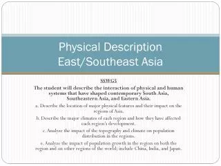
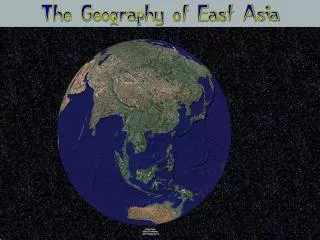
Physical Description East/Southeast Asia. SSWG5 The student will describe the interaction of physical and human systems that have shaped contemporary South Asia, Southeastern Asia, and Eastern Asia. a. Describe the location of major physical features and their impact on the regions of Asia.

E N D
Physical DescriptionEast/Southeast Asia SSWG5 The student will describe the interaction of physical and human systems that have shaped contemporary South Asia, Southeastern Asia, and Eastern Asia. a. Describe the location of major physical features and their impact on the regions of Asia. b. Describe the major climates of each region and how they have affected each region’s development. c. Analyze the impact of the topography and climate on population distribution in the regions. e. Analyze the impact of population growth in the region on both the region and on other regions of the world; include China, India, and Japan.
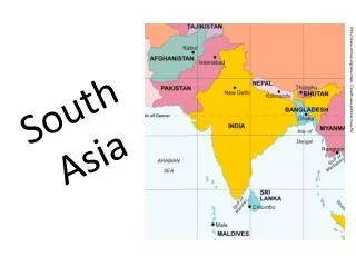
East Asia & SE Asia/Background • Includes 4 major areas: • China, Mongolia, Taiwan (1) • Japan, North/South Korea (2) • Mainland SE Asia (3) • Islands SE Asia (4)
Landforms /China, Mongolia, Taiwan • China • world’s 3rd largest country • Mountains cover 40% of China’s land area • Himalayas located in SW with Nepal and Bhutan • Includes Mount Everest on border
Landforms/China, Mongolia, Taiwan continued • Mongolia • Mongolian Plateau (1) • makes up most of country • elevation from 3,000-5,000 ft • Gobi Desert (2) • Extends from north-central China into Mongolia—bare rock/gravel • Gobi means “waterless place” • Taiwan • Eastern coast has high, steep mts • Western coast flatter • Located near tectonic plates/earthquakes common
Bodies of Water/China • Plains and river valleys in eastern China hold large amount of population • Area receives most rain 3 major rivers: 1. Huang (Yellow) River 2. Chang (Yangtze) River 3. Xi River
China, Mongolia, Taiwan/Climate • Influenced by Asian monsoon season • Dry winter winds blow from the Asian interior to the coast • Winds can be bitterly cold • Can cause typhoons in summer • SE China/Taiwan --- mild humid subtropical climate • NE China --- humid continental • Western China --- dry highland climate • Mongolia---high continental—very cold, dry winters, mild summers
China/Natural Resources • Huge amounts of resources • World’s leading producer of coal, lead, tin, and tungsten • Most important reserves are located in north and northeast • Oil and natural gas found in many areas • Only 10% of China has fertile land • Chang River important for rice fields
Japan/The Koreas/Landforms • Japan • 4 main islands/thousands of smaller ones • 70% is mountainous • Longest mt range -- Japanese Alps • Japan’s highest peak -- Mt. Fuji (12, 388 ft) • Lies in the Ring of Fire • 1500 earthquakes can occur in Japan every yr • Almost 200 volcanoes and 1/3 are active
Japan/The Koreas/Landforms • Korean Peninsula • 600 miles long • Same size as Utah • Mostly hills/low mts • Most people in the Koreas live on a coastal plain on the west coast
Japan’s Natural Resources • Japan lacks many mineral and energy resources • Have to import most minerals and resources • Ex: oil, coal, timber, iron, and aluminum
Mainland SE Asia • Includes Cambodia, Laos, Myanmar, Thailand, and Vietnam • 3 major landform regions: • Rugged mountains in north (Himalayas & Plateau of Tibet) (1) • Plains & plateaus in Thailand and Cambodia (2) • River valleys & deltas (3)
Mainland SE Asia continued • Mekong River is largest in region • Flows through Laos, Cambodia, and Vietnam • Area holds tropical rain forests
Island Southeast Asia • Includes Brunei, East Timor, Indonesia, Malaysia, Philippines, and Singapore • Area contains more than 20,000 islands • Shaped by tectonic activity • Many seas/narrow straits separate islands • Strait of Malacca: lies between island of Sumatra and the Malay Peninsula • Major shipping route for area
Climate of SE Asia • Tropical climate • 80-100 inches of annual rainfall • Area affected by monsoons • High precipitation • Typhoons affect Philippines • Area has many tropical rainforests
Natural Resources SE Asia • Tropical rainforests used for timber • Mahogany, teak and ebony • Iron, manganese, tin, and tungsten • Export sapphires and rubies • Large exporters of rice • Opium is grown in mountains of Myanmar, Thailand, and Laos
Tsunami • Tsunami: catastrophic ocean wave caused by an underwater earthquake, coastal landslide, or volcanic eruption • Japanese for “harbor wave” • Travels up to 500 mph in deep water • Tsunami warning systems have been created to detect hazards • Begin warnings after underwater earthquakes that register 7.0 or higher • Estimates path, magnitude, and arrival time of tsunami
Tsunami of 2004 • Most destructive tsunami ever recorded • Hit (Sumatra) Indonesia, Thailand, India, Sri Lanka, Malaysia, Myanmar, Bangladesh, Maldives, and Somalia • Caused by 9.0 earthquake in Indian Ocean off Sumatra’s coast • Sumatra is largest island in Indonesia • Waves that hit Sumatra were between 50-100 feet high • 2 hrs after the earthquake, 30 foot waves hit the shores of India and Sri Lanka
Tsunami of 2004 continued • More than 225,000 people were killed • 200,000 dead in Sumatra • 1000’s in Thailand, India, and Sri Lanka • Deaths in Malaysia, Myanmar, Bangladesh, Maldives, and Somalia • 1000’s dead were tourists to the area • Tsunami lasted 7 hours and spread to Eastern Africa
https://www.youtube.com/watch?v=1J8Feyr38Ss • https://www.youtube.com/watch?v=-5fKvN-RwKs


![The Most InDemand Talent in South East Asia [Infographic]](https://cdn4.slideserve.com/7359969/slide1-dt.jpg)