Download
1 / 14
140 likes | 255 Views
This guide by Anand Paleja and Pratik Mehta offers a comprehensive approach to finding the best public transport routes to points of interest like hospitals and malls. It covers data preparation, creating network data, available services, uploading on servers, development, and interfaces. Utilizing spatial and non-spatial data, it details creating final data and essential services in network analysis. Uploading on servers explores various service types and capabilities, while the section on development discusses in-built and REST services.

E N D
Optimum route finder to the point of interest through public transport By AnandPaleja Pratik Mehta
Index • Introduction • Available spatial and non-spatial data • Data Preparation • Creating Network data • Available services in network analyst • Creating final data • Uploading on server • Development • Interface
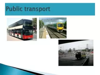
1. Introduction • Origin bus stop • Point of interest (hospitals, malls, theatres etc.) • Nearest bus stop from point of interest • Route from point of interest to nearest bus stop • Route from origin bus stop to destination bus stop
2. Available spatial & non-spatial data • A_C Bus Stop 2011.xls- Ac bus routes and bus stops • CityBus Time Sept 2010.doc- time among stations • Route timing.doc- timing for new Mumbai • ACTimeTableApril 2012.doc- total number of trips for any route • AC Bus Stop.shp- Bus stops (busstop, route, xcoord, ycoord) • AC Bus Route.shp- default attributes
3. Data Preparation • Requires direction and unique id for bus stop • Directions • Up and down • Truncated routes • Bus Stops • Two names • Two points on same location • Unique id for each stations (odd & even)
3. Data Preparation • Bus Route • Add Name attribute • Locator • Why we need locator? • Many styles available • Depends on your data • Can set sensitivity too • Tolerance value is necessary
5. Available services in network analyst • Route • Closest facility • Service Area (Accessibility) • OD Cost matrix (number of origins + number of destinations) • Same like closest facility • Doesn’t give true shape • Vehicle routing problem • Location-allocation • http://help.arcgis.com/en/arcgisdesktop/10.0/help/index.html#/Types_of_network_analysis_layers/004700000032000000/
6. Creating final data • Manual digitization • Find Route tool (Available in ArcGIS 10) • Requires network dataset • Locator • Add attributes in shapefiles • Route (RouteNo, Run) • Stops (StopID, Sequence, Run, RouteNo, Ref_ID) • Adding time • Alone Route no and run are not enough • Combination of three
7. Uploading on Server • Type of services server provides • Map service (.mxd) • Geocode service (.loc) • Geodata Service • Geometry service (no GIS resource requires) • Geoprocessing services (toolbox- .tbx) • Image Service (For raster data) • Search Service
7. Uploading on server • Capabilities available • Mapping • KML • Feature Access • WMS • WFS • Mobile Data Access • Network Analysis
8. Development • In built application • SOAP Services (Java, .NET) • Lack of functionalities • REST Services (JavaScript, Silverlight, Flex, Apex) • Very popular