Download
1 / 10
100 likes | 285 Views
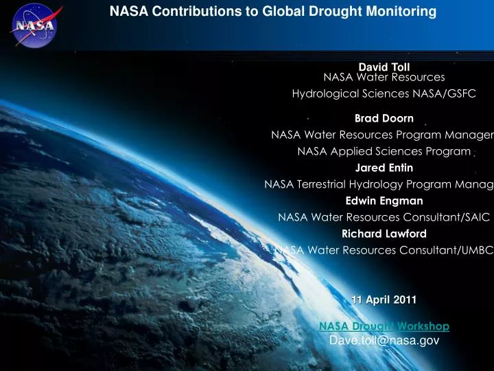
NASA Contributions to Global Drought Monitoring. David Toll NASA Water Resources Hydrological Sciences NASA/GSFC Brad Doorn NASA Water Resources Program Manager NASA Applied Sciences Program Jared Entin NASA Terrestrial Hydrology Program Manager Edwin Engman

E N D
NASA Contributions to Global Drought Monitoring David Toll NASA Water Resources Hydrological Sciences NASA/GSFC Brad Doorn NASA Water Resources Program Manager NASA Applied Sciences Program Jared Entin NASA Terrestrial Hydrology Program Manager Edwin Engman NASA Water Resources Consultant/SAIC Richard Lawford NASA Water Resources Consultant/UMBC 11 April 2011 NASA Drought Workshop Dave.toll@nasa.gov
NASA Water Resources Program & Drought • • Drought: FAO estimates that by 2025 two-thirds of the world population will be living under water stress conditions from climate change, population increases and increases in water use. • • NASA remote sensing & modeling: Combined with and other Earth science data for global drought monitoring using satellite and modeling, including water for food, improved water management, and water availability for ecosystems. • Integrated system addressing meteorological (e.g., precipitation), hydrological (e.g., streamflow, snowpack, ground water), agricultural (e.g., soil moisture), ecological (e.g., vegetation stress) drought. • • NASA Water Resources has had a strong focus on drought applications the last five years • - Nghiem (JPL) & Verdin (USGS): Remote Sensing for USDM {vegetation indices & soil moisture change) • - Rodell (NASA/GSFC): Terrestrial Water Storage & Ground Water (Using GRACE )to USDM & NADM • - Cai (U. Illinois): Developing Seasonal Predictive Capability for Drought Decision Support • - Koster (NASA/GSFC): Development of Robust Drought Index for Agricultural Applications • - Verdin (USGS): A Land Data Assimilation System for Famine Early Warning • - Linked support for NOAA/NASA: North American LDAS & Drought Monitoring
NASA USDM DROUGHT – Accomplishments • NASA Funding Several Projects to Support US Drought Monitor • Expedited MODIS Vegetation Drought Response Index (VegDRI) & Soil Moisture Change: USGS/EROS and NDMC have integrated MODIS into the national ‘VegDRI model’ on a rapid, weekly schedule. JPL automated a procedure to provide Soil Moisture Change updated projects. • Prototype Terrestrial Water Storage (TWS) Using GRACE Satellite Data: GSFC and NDMC working to provide GRACE TWS data assimilated in to land surface models for a new key drought indicator including deep soil moisture and ground water. • Resolution Benchmark: NASA results have excellent resolutions to resolve the county-level goal of NIDIS. This is evident in the comparison of SMC, TWS and VegDRI products versus USDM drought maps at the higher resolution. • Improvements of USDM are important for users: NOAA NWS uses ‘D2’ to trigger drought information statements, IRS for tax deferrals, USDA programmatic usage, and Livestock Forage Disaster Program disbursement ($147,109,381 in 2008, and $77,608,125 in 2009). User community interactions: Drought Forum 2009
MODIS System Characteristics for Inputs to US Drought Monitor – PI J. Verdin (USGS) Product Characteristics Expedited Historic Instruments Aqua and Terra MODIS Extent Continental U.S. (CONUS) Spatial Resolutions 250, 500, and 1000 meters Product Latency ~ 1 day after last input < 30 days after last input Archive Persistence 90 days Indefinitely Composite Period 7-day, Rolling 7-day, Interval Example eMODIS product: Terra MODIS 1000m NDVI CONUS composite for August 2-8, 2006 Layers NDVI, Surface Refl. Bands, Quality, Acq. Date Projection/Format Lambert Equal Area Azimuthal / GeoTIFF Processing Flow Expedited L1B (NOAA NRT) Long Term Archive and Web-enabled Access Cloud Mask Processing (MODIS PGE 03) Historic L1B (NASA LAADS) Surface Refl. Processing (MODIS PGE 11) Composite Processing (NDVI, CONUS) Ancillary Data
The Famine Early Warning Systems Network (FEWS-NET) • Using NASA Land Information System (LIS) to Help Extend Coverage beyond Sub-Sahara • Satellite Precipitation • Satellite Vegetation Greenness • Biomass Yield Forecasting • Satellite Snow Cover and Snow Water Equivalent
Integrating Enhanced GRACE Water Storage (Including Ground Water ) towards Global Assessments Model assimilated water storage, mm January – December 2005 Loop GRACE water storage, mm January – December 2005 Loop Rodell
D4 D3 D2 D1 D0 D4 D4 D3 D3 D2 D2 D1 D1 D0 D0 Multi Model Drought Model Comparison for Use in Global Monitoring Systems ● Soil moisture percentiles from each Land Surface Model combined to form ensemble mean. ● Project will eventually use multiple land surface models (Mosaic, Noah, VIC, Sacramento, CLM3, HySSiB, and Catchment). ● Ensemble model outputs often offer more accurate depictions of drought ● Even poor depictions are informative--Large model spread indicates lack of confidence ● Indices of Met drought (NCDC PDSI), Met drought-II (NCDC PHDI), Ag drought (Palmer Z)
Seasonal Root Zone Predictions (Applicable Globally) Useful for Rain-fed Agriculture Production Initial conditions (Dec. 1, 2008) 1-month lead (Jan. 1, 2009) Root zone soil moisture anomaly (expressed as standard normal deviate) 3-month lead (Mar. 1, 2009) 2-month lead (Feb. 1, 2009) Drought conditions given a probability to persist into early March. Project: Development of a Robust Drought Index for Agricultural Applications. PI: R. Koster, NASA/GSFC http://gmao.gsfc.nasa.gov/forecasts/# http://www.cpc.ncep.noaa.gov/products/fews/
Middle East & North Africa (MENA) NASA Water Information System Platforms (WISPs) for Water Management Joint Activity between NASA, the World Blank and USAID (with support from USDA and Universities) • NASA, USAID, and the International Center for Biosaline & Agriculture (ICBA) have partnered to provide a regional (1/8o) Land Data Assimilation System of the MENA using remote sensing to address water management issues. • The World Bank through the Global Environment Fund (GEF) and USAID is funding NASA to install Water Information System Platforms throughout the MENA (centers: Jordan, Tunisia, Morocco, Lebanon & Egypt) for country and regional (basin) use. • NASA Water Information System Platform Tools • - Regional (1/8o) to Local (1km and finer) water availability maps. • - Monitoring & prediction of drought processes. • - Flood warning & inundation mapping . • - Climate and land use change impacts on water resources. • - Estimates of crop yield, irrigation mapping and land cover change. • Satellite data to estimate evapotranspiration and the consumptive water loss. • Estimation of changes to ground water and terrestrial water storage changes using GRACE satellite data. Figure 1. Precipitation (mm/month) for July 2007 at 0.04° resolution, from the UC Irvine PERSIANN-GCCS system. Hourly, near-real time data from PERSIANN will be a primary input to the MENA LDAS. Figure 2. Seasonal variations in evapotranspiration (mm/month) over the MENA region, output from MENA LDAS. Top: December 2002 - February 2003 average. Bottom: June 2003 - August 2003 average. (Contact D. Toll and J. Bolten – NASA)
NASA Water Resources Drought Related Activities • World Bank, USAID & NASA Water Information System Platforms (WISPs): Installing in the MENA with Drought Monitoring as a Major Component for Jordan, Morocco, Lebanon & Egypt. - MENA Regional Center on Water (Obama’s June 2009 Pledge on Scientific Centers) - Highlighted in World Bank and US Government MOU, ‘Cooperation Relating to Water’ • Coordinate and Leverage Group on Earth Observations (GEO) Drought Activities, including Continental Drought, Drought Clearinghouse & NIDIS subtask. • FEWS-NET & SERVIR: Plans for drought monitoring in East Africa SERVIR node. • UNESCO – NASA: Working with UNESCO IHP (Princeton U. and FEWS-NET) for African Drought Monitor • LIS-AFWA: Air Force Weather Agency replacing their AGHRMET hydrology-meteorology with NASA Land Information System • Science & Technology to Aid the World – USAID and NASA MoU for April 25, 2011. • ICIWaRM (International Center for Integrated Water Resources Management) UNESCO Category II Water Center Activities include G-WADI for semi-arid to arid ecosystems of the world. • USAID Global Water for Food at University of Nebraska – Lincoln. • Global Water Solutions Center (GWSC) - NGO with State Department to address world's critical freshwater issues.