
Geographic Entities Classification in GIS and Reclassification Methods
E N D
Presentation Transcript
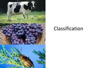
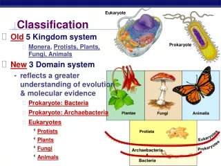
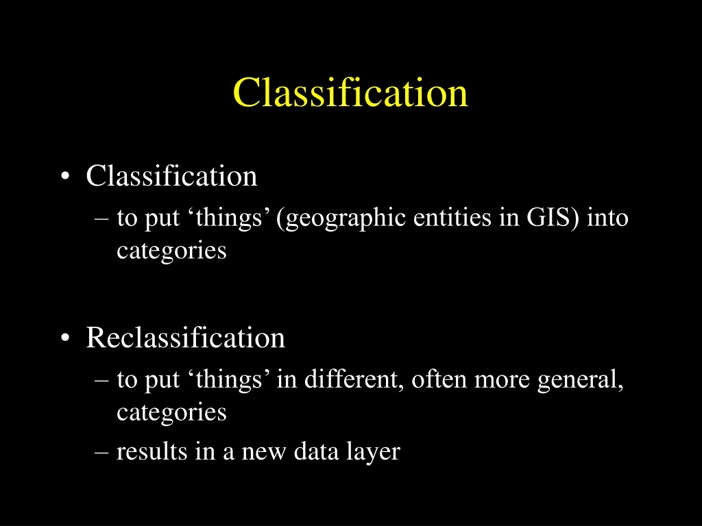
Classification • Classification • to put ‘things’ (geographic entities in GIS) into categories • Reclassification • to put ‘things’ in different, often more general, categories • results in a new data layer
Classification • An example classification: Anderson Land Cover classification (Anderson et al., 1976) 1 urban or built-up 2 agricultural 3 rangeland 4 forest ... 9 41 deciduous forest 42 evergreen forest 43 mixed forest
2 1 2 1 1 1 3 2 2 3 1 2 1 2 1 1 3 2 2 3 2 1 2 1 1 1 3 2 3 2 1 1 1 1 1 1 2 4 2 4 1 1 1 1 1 1 2 4 2 4 Classification • Raster reclassification: land cover 1 grain crops 2 orchards 3 residential 4 commercial 1 agricultural 2 non-agricultural
32 1 39 1 2 45 47 2 2 43 1 31 1 38 42 2 43 2 2 44 37 1 39 1 45 2 45 2 46 2 42 2 43 2 51 3 3 52 3 51 47 2 47 2 55 3 3 54 3 56 Classification • Raster reclassification: temperature (interval) Grid cell value = temperature (F) 1 31 - 40 2 41 - 50 3 51 - 60
Classification • Vector reclassification: land cover • line dissolve (map dissolve) 2 3 1 2 1 4 1 grain crops 2 orchards 3 residential 4 commercial 1 agricultural 2 non-agricultural
Classification • Buffer: classification of within/without a given proximity • vector: a polygon ‘around’ a feature Line buffer Point buffer Polygon buffer
Classification • Buffer • doughnut buffer (e.g. within 10 meters but not within 5 meters Buffer polygon 5 10 Hole
Classification • Buffer • variable buffer: buffer distance varies by some feature attribute or friction surface
Original line ID Dist A 3 B 2 C 5 B A C 4 6 10 Buffer polygon
2 0 2 0 0 2 0 2 0 2 0 2 1 1 1 1 1 1 2 0 0 2 1 1 0 1 1 1 2 0 0 2 1 1 1 1 1 1 0 2 2 0 0 2 2 0 0 2 2 0 Classification • Raster buffer • raster surface of within/not within proximity Reclassify: 1 within 1 unit 0 not within 1 unit Spread operation from buffered feature (0)
Classification • Moving window • also called roving window, neighborhood function, filter • derived from image processing • raster data model only • assigns the value of a neighborhood of grid cells to one particular grid cell (kernel) • high pass filter - exaggerates local differences • low pass filter - smooths local differences
32 32 39 39 45 45 47 47 43 43 31 31 32 38 42 42 43 43 44 44 37 37 39 39 45 45 45 45 46 46 42 42 43 43 51 51 52 52 51 51 47 47 47 47 55 55 54 54 56 56 Classification Move window one cell over and begin again (use original data values) • Moving window • high pass filter kernel 3 x 3 window: multiply kernel (center grid cell) by 9 and subtract the other cell values - assign resulting value to the kernel
32 32 39 39 45 45 47 47 43 43 31 31 38 39 42 42 43 43 44 44 37 37 39 39 45 45 45 45 46 46 42 42 43 43 51 51 52 52 51 51 47 47 47 47 55 55 54 54 56 56 Classification Move window one cell over and begin again (use original data values) • Moving window • low pass filter kernel 3 x 3 window: average all values in window - assign resulting value to the kernel
Classification • Moving window - defining the window • windows can be any number of cells in width and length • windows can be defined by a radius (e.g. including grid cells whose centroid is within the radius) • windows can assign maximum, minimum, etc. to the kernel
Classification • Neighborhood operations for vector • how many other cities within a certain distance of each city • which city has the maximum population of all cities within a certain proximity from each city City Distance buffer
Classification • Terrain classification • slope • aspect (orientation) • intervisibility
32 32 34 39 43 33 33 36 43 44 34 35 44 45 46 42 43 47 52 55 47 47 52 54 56 Classification • Terrain classification • Digital Elevation Model (DEM) • a raster grid of elevation values
32 32 32 32 34 34 39 39 43 43 33 33 35 35 34 34 43 43 44 44 34 34 35 35 44 44 45 45 46 46 42 42 43 43 53 53 52 52 55 55 47 47 47 47 52 52 54 54 56 56 Classification • Terrain classification: Slope (rise/run) DEM Percent Slope 19 Elevation in meters resolution = 100 meters 53 - 44 = 19 meters 19 / 100 = .19 or 19 % slope
32 32 32 32 34 34 39 39 43 43 33 33 35 35 34 34 43 43 44 44 34 34 35 35 44 44 45 45 46 46 42 42 43 43 53 53 52 52 55 55 47 47 47 47 52 52 54 54 56 56 Classification • Terrain classification: Aspect (orientation) DEM Aspect 0 Elevation in meters resolution = 100 meters Min = 34, North (0 deg) Max = 53, South (180 deg) Aspect = 0 deg
Classification • Terrain Classification: Intervisibility
32 32 32 32 34 34 43 43 39 39 33 33 35 35 34 34 43 43 44 44 34 34 35 35 44 44 45 45 46 46 42 42 43 43 53 53 52 52 55 55 47 47 47 47 52 52 54 54 56 56 Classification observer • Terrain classification: Intervisibility DEM Visibility 0 1 Elevation in meters resolution = 100 meters Is there a higher elevation between observer and each cell? 0 not visible 1 visible