Download
1 / 57
570 likes | 683 Views
Intro to ARCGIS and GIS Data Types. ArcGIS Software Overview Geographic Data: Concepts, File Formats, Topology Anatomy of Spatial File Formats shapefile, geodatabase, coverage Coordinate Systems and Projections Spring 2005.

E N D
Intro to ARCGIS and GIS Data Types ArcGIS Software Overview Geographic Data: Concepts, File Formats, Topology Anatomy of Spatial File Formats shapefile, geodatabase, coverage Coordinate Systems and Projections Spring 2005 GISC 6382 Applied GIS UT-Dallas Briggs
Environmental Systems Research Institute, Inc. (ESRI)Redlands, CA • Privately held by Jack & Laura Dangermond • 49th largest software company in world • Leader in GIS with at least 1/3rd of market • 1 million users (2002) and 2,600 employees • Originator of commercial GIS in 1981 with release of ArcInfo • Released their first GUI (graphics user interface) product, ArcView, in 1991 based on proprietary Avenue programming language (for MS Windows, UNIX, Macintosh) • Combined these two product lines together with release of ArcGIS v.8 in 2000 (for Microsoft Windows only) • complete rewrite based on Microsoft COM/Active X software objects • completely different interface from earlier ArcView and ArcInfo • old, Avenue based, ArcView still available as ArcView 3.3 • old command line ArcInfo still available as ArcGIS Workstation • ArcGIS 9 released in 2004 GISC 6382 Applied GIS UT-Dallas Briggs
ArcInfo ArcEditor ArcView ArcExplorer Browser Internet ArcGIS System Consistent interface Increasing capability Clients c:\ ArcGIS Workstation $ ArcMap ArcCatalog ArcToolbox ArcMap ArcCatalog ArcToolbox ArcMap ArcCatalog ArcToolbox ArcServer Services ArcEngine/ ArcObjects Application Development & Customization ArcIMS Services ArcSDE Services ArcPad Databases Multi-user Geodatabases (in Oracle, SQL Server, IBM DBII, etc) Files (Personal Geodatabase, Shapefiles, Coverages, Grids, tins, etc) Source: ESRI with mods. Handheld/Wireless GISC 6382 Applied GIS UT-Dallas Briggs
ESRI Product Line-up: ArcGISclient products (Fall 2004) ArcReader (“adobe acrobat” for maps) & ArcExplorer (spatial data viewer) • Free viewers for geographic data. ArcGIS 9.x Desktop: two primary modules (MS NT/2000/XP only) • ArcMap: for data display, map production, spatial analysis, data editing • ArcCatalog: for data management and preview ArcToolbox, for specialized data conversions and analyses, available as a window in both Available capabilities within these modules are “tiered” • ArcView: viewing, map production, spatial analysis, basic editing • ArcEditor: ArcView, plus specialized editing • ArcInfo: ArcView & ArcEditor plus special analyses and conversions Extensions: for special apps.: Spatial Analyst, 3D Analyst, Geostatistics, Business Analyst, etc. ArcObjects: build specialized capabilities within ArcMap or ArcCatalog using VB for Applications ArcGIS Workstation (for UNIX and MS NT/2000/XP) • the old command line ArcInfo 7.1 ArcGIS Engine (MS NT/2000/XP) • Set of embeddable GIS components (ArcObjects software objects) for use in building custom applications • Runs under Windows, Unix and Linux, with support for Java, C++, COM and .NET • Replaces MapObjects which were based upon a previous generation of GIS objects Notes: ArcGIS 8 released 2000 to integrate two previous standalone products: ArcView and ArcInfo ArcGIS 9 released 2004 providing the full capability that should have been in ArcGIS 8!!! --full support for all data types (coverages, shapefiles, geodatabases) --full support for all previous geoprocessing analyses --Modelbuilder for scripting and repetitive processing --ArcEngine for building custom applications ArcView 3.3 (the predecessor to ArcGIS 8.x) the only GUI option for UNIX. GISC 6382 Applied GIS UT-Dallas Briggs
ESRI Product Line-up: ArcGISserver products (Fall 2004) SDE (Spatial Database Engine) • middleware to support spatial data storage in standard DBMS • Supports all major industry databases: • Oracle, SQL-Server, IBM DB2, Ingres ArcGIS Server • Permits the creation of server-based GIS services using any ArcGIS capability • Provides GIS capabilities to a user without a desktop GIS system: • inward focus—user goes to server ArcIMS • Software to develop Internet server-based mapping and basic analysis • Provides maps to the user without a desktop GIS system : • outward focus—gives user a map ArcGIS Services • Server based applications built and operated by ESRI or its partners and made available on the Internet for subscription • Normally charged on a “per transaction” basis, but can be flat fee • presumably built using ArcGIS Server GISC 6382 Applied GIS UT-Dallas Briggs
Other ESRI Products:Current and Planned • ArcPAD • Mapping on PDAs (“handhelds”) with Windows CE operating system • ArcLogistics Route • Specialized business application for delivery routing • ArcFM • water and telecom: industry specific facilities management • ArcGIS Extensions • Spatial Analyst: raster data analysis • 3D Analyst: 3-dimensional data display • Geostatistics: surface analysis • Business Analyst: marketing and site selection • Survey Analyst: update of ArcInfo COGO (coordinate geometry) module • Network Analyst: network routing algorithims; shortest path, etc. (2005?) • Maplex: automated, high quality labeling for maps • Publisher: creates .MXP maps for reading with ArcReader Extensions work irrespective of ArcView/ArcEditor/ArcInfo tier • BusinessMap: • $99 standalone business mapping (originally Richardson-based MapLynx) GISC 6382 Applied GIS UT-Dallas Briggs
Discontinued Products • ArcCAD • CAD product from ESRI • PC ArcInfo • 1st effort at PC based GIS • DOS based, command-line driven • Data not compatible with ArcInfo UNIX • Replaced by ArcInfo 8 and ArcView 3.2 • DAK (Data Automation Kit) • Subset of PC ArcInfo for data preparation for ArcView 3.2 • Atlas/GIS • once a leader in PC-based mapping • Bought by ESRI in 1996 & discontinued in 2001 GISC 6382 Applied GIS UT-Dallas Briggs
ArcGISVersion 8/9 With Version 8 & 9, now have two flavors: Desktop: • Largest Microsoft COM/ActiveX application to date • Full GUI interface • Customization via Visual Basic for Applications (altho’ must have ArcInfo to run custom apps) • New data base concepts: Geodatabase • Runs on XP/2000/NT only • no UNIX version available Workstation: • classic, command-line ArcInfo with AMLs (Arc Macro Language) for customization • same as version 7 and earlier, with minor enhancements • the only option for UNIX, but also available on MS XP • With release of ArcGIS 9, little reason to use GISC 6382 Applied GIS UT-Dallas Briggs
ArcGIS Desktop Primary Characteristics • GUI-based tools • ArcCatalog, ArcMap, ArcToolbox • Standard Database Environment • MS Access (.msb) for personal applications • Any industry db via SDE for multi-user applications • Modeling of real world as intelligent objects • Houses, poles, not points, lines, polygons • COM/ActiveX components (ArcEngine) for embedding geography in other applications ArcInfo7: simple data complex applications ArcInfo8: intelligent data simpler applications GISC 6382 Applied GIS UT-Dallas Briggs
ArcGIS 9 Desktop Modules ArcCatalog (schema editor, with VISIO generation) • The base application for ArcInfo Desktop • Windows Explorer-like interface • for organizing access to data and metadata • For launching other Desktop apps: MAP and TOOLBOX ArcMap (object editor) • Powerful GUI for map creation and spatial data editing • ArcPlot/ArcEdit (from ArcInfo v. 7) & ArcView 3.2 View/Layout combined • Map projections on the fly (not via conversion as in AV) ArcToolbox (geoprocessor) • An interface to geoprocessing tools • In ArcGIS 8 it was a separate module • In ArcGIS Release 9 it’s an integrated window in ArcCatalog or ArcMap GISC 6382 Applied GIS UT-Dallas Briggs
ArcGIS Desktop Capability Tiers: Each tier has the same interfaces (ArcCatalog, ArcMap, and ArcToolbox), but an increasing set of capabilities are available within them (and $ price rises accordingly!) ArcView: • viewing, map production, spatial analysis, basic editing ArcEditor: • ArcView, plus editing of coverages and topologic editing of geodatabases ArcInfo: • ArcView and ArcEditor, plus more geoprocessing analysis, conversions, and full support for coverages. • Old, command line ArcInfo including AML support GISC 6382 Applied GIS UT-Dallas Briggs
ArcGIS 9.0 versus ArcGIS 8.3 • For Spring 2005, we will use ArcGIS 9.0 • Main differences from 8.x are in ArcToolbox • ArcToolbox built into ArcCatalog and ArcMap rather than a separate module • All ArcToolbox tools support all data types (geodatabase, shapefiles, coverages) • 8.3 primarily support coverages • ModelBuilder diagrammatic modeling tool • Invaluable for tracking and replicating geoprocessing steps • New scripting capability for repetitive actions • Python, JScript and VBScript--simpler to use than VB for Applications, the only alternative in 8.x • Old aml (arc macro language from ArcInfo 7) also supported What ArcGIS 8 should have been when it was first released! Incorporates just about everything from ArcInfo 7/ArcView 3. GISC 6382 Applied GIS UT-Dallas Briggs
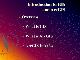
Geographic Data Concepts File Formats Topology GISC 6382 Applied GIS UT-Dallas Briggs
Geographic Data: Classic Approach • Two components of geographic data • Spatial Data: representations of geographic features associated with real-world locations • Stored in files and managed by the GIS software • Attribute Data: descriptive information • stored in tables and managed by an RDBMS (relational database managemnt system) (originally Info, but now most commercial systems) • Two formats for geographic data • Raster data • Rectangular array of cells or pixel • Vector data: three feature types • points/nodes (single x,y locations) • lines/arcs (linear string of x,y locations) • areas/polygons (closed string of x,y locations) GISC 6382 Applied GIS UT-Dallas Briggs
Geographic Data: Another (object-oriented) View Object View • The real world is a series of entities located in space. • An object is a digital representation of an entity, with three types • Point objects • Line objects • Area objects • The same entity can be represented at different scales by different object types: the multi-representation problem • Behavior can be associated with objects thus they can change over time Field View • The real world has properties which vary continuously over space; every place has a value • May be represented as raster data, or with vector data as a TIN (triangulated irregular network • If the value is a categorical or integer variable, then places with the same value (e.g. soil type) can be grouped--and doesn’t this give us an area object?! The world is how we decide to look at it!!! From O’Sullivan and Unwin GISC 6382 Applied GIS UT-Dallas Briggs
File Formats for Vector Spatial Data Coverage:vector data format introduced with ArcInfo in 1981 • multiple physical files (12 or so) in a folder • proprietary: no published specs & ArcInfo required for changes • Can be “exported” to a single E00 (E-zero-zero) file for transfer Shape ‘file’:vector data format introduced with ArcView in 1993 • comprises several (at least 3) physical disk files (with extension of .shp, .shx, .dbf), all of which must be present • openly published specs so other vendors can create shape files Geodatabase: new format introduced with ArcGIS 8.0 in 2000 • Multiple layers saved in a singe .mdb (MS Access-like) file • Proprietary, “next generation” spatial data file format Shapefiles are the simplest and most commonly used format. Used them in GIS Fund. Will use Geodatabases in Applied GIS (and some coverages). GISC 6382 Applied GIS UT-Dallas Briggs
Geo-relational Database the old “classic” environment proprietary coverages in ArcInfo (INFO database) published shapefiles in ArcView 3.2 (dbIV database) Based on points, lines, polygon model Raster data (GRIDS) and TINS (for 3D) kept in separate files Geodatabase The new approach Replacement for coverages, with support for Simple features: points, lines polygons Complex features: real world entities modeled as objects with properties, behavior, rules, & relationships ArcView downgrades complex features to simple features Personal Geodatabase Single-user editing Stored as one .mdb file Max 2GB total & 250,000 features per layer Multiuser Geodatabase Multi-user simultaneous editing via versioning and long transactions Uses ArcSDE 8 as middleware to store in standard db: ORACLE, MS SQL Server, etc GIS User SDE db Database Environment GISC 6382 Applied GIS UT-Dallas Briggs
Geodatabase Features Grids Images Coverages Shapes Relationships Tables Tins Rules Tables Grids Images GIS Data ModelsFile-based and “Databased” Workspace One Repository Source: ESRI, Inc. GISC 6382 Applied GIS UT-Dallas Briggs
Concept of Topology • Topology distinguishes GIS data models from non-topological data models supported by many CAD, mapping and graphics systems • Topology refers to knowledge about relative spatial positioning of features. • knowledge about how features are connected and which features are adjacent to each other. • Can be viewed as a mathematical procedure that determines spatial relationships and properties, including: • The three Cs • Connectivity, • Congruency (same location) • Contiguity (adjacency or “next door”) • Lengths of arcs and the areas of polygons GISC 6382 Applied GIS UT-Dallas Briggs
Topology Rules for Coverages:the classic view of topology • Each arc has a beginning node and an ending node - this determines directionality. Directionality is determined during digitizing. • Actual direction is important only if your application requires directional modeling. • Arcs connect to other arcs at nodes • Connected arcs form polygon boundaries - arc coordinates are stored only once because two adjacent polygons share the common arc between them. • Arcs have polygons on their left and right sides The next three slides illustrate this GISC 6382 Applied GIS UT-Dallas Briggs
Topology Concept I • Arc-node topology is how Arc/INFO keeps track of which arcs are connected to other arcs through shared nodes (nodes are endpoints of arcs). It defines length, direction, and connectivity for arcs. The from-node is an arc’s starting point; the to-node is its ending point. They are determined as you digitize your data. You can see the from-node and to-node whenever you list attribute records for a coverage containing lines. Arcs connect if they share a node. GISC 6382 Applied GIS UT-Dallas Briggs
Topology Concept II • Polygon-arc topology expresses the relationship between the arc features and the polygon features for which the arcs create boundaries. It defines area and adjacency. Arcs or a set of arcs that form a closed figure define the area of a polygon. Two polygons are adjacent if they share an arc. Polygons are stored as a list of arcs to avoid redundancy. GISC 6382 Applied GIS UT-Dallas Briggs
Topology Concept III • Left-right topology refers to contiguity -- how polygons are associated with their neighboring polygons. Each arc has a list of which polygons are on the right side and which are on the left side. Commands in Arc/INFO use this information to determine from one polygon what the adjacent polygons are: 1 5 4 2 6 7 3 GISC 6382 Applied GIS UT-Dallas Briggs
Topology: Coverages v. Geodatabase v. Shapefiles Coverages (classic view of topology) • Topology is a property of the data itself • Applying Topology potentially changes the data file (coverage) via Clean (location of points) and Build (table structure) commands • A single coverage may have multiple geographic data types (points and lines, polygons and lines, but not points and polygons) Geodatabase(new view introduced with ArcGIS 8.3) • Topology is a set of rules selectively applied by the user ( 28 or so currently defined) • Does not alter the data file (feature class), unless user chooses to ‘fix’ violations • Topology saved as a relationship class within a geodatabase feature dataset • A feature class contains only one geographic data type (point or line or polygon), but all can be related together by a topology relationship class providing they are in the same feature dataset Shapefiles • share some similarities with coverages but are not fully topological • May need to covert to coverages for some analyses. Discuss topology for coverages later today and for geodatabases later in the course. GISC 6382 Applied GIS UT-Dallas Briggs
Anatomy of Spatial File Formats Shapefile Geodatabase Coverage • The following two diagrams show how geographic files appear in: • ArcCatalog • Windows Explorer • We will refer back to these as we discuss each of these file formats. GISC 6382 Applied GIS UT-Dallas Briggs
Personal Geodatabase Feature data set Feature class (feature type = polygon) Feature class (feature type = arc) In a gdb, feature class can have only one feature type. Coverage (= feature class) Feature type (arc) Feature type (point) Feature type (polygon) Feature type (point) A coverage can have multiple feature types-now viewed as a shortcoming. Coverage (= feature class) Feature type (arc) Feature type (point) Locator (table) Raster Shapefile Shapefile Spatial File Formats—example ArcCatalog View Tracts feature class table (attributes in columns) Features (rows) Feature ID (key field) Feature type Secondary or Foreign key
Spatial File Formats: NT Explorer View Info ‘master’ folder for AVCAT workspace Tracts coverage Trans coverage Locator (table) Personal Geodatabase Raster Tracts shapefile Trans shapefile GISC 6382 Applied GIS UT-Dallas Briggs
Shapefiles • openly published structure for spatial data (Coverages & Geodatabases are proprietary) • Partially an attempt (successfully!) by ESRI to make “their” format the industry standard • much simpler than coverages: rather than multiple folders and files, three main files with same name (road) but different extensions, e.g. • road.shp road.shx road.dbf • Attribute (feature) data stored in dBase (.dbf) file • Can be edited in Excel (or other) but do not change the number of rows • If you add columns, may need to change “refers to” definition via Insert/Name/Define • Files can be dragged, dropped, cut and pasted into other folders -- providing the complete file set is moved. GISC 6382 Applied GIS UT-Dallas Briggs
Geodatabase (gdb) File Structure GISC 6382 Applied GIS UT-Dallas Briggs
Geodatabase (gdb) Feature datasets Spatial Reference Object classes and subtypes Feature Classes and subtypes Relationship classes Network Topology Planar topology Domains Validation Rules Raster Datasets rasters TIN datasets nodes, edges, faces Locators addresses x,y locations Zip codes place names route locations Geodatabases may contain: feature datasets, raster datasets, TIN datasets, locators Feature datasets contain vector data All data in a single feature dataset share a common spatial reference system Similar Objects (e.g. Jane Blow, land owner) are instances of object classes (e.g. land owners) and have no spatial form. Features and feature classes are spatial objects (e.g. land parcels) which are similar and have same spatial form (e.g. polygon) Object (or feature) classes are the tables, and objects (or features) are the rows of the table Attributes are in the columns of the table Subtypes are an alternative to multiple object (or feature) classes (e.g. ‘concrete’, ‘asphalt’, ‘gravel’ road subtypes): think of subtype as the most significant classification variable (attribute) in the class table Domains define permitted data values. Topology is saved as a relationship between the feature classes in the feature dataset. Anatomy of a Geodatabase
Spatial ReferenceAll feature classes within a feature dataset must have the same spatial reference. • Coordinate System • Datum • Geographic (lat/long) or projected? • Projection parameters: central meridian, standard parallels, coordinate system origin (false easting and northing) • Measurement (map) units: dd (for lat/long), feet, meters, etc. (for proj.) • Spatial domain • The allowable coordinate range for the geographic coordinates • X/Y Domain: MinX, MaxX, MinY, MaxY (horizontal extent) • Z Domain: Min, Max (vertical extent) • M Domain: Min, Max (other parameter, e.g. distance from river mouth ) (can differ within feature data set) • Once created, the spatial domain for feature dataset/class cannot be changed. • Data outside extent will require a new feature dataset or standalone feature class. • Precision • Number of system storage units (SU) per one map measurement unit (MU) • If precision is 1 and mu= 1 meter ( 1 SU per MU), cannot record values less than 1 meter • If precision is 100 and mu= 1 meter (100 SUs per MU), can record values to 1/100 = .01 = 1 cm
Data Types: Geodatabase • For every attribute field, must select a data type • Each RDBMS stores data slightly differently • ESRI generic data types will translate into closest RDBMS equivalent • Values given below may differ with RDBMS used ESRI Generic Data Types String: text field. Be sure its length (number of characters), absolute or what you specify, is sufficient to record longest data value. Short Integer:(or integer) whole numbers (no decimal point) generally +/-32,767 (2 bytes). OK for size of family, not OK for city size Long Integer:(or long) only supports integers to +/- 2,147,483,647 (4 bytes) Float:(or single) single precision floating point; again, be careful-- supports decimal point but perhaps only 6 digits long with decimal moveable 34 places (E34) (4 bytes) Double:double precision floating point; the safest-- supports 12-15 digits with decimal moveable up to 308 places (E308) (8 bytes) Blob:binary long decimal for special programming applications Note terminology: • Precision: the total number of digits (before plus after decimal) • Scale: number of digits after decimal
Coverage File Structure GISC 6382 Applied GIS UT-Dallas Briggs
Workspace • Coverages must be stored in workspaces • A workspace is the work area used during an ARC/INFO session. • Within the computer file system, the workspace is a directory (folder) containing one or more geographic data sets (e.g., coverage, tin, grid), a local INFO database, and other supporting data. • at a minimum it is a folder containing an INFO subfolder (subdirectory) • More than one user can read data from the same workspace, however, it is strongly recommend that only one user access a workspace for creating or updating data. GISC 6382 Applied GIS UT-Dallas Briggs
The Coverage • Digital version of a single map sheet layer and generally contains one type of map feature such as streets, parcels, soils, • Can contain both the coordinate/spatial data and the descriptive data for features in a given geographic area. • Additional attribute data about features (entities) can be stored in data base tables using proprietary INFO relational data base system • Allowed user to customize, organize and store substantial amounts of attribute data and relate to spatial data • Spatial data stored in indexed binary files for performance • Full topological relationship information maintained: e.g. nodes that delimit a line • Permits sophisticated spatial analysis • Coverage will be stored as a directory (folder) within a workspace. An identifier (feature ID), a unique number for each feature in the coverage, ensures strict correspondence between spatial and attribute data and between the various data types (e.g. point feature ID also identifies the from or to node for an arc) • Names for coverages are maximum 13 characters in length and cannot include blanks or “special characters” (-,#, etc) other than under_score GISC 6382 Applied GIS UT-Dallas Briggs
Role of Features IDs GISC 6382 Applied GIS UT-Dallas Briggs
File Structure: Coverage • ArcInfo coverages consist of a series of files in two folders • The INFO folder • And a folder named the same as the coverage (e.g. water, soil) • both are at the same directory level, which is called a “workspace”. • The INFO folder contains the feature attribute tables and related tables for all coverage in that workspace. • Unfortunately, file names do not correspond to the names of files we work with! GISC 6382 Applied GIS UT-Dallas Briggs
Soil G T POLYGON ARC/INFO Spatial Database Structure (coverage) INFO Soil ARC AAT TIC BND ETC. PAT These are the files we work with within ArcInfo: --PAT: Polygon (or Point) attribute table --AAT: Arc Attribute Table --BND: bounding box --TIC: tie coverage to real world location
Manipulating Coverage File Structure • Ramifications of Coverage File Structure • Do not drag and drop, cut, copy, paste, delete, or rename a coverage from the NT explorer window. Any of these actions may result in corruption (and loss) of not only the coverage manipulated, but of the entire workspace. • Must use ArcCatalog GUI application, or use ArcInfo Workstation and issue Arc commands (see next slide for full list) within the relevant workspace to work with coverages: • Exceptions: • Can drag and drop, cut, copy, paste, and delete the entire workspace • Can drag and drop, cut, copy, paste, and delete the interchange file (e00) created by exporting the coverage • Naming Coverages • Names for coverages are maximum 13 characters in length and cannot include blanks or “special characters” (-,#, etc) other than under_score GISC 6382 Applied GIS UT-Dallas Briggs
Topology Maintenance for Coverages • BUILD and CLEAN are the essential commands for creating/maintaining topology and defining/updating feature attribute tables for coverages • You must BUILD topology after creation of a new coverage or after modifications to the coverage such as in ArcEdit or after changing the projection. • You must CLEAN a coverage if the build command detects errors. CLEAN will correct geometric relations (thus changes spatial structure and/or point locations) using the parameters you specify by • adding nodes at intersections • fixing dangling nodes (if within dangle length) • Combining nodes (if within fuzzy tolerance) • BUILD constructs topology and defines and updates feature attribute tables for a coverage. After creating a coverage you will not have attribute tables unless topology is constructed. GISC 6382 Applied GIS UT-Dallas Briggs
Feature Attribute Tables • When Arc/INFO constructs topology for a coverage, topological and geometric properties are defined and stored in a file called the feature attribute table. • Depending on the feature type (e.g., point, arc, polygon), the contents of feature attribute tables differ; however, they all have some characteristics in common, including • Feature attribute tables are INFO data files • Each feature in a coverage occupies one record or row of data in the feature attribute table • Attribute data comprise columns (items) placed after the internally stored data • You can have more than one feature attribute table for a coverage, e.g. arcs and polygons define both streets and blocks. • But you cannot have both points and polygons in the same coverage. • Common feature attribute tables: • Points - Point attribute table - PAT • Arcs - Arc attribute table - AAT • Polygons - Polygon attribute table - PAT GISC 6382 Applied GIS UT-Dallas Briggs
Data Stored for Points • Coordinate information is stored in a LAB file. Each point is described by a single x,y coordinate pair and an internal sequence number. • A point attribute table (PAT) is created when topology is constructed for a point coverage. The PAT is used to hold the attribute data about points. There is one record (row) in the PAT for each point. The record is related to the point by the sequence number. • At a minimum the PAT contains four items • AREA Holds the area of a polygon. The value is 0 for points • PERIMETER Holds the perimeter of a polygon. The value is 0 for points • <cover># Arc/Info assigned unique internal sequence number of the point feature in the LAB. Same as RECNO - do not tamper with these values (sometimes called “pound id”) • <cover>-id User assigned unique feature ID for each point (sometimes called “dash id” or “user id”) You can add items (columns) to the PAT after the <cover>-id item. GISC 6382 Applied GIS UT-Dallas Briggs
Data Stored for Arcs • Coordinate information is stored in an ARC file. Each arc is described in a single record by a series of x,y coordinates, the from-node and to-node (for arc-node topology) and an internal sequence number • An arc attribute table (AAT) is created when topology is constructed for an arc coverage. There is one record in AAT for each arc in the coverage. The record is related to the feature (ARC file) by the internal sequence number. • At a minimum the AAT contains seven items • FNODE# Internal sequence number of the from-node • TNODE# Internal sequence number of the to-node • LPOLY# Internal sequence number of the left polygon; set to 0 if the coverage does not have polygon topology • RPOLY# Internal sequence number of the right polygon; set to 0 if the coverage does not have polygon topology • LENGTH Length of the arc in coverage units • <cover># Arc/Info assigned unique internal sequence number of the arc in the ARC file. NEVER modify this value. • <cover>-id User assigned unique feature ID for each arc • You can add items (attributes) to the PAT after the <cover>-id item. GISC 6382 Applied GIS UT-Dallas Briggs
Data Stored for Polygons (PAT) • A polygon is defined by the arcs comprising its border and interior islands, with polygon-arc topology stored in the PAL file, and arc-node/left-right topology stored in the ARC file, and a label point inside the polygon stored in the LAB file. The label point id identifies the polygon and is consistent between files. • A polygon attribute table (PAT) is created when topology is constructed for a polygon coverage. The PAT is used to hold the attribute data about polygons. There is one record in the PAT for each polygon. The record is related to the polygon by the label point id. • At a minimum the PAT contains four items (same as point attrib table) • AREA Holds the area of a polygon, in coverage units. • PERIMETER Holds the perimeter of a polygon. The value is 0 for points • <cover># Arc/Info assigned unique internal sequence number of the polygon feature in the LAB, ARC and PAL files • <cover>-id User assigned unique feature ID for each point You can add items (attributes) to the PAT after the <cover>-id item. • The first polygon is always the universal polygon which represents the coverage boundary. GISC 6382 Applied GIS UT-Dallas Briggs
Polygon data stored in PAT GISC 6382 Applied GIS UT-Dallas Briggs
Understanding Item Definitions • An item (variable stored in a column) is defined by four characteristics • name - the name of the item, up to 16 characters in length • e.g. cover-id, landuse, pop97, etc. • type - the data types used to store values • I - integer (one byte per digit) • B - binary integer (requires less storage than I types) • C - character • N - floating point (e.g. decimal) number stored as one byte per digit • F - floating point binary number • D - date (e.g. yyyymmdd) • width - the width of the item in bytes required for storage • I - 1-16 bytes B - either 2 or 4 bytes • C - 1 to 320 characters N - 1 to 16 digits • F - 4 for single, 8 for double precision D - always 8 bytes For F or N also provide the number of decimal places for real numbers • Output width - the width of item values when displayed GISC 6382 Applied GIS UT-Dallas Briggs
A Example of Item Definitions Maximum 4 byte binary is 2,147,483,648; maximum 4 byte integer is 9,999 GISC 6382 Applied GIS UT-Dallas Briggs
How to Convert Between File Formats:multiple different ways! In ArcCatalog: • By importing from one format into another • E.g import shapefile into geodatabase • By exporting from one format into another • E.g. export shapefile to a geodatabase (Each achieves same thing. gdb must already exist) In ArcMap: • ArcMap can read and overlay all three data types • Can use data/export to output and (thus potentially convert) to a gdb feature class or a shapefile (but not a coverage) • Note: will read coverages but cannot export to a coverage In ArcToolbox: • The greatest number of conversion options are available here. GISC 6382 Applied GIS UT-Dallas Briggs
Coordinate Systems GISC 6382 Applied GIS UT-Dallas Briggs
Coordinate Systems • All spatial data is in a coordinate system • You must know what it is! • Often loosely, but incorrectly, called a map projection • Coordinate System consists of two main things: • Datum: normally NAD 27 or NAD 83 • The same location may have different coordinates just ‘cos of the datum • Projection • The transformation by which 3D lat/long is converted to 2D X/Y Cartesian values • parameters normally required to describe the exact nature of the projection • Projected Coordinates must be in some measurement unit: usually feet or meters • A “geographic projection” uses lat/long values as X/Y Cartesian coordinates (not recommended) • Thus, for any a spatial data set, knowing simply the name of the projection is notsufficient. Must also know: • Datum • Parameter(s) • Measurement units We often say map projection, when we really mean coordinate system! GISC 6382 Applied GIS UT-Dallas Briggs