Download
1 / 7
70 likes | 185 Views
This project focuses on improving coastal erosion analysis and forecasting for Lake Erie. By addressing existing limitations in environmental observation systems and leveraging emerging web-services and grid-services, we aim to integrate and analyze various data sources, including satellite and in-situ sensor data. Our proposed infrastructure, featuring tools like GATES and FREERIDE-G, will enable real-time data processing and support scalable data analysis. Collaboration with OSU, NOAA, and GLOS seeks to overcome challenges in data integration and provide a demand-driven implementation for timely coastal erosion predictions.

E N D
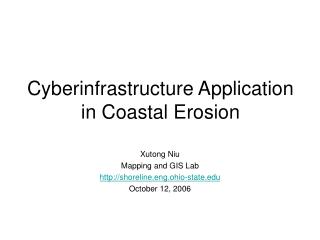
Cyberinfrastructure for Coastal Forecasting and Change Analysis Gagan Agrawal Hakan Ferhatosmanoglu Xutong Niu Ron Li Keith Bedford
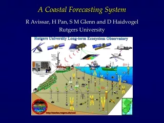
Coastal Forecasting and Change Detection (Lake Erie) Lake Erie Coastal Erosion Analysis: OSU Geodetic Science and ODNR GLOS: Collaboration between OSU Civil and NOAA
Project Premise and Challenges • Limitation of Current Environmental Observation Systems • Tightly coupled systems • No reuse of algorithms • Very hard to experiment with new algorithms • Closely tied to existing resources • Our claim • Emerging trends towards web-services and grid-services can help • Challenges • Existing Grid Middleware Systems have not considered streaming data or data integration issues • Enabling algorithms (data mining, query planning, data fusion) need to be implemented as grid/web-services
Middleware Developed at Ohio State • Automatic Data Virtualization Framework • Enabling processing and integration of data in low-level formats • GATES (Grid-based AdapTive Execution on Streams) • Processing of distributed data streams • FREERIDE-G (FRamework for Rapid Implementation of Datamining Engines in Grid) • Supporting scalable data analysis on remote data
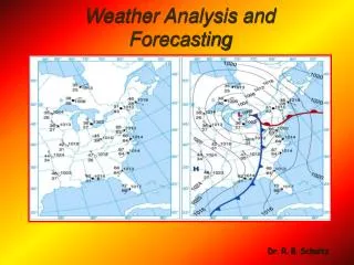
Focus: Erosion along Lake Erie Shore Serious problem Substantial Economic Losses Prediction requires data from Variety of Satellites In-situ sensors Historical Records Challenges Analyzing distributed data Data Integration/Fusion Long Term Goal : Create Service-oriented implementation Design a WSDL to describe available data Describe available tools and services Support discovery and composition of datasets and services for a given query Application Details: Coastal Erosion Prediction and Analysis
GLOS: Great Lakes Observing System Co-designer/project manager: K. Bedford, a co-PI on this project Collaboration with NOAA Limitations: Hard-wired Cannot incorporate new streams or algorithms Create a Demand-driven Implementation using GATES Event of Interest A boat accident, oil leakage Need to run a new model Time Constraints Find grid resources on the fly Need to decide: Spatial and Temporal Granularity Parameters to Model Application Details: Great Lakes Now/ForeCasting