Download
1 / 7
80 likes | 250 Views
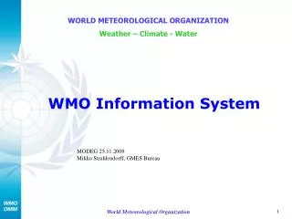
WMO Information System (WIS) Managing & Moving Weather, Water and Climate Information in the 21 st Century. WORLD METEOROLOGICAL ORGANIZATION Weather – Climate - Water. NMHS participation in DRR coordination and early warning 26-27 Nov 2007. David Thomas (WIS). WWW – GOS, GDPFS & GTS.

E N D
WMO Information System (WIS)Managing & Moving Weather, Water and Climate Informationin the 21st Century WORLD METEOROLOGICAL ORGANIZATION Weather – Climate - Water NMHS participation in DRR coordination and early warning 26-27 Nov 2007 David Thomas (WIS) World Meteorological Organization
WWW – GOS, GDPFS & GTS • GTS (data management & communications) has over the years supported the collection and sharing of information from GOS & GDPFS • An exemplary case of long-term global collaboration in a world of vastly different communication systems and standards. • This historical info and critical real-time info feeds RI, RR & RT • GTS also plays a major role in RR through daily monitoring & forecasting the state of the environment • GTS distributes warnings • Globally within 2 minutes • GTS is a closed network WWW - World Weather Watch GTS – Global Telecommunication System GOS – Global Observing System GDPFS – Global Data Processing and Forecast System RI – Risk Identification RR – Risk Reduction RT – Risk Transfer World Meteorological Organization
WMO Information System (WIS) • GTS serves much of WMO but not all • Many WMO activities have made use of the internet & bilateral agreements • These are outside the data management of the WWW/GTS • It is like having a library where not all books are catalogued • WIS incorporates all WMO information systems • WIS includes a central catalogue listing all WMO information available & how to get it. • WIS does for WMO what online catalogues have done for libraries. World Meteorological Organization
Current situation: GTS Not Shown WMC – World Meteorological Centre RSMC – Regional Specialist Meteorological Centre RTH – Regional Telecommunication Hub NMC – National Meteorological Centre World Meteorological Organization
DCPC NC NC NC/ DCPC Managed, Regional and Internet NC NC/DCPC Communication Networks NC GISC NC GISC GISC NC DCPC DCPC GISC GISC Satellite Dissemination (IGDDS, RETIM, etc) NC NC SatelliteTwo-Way Systems NC NC On-demand “pull” GISC – Global Information System Centre DCPC – Data Collection or Production Centre NC – National Centre WIS World Radiation Centre Regional Instrument Centres International Organizations (IAEA, CTBTO, UNEP, FAO.. ) GAW World Data Centres GCOS Data Centres Global Run-off Data Centre Global Precip. Climatology Centre IRI, Hadley Centre, and other climate research centres; Universities; Regional Climate Centres (CIIFEN, etc.) Commercial Service Providers WMO World Data Centres International Projects (e.g. GMES HALO) internet Real-time “push” World Meteorological Organization
Structure of WIS • National Centres (NC) • Links national data providers and users to regional and global data exchange nodes, and administrates access to WIS • Data Collection or Production Centres (DCPC) • Provides for regional and international exchange of WMO programmes’ data and products • Supports data and information push and pull • Global Information System Centres (GISC) • Provides for global exchange of data and products • Collects and provides metadata for all data and products • Supports data and information discovery and pull • Data communication networks (including the internet) • For more information on WIS see http://www.wmo.int/pages/themes/wis/index_en.html World Meteorological Organization
So what will WIS do for DRR? • Ensure continued improvements in the GTS • Provide central metadata catalogues listing all available WMO data and products and how to get them. • Allow non WMO centres to become DCPCs within WIS. • Open WIS catalogues to the web. • DRR workers will have • better access to information to assist in RI, RR & RT, • the ability to collect critical information necessary to monitor and predict the state of the environment World Meteorological Organization