Download
1 / 27
270 likes | 443 Views
Pedology Distance Ed. Field Project. FLREC established in 1955 moved to it’s current location 1968. Only 5′ above sea-level Mean annual Precipitation: 60 – 68 inches, not uniform throughout the year. Udic soil moisture regime. Mean annual air temperature 72 – 79 o F.

E N D
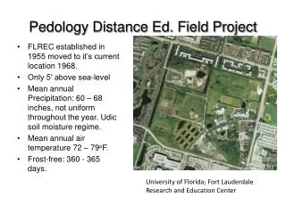
Pedology Distance Ed. Field Project • FLREC established in 1955 moved to it’s current location 1968. • Only 5′ above sea-level • Mean annual Precipitation: 60 – 68 inches, not uniform throughout the year. Udic soil moisture regime. • Mean annual air temperature 72 – 79oF. • Frost-free: 360 - 365 days. University of Florida; Fort Lauderdale Research and Education Center
Previous Land Use • Originally part of the Everglades and vegetatively dominated with Sawgrass. • In 1904, the Flood Control District was formed and an extensive canal system was initiated. Intensive drainage continued until the 1950’s, permitting dairy farming that changed the flora to white clover and Natalgrass dominated pasture. • The University of Florida acquired the land in 1968 without significantly altering the land to this date.
Topography Soil surface extremely flat, nearly level (0-2%). Highly weathered soils, composed almost entirely of weathering resistant quartz; despite this these soils are classified as poorly drained, carrying a capability subclass of IVw (severe limitation of plant choice due to wetness) Large scale drainage may nullify this wetness sub classification, permitting extensive urban development and flora species choice.
VegetativeCover Undisturbed grassland area, receiving no additional fertility inputs Combination of grassy and herbaceous plant species
Master Horizons Ap 0 – 6" E1 6 – 19" E2 19 – 25" Bh 25 – 28" Bw 28 – 46" IIR
Horizon Ap Ap-0 to 6 inches; very dark grey (N 3/1); fine sand; granular, weak structure; very friable; many fine and medium roots; clear smooth boundary.
Horizon E1 E1- 6 to 19 inches, light brownish grey (10YR 5/1); few streaks of black (10YR 2/1) in root channels; fine sand; structureless, single grained, loose; few medium to fine roots; gradually wavy boundary. Redox depletions (10YR 8/1) may be a relic of an era of high water saturation prior to drainage practices.
HorizonE2 E2- 19 to 25 inches, light yellowish grey (10YR 6/2); few streaks of black (10YR 2/1) in root channels; fine sand; structureless, single grained, loose; few fine roots; gradually smooth boundary; soft yellowish brown (10YR 5/6) redox concentrations .
Horizon Bh Bh-25 to 28 inches, very dark greyish brown (10YR 3/2); very few black streaks (10YR 2/1) in root channels; fine sand; granular structure; friable; few medium roots; clear broken boundary.
Horizon Bw Bw-28 to 46 inches; greyish brown (10YR 4/3) fine sand; few streaks of black (10YR 2/1) in root channels; structureless, massive, very friable; few medium roots; clear wavy boundary.
Horizon 2R 2R- below 46 inches; light grey (10YR 7/1) hard fractured limestone; brown (10YR 5/3) fine sand bridging limestone fragments; May be excavated with power equipment.
Soil Profile Properties and Interpretations Infiltration Rate: High AWC: Very low (5.75 cm) KSAT: High Soil Wetness Class: 3 Wet between 50 and 100 cm Soil Interpretations Dwellings with Basement: Moderate (Redox features between 50 and 100cm) Septic Tank Absorption Fields:Severe (Depth to water table & KSAT) Local Roads and Streets: Slight Site Characteristics Position of Site: Broad marine terraces Parent Material: Alluvium sandy marine sediment over limestone Soil Slope: Nearly level - 0 to 2% Surface Runoff: Very slow Erosion potential: Very Low
Soil Classification Epipedon: Ochric Subsurface: Albic Order: Entisols Suborder: Aquents Great group: Psammaquent Subgroup: Spodic Psammaquent Family: Siliceous, hyperthermic Series: Basinger Phase: Fine sand
Previous Land Use • A US Naval Air Station previously occupied this site from 1941 to 1947. • The airfield remained undisturbed until the early 1960’s when urban development ensued. • In 1968, the University of Florida was allocated a section of the original airfield as part of the agricultural research station.
Topography A gradual drop of 0.9m from the surrounding land has resulted in a nearly level (0-2%) area of approximately 200m2 that is significant wetter than the adjacent terrain.
Vegetative Cover • Wetland plant species dominate the vegetative cover. • Increased biodiversity was observed compared to site 1.
Master Horizons A 0 – 4" C 4 – 8" 2Ab 8 – 10" 2AC 10 – 12" 2C 12 - 20" 2R below 16"
A Horizon A – 0 to 4 inches; very dark brown (10YR 2/1); fine sand; granular, weak structure, friable; many fine and medium roots; clear wavy boundary.
C Horizon C- 4 to 8 inches; light grey (N 7/1), very gravelly, fine sand bridging limestone fill material; structure-less and massive; very friable; many fine and medium roots; clear wavy boundary.
2Ab Horizon 2Ab- 8 to 10 inches; very dark grey (10YR 3/1) fine sand; granular, weak structure; friable; many fine and medium roots; clear, smooth boundary.
2AC Horizon BCb- 10 to 12 inches; dark greyish brown (10YR 4/1) fine sand; granular, weak structure; very friable; many fine and medium roots; abrupt wavy boundary.
C2 Horizon C2-12 to 20 inches; greyish brown (10YR 5/2) fine sand; numerous streaks of black (10YR 2/1) from root channels; single grained; loose; few fine and medium roots; abrupt broken boundary interrupted with a limestone pinnacle.
2R Horizon 2R- below 16 inches; very pale yellow (10YR 8/2) fractured limestone; brown (10YR 5/3) fine sand bridging limestone fragments; may be excavated with power equipment
Soil Profile Properties Infiltration Rate: High AWC: Very low (2.48 cm) KSAT: High Soil Wetness Class: 5 (wet above 25 cm) Soil Interpretations Dwellings with Basement: Severe Septic Tank Absorption Fields: Severe Local Roads and Streets: Severe Site Characteristics Position of Site: Broad marine terraces Parent Material: Gravelly fill material over alluvium sandy marine sediment, over limestone. Soil Slope: Nearly level - 0 to 2% Surface Runoff: Very slow Erosion potential: Very Low
Soil Classification Epipedon: Ochric Subsurface: Order: Entisol Suborder: Aquent Great group: Endoaquent Subgroup: lithic endoaquent Family: Sandy-skeletal, siliceous, hyperthermic