Download

1 / 38
390 likes | 461 Views
Learn about the evolution of meteorological satellites, from the first successful launches to modern systems like NOAA, ITOS, and AVHRR, and their impact on weather observation.

E N D
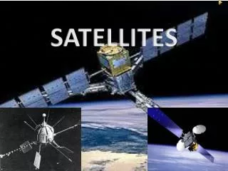
MET SATELLITES HISTORY
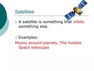
SATELLITE SYSTEMS FOR MET OBSERVATION LOW EARTH ORBITING GEOSYNCHRONOUS • TIROS • NIMBUS (1964 – 1978) • ITOS NOAA • TIROS-N / NOAA • (VHRR/SOUNDERS) • SPINNERS - SMS • • GOES • METEOSAT • THREE AXIS STABILISED • INSAT • GOES-8 • (1999)
TYPES OF ORBITS Types of orbits Inclination altitude • Geosynchronous ≈ 0 High • Tropical ≈ 30 Low • Medium Inclination ≈ 45-65 Low • Molniya * ≈ 65 High • High Inclination ≈ 80 or 100 Low (not 90 ) * It has never been used
TYPES OF ORBIT POLAR INCLINED EQUITORIAL Polar Inclined Equatorial Equator Schematics showing different types of orbits.
Metosat-5 74 E, 83.5 E, 93.5 E
AUGUST 7, 1958 EXPLORER-6 transmits first TV photo of earth from space OCTOBER 13, 1959 EXPLORER-7 launched Carried Suomi radiometer measuring solar & terrestrial radiation (ERB study) APRIL 1, 1960 TIROS-1 First dedicated satellite for metereological observation DECEMBER 6, 1966 ATS-1 – Spin Scan Cloud Camera First geostationary met satellite MET OBSERVATION FROM SPACE
HISTORY OF SAT MET • ON 04 OCT 1957, FIRST SUCCESSFUL EARTH SAT, “SPUTNIK 1” WAS LAUNCHED BY SOVIET UNION. • ON 31 JAN 1958, “EXPLORER 1” WAS LAUNCHED BY US. • NASA WAS FORMED ON 01 OCT 1958.SINCE THEN FOR NEXT 30 YEARS , IT HAS LEAD THE DEVELOPMENT OF SATELLITES. • EXPLORER SERIES CONTINUED AND FIRST SUCCESSFUL MET INSTRUMENT (SUMOI RADIOMETER ) FLEW ON EXPLORER 7 ON 13OCT59.
TIROS - SERIES • From 1 April 1960 to 2 July 1965 ten TIROS were launched • Several technological improvements in TIROS series • MAJOR IMPROVEMENTS: • Medium Resolution Infrared Scanning Radiometer (MRIR) 5 channels in VIS and IR • TIROS-8: Slow scan (4 lines/sec) Vidicon Camera for Automatic Picture Transmission • (APT) too inexpensive ground equipment twice a day • TIROS-9; Sun-synchronous Orbit; CARTWHEEL Orientation Opportunity to take picture for every rotation of the satellite Sun-synchronous orbit
TIROS Satellites a Scanning radiometer (visible and infrared channels) b Automatic picture transmission for direct readout locally.
TIROS Operational Satellite TOS/ESSA Dia 42”, Height 2’ • TOS is follow on to TIROS • First operational weather satellite system of the US • Managed by Environmental Science Services Administration (ESSA) • TOS spacecraft is also referred as ESSA • 1400 Km sun-synchronous orbit • Odd numbered satellites carried two (redundant) Advanced Vidicon Camera System (AVCS) • Even numbered satellites carried two (redundant) APT cameras.
ESSA Satellites – The First Operational Weather Satellite System a All spacecrafts were placed in near-polar, sun-synchronous orbits. b Number of days until satellite was turned off or failed. c Advanced vidicon camera system with data recorders to obtain cloud pictures globally for central analysis. d Automatic picture transmission vidicon camera for local direct readout over the earth.
Improved TIROS Operational Satellite (ITOS) • SECOND GENERATION OPERATIONAL SATELLITES • EIGHT SATELLITES LAUNCHED FROM 1970 TO 1976 (TWO FAILED) • ITOS-1 WAS FUNDED AND OPERATED BY NASA • ITOS-2 ONWARD FUNDED BY NOAA AND DESIGNATED NOAA-1, 2,…5. • VIDICON CAMERAS DISCONTINUED AFTER NOAA-1 • TWO NEW SENSORS ADDED FROM NOAA-2 TO NOAA-5 • VERY HIGH RESOLUTION RADIOMETER (VHRR) • VERTICAL TEMPERATURE PROFILE RADIOMETER (VTPR)
ITOS Satellites a Automatic picture transmission vidicon camera for local direct readout over the earth. b Advanced vidicon camera system with data recorders to obtain cloud pictures globally for central analysis. a Two-channel (visible and infrared), medium-resolution scanning radiometer providing image data day and night for immediate broadcast (APT function) and stored for later playback to provide global coverage for central analysis. d Very high-resolution radiometer (visible and infrared). e Vertical temperature profile radiometer, the first instrument for obtaining temperature soundings of the earth’s atmosphere from the operational satellite system.
Polar orbiting Operational Environmental Satellites(POES) • THIRD GENERATION LED METEOROLOGICAL SATELLITES STARTED WITH LAUNCH OF TIROS-N IN OCTOBER 1978. • CARRIED IMPROVED SENSORS FOR IMAGING (AVHRR) AND ATMOSPHERIC SOUNDING (TOVS) • SUBSEQUENT TIROS-N SERIES ARE DESIGNATED NOAA-6,7,….NOAA-14. • OPERATED AS PAIR OF SATELLITES OF ORBIT ABOUT 833/870 KM, SUN-SYNCHRONOUS, WITH EQUITORIAL CROSSING 0730 (AM) OR 1430 (PM)
Polar orbiting Operational Environmental Satellites (POES) AVHRR - Advanced Very High Resolution Radiometer HRIR - High Resolution Infrared Radiation sounder MSU - Microwave Sounding Unit SSU - Stratospheric Sounding Unit (provided by the UK) DCS - Data Collection System (provided by France)
NOAA 15, 16, 17 May 1998/Sept 2000/June 2002 • NOAA 15 ONWARDS CARRY DEDICATED MW SOUNDER • IMPROVED AVHRR WITH ADDITIONAL BAND AT 1.6 m • THE MAJOR PAYLOADS ARE – • ADVANCED VERY HIGH RESOLUTION RADIOMETER (AVHRR/3) • HIGH RESOLUTION IR RADIATION SOUNDER (HIRS/2) • ADVANCED MICROWAVE SOUNDING UNIT- A1 (AMSU-A1) • ADVANCED MICROWAVE SOUNDING UNIT- A2 (AMSU-A2) • ADVANCED MICROWAVE SOUNDING UNIT – B (AMSU-B) • SOLAR BACKSCATTER UV RAIOMETER (SBUV)
NATIONAL POLAR-ORBITING OPERATIONAL ENVIRONMENTAL SATELLITE SYSTEM (NPOESS) • NPOESS ESTABLISHED IN 1994 TO CONVERGE DMSP AND NOAA PROGRAMME AS SINGLE NATIONAL PROGRAMME • WILL GIVE CONTINUITY TO THE CURRENT GLOBAL OBSERVATION WITH IMPROVED INSTRUMENTS • FIRST OF THE SERIES (NPOESS C1) TO BE LAUNCHED ON OCTOBER 2009
US POLAR MET SAT SCHEDULE NOAA-16 - Launched September 21, 2000. Afternoon orbit NOAA-17 - Launched June 24, 2002. Mid-morning orbit NOAA-18 – May 20, 2005NPOESS Preparatory Project - October 31, 2006NOAA-N' - 2008 pending repairsNPOESS C1 - October 2009NPOESS C2 - October 2010NPOESS C3 - October 2011NPOESS C4 - June 2013NPOESS C5 June 2016NPOESS C6 June 2018
SYNCHRONOUS METEOROLOGICAL SATELLITES (SMS) • NASA developed the new system • SMS1 launched in May 1974 and SMS-2 in February 1975 • Visible IR Spin Scan Radiometer (VISSR) • Visible – 0.55 – 0.75 m ( 0.9km) IR – 10.5 – 12.6 m ( 9km) • Satellite spins at 100 rpm; W-E scanning
Geostationary Operational Environmental Satellites (GOES) • Operational Geo Met Satellites managed by NOAA • GOES-1 launched in October 1975 • GOES-1 to GOES-3 carried VISRR • 0.5 – 0.7 m (.9 km) • 10.5 – 12.6 m (9 km) • GOES-4 (Sept 1980) to GOES-7 (Feb 1987) carried VISSR Atmospheric Sounder (VAS) • Both imaging & sounding in one instrument • Only one function at a time • Imager resolution (1km/7km) • Sounder resolution (14km) • Full earth disc imaging every 30 mts • Major limitation simultaneous imaging and sounding not possible • Two GOES satellites are positioned 135 W longitude (GOES-WEST) to cover USA
GOES I-M (8-12) • GOES-8 (April, 1994) - First 3-axis Stabilised GOES • Independent Imager and Sounder • Five Channel Imager *19 channel sounder, IGFOV 10 km
GOES DESIGNATION PHILOSOPHY • DURING NASA'S CONSTRUCTION AND LAUNCH PHASES, THE • SATELLITES HAVE ALPHABETICAL DESIGNATIONS: GOES-I, • GOES-J, ETC.. • ONCE THE SATELLITES ARE SAFELY LAUNCHED AND • DEPLOYED, THEY GET A SERIAL NUMBER IN ORBIT: • GOES-I became GOES-8 • GOES-J became - GOES 9 • GOES-K became - GOES 10 • GOES-L became GOES -11 • GOES-M became GOES -12 • GOES-N became - GOES 13 • GOES-O to become - GOES 14 • GOES-P to become - GOES 15 • GOES-Q not contracted • GOES-R to be a new generation
US GEO METSAT SCHEDULE GOES-M(12) - Launched July 23, 2001 GOES-N(13) – Launched May-24, 2006GOES-14 - July 2007GOES-P - October 2008GOES-Q - CancelledGOES-R - April 2012
Geostationary Operational Meteorological Satellite (GOMS) - Russia
POLAR ORBITING SATELLITES • FY 1A SEPT 1988 • FY 1B SEPT 1990 901 Km SS METEOROLOGICAL SATELLITE PROGRAMME OF CHINA FY 1A & FY 1B CHARACTERISTICS Resolution – HRPT : 1.08 Km APT : 4.0 Km Swath : 2,860 Km
METEOROLOGICAL SATELLITE PROGRAMME OF CHINA (Contd.) FY 1C launched May 1999 (orbit 847 x 869 km) FY 1D launched May 2002 (orbit 851 x 871 km) The wavelengths of MVISR of FY-1C Resolution at sub-point: 1.1 Km Quantization: 10 bits/word Swath : 2048 Km
GEOSTATIONARY MET SATELLITE OF CHINA FY 2A - launched June 1997 FY 2B – launched June 2000 FY 2C - 2004 The Characteristics of Channels of VISSR
INSAT • First multifunction operational system to combine communication and meteorological functions in a single spacecraft. • More cost-effective • Complex design • First operational three-axis stabilized geo-stationary Metsat • Imaging instrument continuously oriented towards earth • Compact instrument • Bi-axial scanning • Complex thermal management
INSAT • First generation INSAT (INSAT-1 series) • Carried Very High Resolution Radiometer (VHRR) • Visible Band: 2.75 km • Thermal IR Band: 11 km • Last of the four INSAT-1 spacecraft launched in June 1990 • Second generation INSAT developed indigenously with improved resolution and additional bands. • Continuing Series of Meteorological Instruments • VHRR with • Visible Band: 2 km • Thermal and WV IR Bands: 8 km • CCD Based Payload with • Visible, NIR and SWIR Bands: 1 km
INDIAN NATIONAL SATELLITE (INSAT) FOR METEOROLOGICAL APPLICATIONS PAST AND PRESENT INSAT -1 : Geostationary Satellite Series
INSAT-3A & Kalpana-1 (2003) (2002) Location : INSAT 3A : 93.5ºE Kalpana-1 : 74ºE Payload : (i) VHRR & CCD camera in INSAT 3A (ii) VHRR in Kalpana-1 • VHRR Bands (µm) • Visible : 0.55 – 0.75 • Water vapour : 5.70 – 7.10 • Thermal Infra Red : 10.5 – 12.5 • Resolution (km) : 2 X 2 for Visible • 8 X 8 for WV & TIR • CCD Camera Bands (µm) • Visible : 0.62 – 0.68 • Near Infra Red : 0.77 – 0.86 • Short Wave Infra Red : 1.55 – 1.69 • Resolution (km) : 1 X 1 for all bands
INSAT-3D Met Payloads INSAT-3D to carry: Six Channel Imager: Channel Resolution 0.52 – 0.72 µm : 1 km 1.55 – 1.70 µm : 1 km 3.80 – 4.00 µm : 4 km 6.50 – 7.00 µm : 8 km 10.2 – 11.2 µm : 4 km 11.5 – 12.5 µm : 4 km Nineteen Channel IR Sounder (10 km resolution) Shortwave IR (3.74 – 4.57 µm) : Six Channels Midwave IR (6.51 – 9.71 µm) : Six Channels Longwave IR (11.03 – 14.71 µm) : Six Channels Visible IR (0.67 – 0.72 µm) : Six Channels