Download
1 / 12
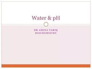
130 likes | 260 Views
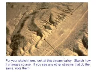
For your sketch here, look at this stream valley. Sketch how it changes course. If you see any other streams that do the same, note them. B. A.

E N D
For your sketch here, look at this stream valley. Sketch how it changes course. If you see any other streams that do the same, note them.
B A Part I. Alone or with 1-2 others, sketch this outcrop and describe what is going on. What is the approximate dip at A and at B? What stress regime likely caused this set of relations?
Part II. Below is a list of topics we can cover next week. Please list your three highest choices. • Mass movements (debris flows, landslides, etc.) • Streams and rivers (surface water!) • Hydrology (groundwater) • Glaciers • Deserts and wind
MOUNTAIN BUILDING,or,why the earth’s surface has such variable relief
Same maps, different views Where is the continental crust thickest? Where is it thinnest? How does this relate to plate tectonics?
So, how much of a material floats in another material depends on their relative densities
Draw a slice through the earth, with N to the left and S to the right, from Flagstaff to Tucson, showing how elevation changes from north to south. Tucson is at about 800 m (2500’) elevation, and we are at about 2000 m (7000’). Beneath the above-ground topographic profile, draw the likely topography of the crustal root under Arizona. The root does not change elevations rapidly.
Very flat topography over a few hundred km (scale below sea level exaggerated 5 X) The point is, how does the crustal thickness change, and how thick is the crust under 2-km-high Flagstaff?
Scale below sea level again vertically exaggerated (above sea level too, though not as much). If the crust below Flagstaff (2100 m) is 40 km thick, how thick might the crust below K2 and Everest be? How much more can the crust thicken below the Himalaya, if at all?