Download
1 / 45
450 likes | 557 Views
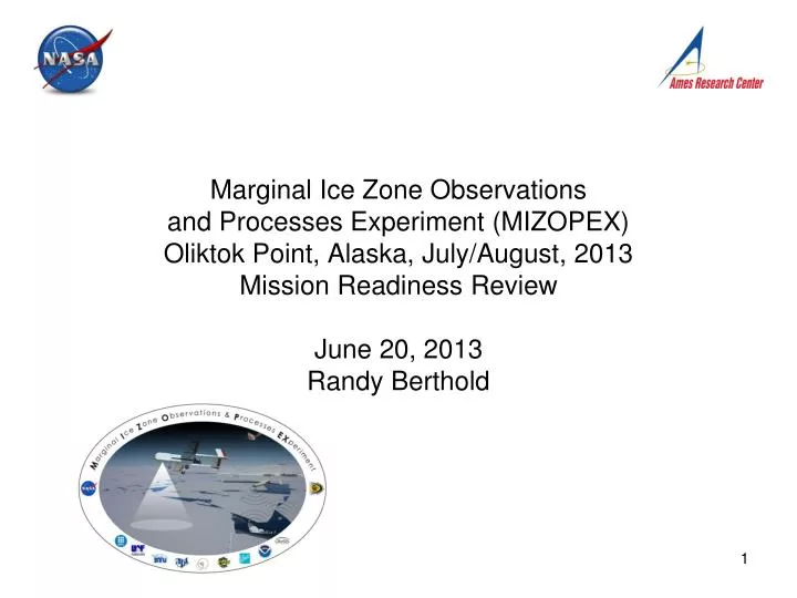
Marginal Ice Zone Observations and Processes Experiment (MIZOPEX) Oliktok Point, Alaska, July/August, 2013 Mission Readiness Review June 20, 2013 Randy Berthold. MRR Goal: Authority To Proceed Granted for the MIZOPEX Mission. Mission Background Science Objectives Mission Description

E N D
Marginal Ice Zone Observations and Processes Experiment (MIZOPEX)Oliktok Point, Alaska, July/August, 2013Mission Readiness ReviewJune 20, 2013Randy Berthold
MRR Goal: Authority To Proceed Granted for the MIZOPEX Mission
Mission Background • Science Objectives • Mission Description • Success Criteria • Deployment/Operational Location • Airspace • Spectrum • Flight Operations Area • Sense and Avoid • Range Safety • Coordination Plan • Organization Chart • Communications Plan • Logistics Overview • Mission Schedule • Concept of Operations • Site Safety • Aircraft Payload & Flight Readiness • SIERRA • ScanEagle: • DATA HAWK: • SIERRA: • Open Items Package Contents
Mission Background • The MIZOPEX project was selected under an open NASA ROSES 2010 Solicitation entitled “UAS Enabled Earth Science” (NNH10ZDA001N-UAS). The funding originated from a congressional earmark to facilitate research on UASs - the monies expire at the end of FY2013. • The goal of the mission is to collect radar, lidar and imagery of the marginal ice zone using 3 different classes of UASs • The mission will utilize 16 instruments, developed by and supporting 11 organizations /partners. • The mission will operate the NASA SIERRA, U. AK ScanEagle and U. CO Data Hawk from Oliktok Point, Alaska from July 12-August 9th, 2013. • Flights of the SIERRA and Scan Eagle will use ground-based radar for sense and avoid in order to safely transit to international waters • The Ikhana was originally assigned the mission but was re-assigned to Ames in Feb 2013 • Mission AFSRB/FRR Completed 18 June, 2013, ATP issued with open items
Science Objectives • MIZOPEX Project will be conducted from Olitkok Point Alaska, July 10-August 10, 2013 • (Goal) Fly a combination of different types of remote sensing instruments over the marginal ice zone off the North Slope, along with deploying small buoys to measure ocean conditions. • (Objectives) Assess ocean and sea ice variability during the melt season within a key marginal ice zone region that has undergone major changes in recent years. • (Outcome) The data will be used to investigate: • - Amount and distribution of heat in the ocean mixed layer • - Relationships between atmospheric conditions and solar heating • - Sea ice characteristics and relationships to melt rates and change • - Validation and improvement of satellite-derived products for sea surface temperature, ice concentration and ice type, thickness and roughness.
Mission DescriptionMission Success • “First Order” Overall Project Success Criteria: • Establishment of coordination procedures and “best paths forward” for operations of multiple UAS in a single project under NASA and FAA guidelines • Demonstration of ability to deploy at least two separate classes of UAS to an Arctic location • Successful integration of at least half of the identified payloads in SIERRA and ScanEagle • Successful deployment of each SIERRA payload bay (“nose cones”) for flight durations of at least 2 hours each • Successful deployment of each ScanEagle payload bay for flight durations of at least 8 hours each • Acquisition of at least 25 hours of science-quality data over the study area using SIERRA (weather permitting) • Acquisition of at least 50 hours of science-quality data over the study area using ScanEagle (weather permitting) • Operations over the 4-week deployment period with no loss or significant damage to UAS
Mission DescriptionMission Success Continued • “First Order” Science-Related Success Criteria: • Acquisition of sea surface temperature (SST) and sea ice characteristics in/near the MIZ over a 20 x 20 km region, with multiple missions spaced over the deployment period, sufficient to document spatial and temporal variability of SST and ice conditions • Overlapped measurements of an SST grid with ADMB and UpTemPo buoy measurements, sufficient to document spatial variability and relationships between remotely-sensed and in-situ measurements • Quantifying the differences in temperature measurements from the 3 different types of temperature sensors in the SIERRA small nose • Collection of at least one hour of science-quality products from SlimSAR, Snow Radar and Riegl scanner over sea ice • Collection of SST and ice data coincident with at least one overpass of EOS, S-NPP, Cryosat-2 and AMSR2 satellites • Acquisition SSTs in the vicinity of different ice types (i.e., first-year and multiyear, or smooth and ridged ice)
Mission DescriptionLocation Oliktok Point Alaska, Oliktok Long Range Radar Site, USAF-PAC-VNMH-13 USAF Controlled, POC,Nicky C. Hilton 611 ASUS/ARS JBER Alaska 907-552-4400. N N
Domestic Airspace Operations • Operations under FAA COA • Launch/land from C-130 gravel runway in restricted airspace • Utilize 1 nm wide x 2000’ high transit corridor to international airspace • Sense-and-Avoid (SAA) required; ground-based radar in lieu of surface observers or chase • Loss of radar capability • RTB if in transit corridor • RTB at end of mission if in international airspace
International Airspace Operations • No COA needed • Operation as State aircraft under Due Regard • No SAA used; no radar coverage and no observers or chase • Analytical approach to determining Probability of Mid-air Collision (PMAC)which must be <1.0E-7 per flight hour
Mission DescriptionFlight Operations Area with Flight Paths Shown Science Flight Path - Example Oliktok Airfield/Flight Transit Corridor
Mission DescriptionSense and Avoid Flight Observations • Contracted with UAV Collaborative for dedicated use of Thales-Raytheon Systems Company LLC (TRS), Sentinel AN/MPQ-64 (FRP-5) radar. • Sentinel will provide 3 dimensional radar data of aircraft to the Sense and Avoid Display System (SAVDS). • Radar will provide for air traffic detection and tracking in the airspace within and surrounding the transit corridor for MIZOPEX operations. • TRS engineer will be responsible for and operation of the radar.
Mission DescriptionSense and Avoid Flight Observations •Radar provides SAA capability to prevent air traffic conflicts within domestic airspace –Subject to adequate SV to be determined from testing •Agency PMAC requirement of <1.0E-07 is satisfied in International airspace without use of SAA Conclusion
Range Safety • Primary goal is protection of persons and property (other than the UAS) • No overflight of persons or occupied structures • Designated RSO and safety observers on site • NOTAM will be issued per the COA • Probability of surface casualty is less than 1.0E-06 per flight hour for population density of 195persons/sq nm (does not include SIERRA team) - Remote location meets Agency range safety requirements for surface casualties
Local Airfields 1) Alpine Airstrip Airport (AK15, LID: PALP), located 23.2 NM WSW of Oliktok airfield at N70°20.66' / W150°56.68', at an elevation of 21 ft. MSL. This is a private use airport owned by ConocoPhillips Alaska, Inc. 2) CD-3 Airstrip (LID: AK20), located 20.6 NM WSW of Oliktok airfield, at N70°25.24' / W150°53.20', at an estimated elevation of 7 ft. MSL. This is a private use airport owned by Conoco Phillips Alaska, Inc. 3) Deadhorse Airport (PASC, LID: SCC), an operational public airport located 33.8 NM ESE of Oliktok point, at N70°11.73' / W148°27.95' at an elevation of 67 ft. MSL. As of Jan. 2012, there were 2 single engine aircraft, 3 multi-engine aircraft, and 2 helicopters based on field, with 16060 annual commercial operations, 4576 annual air-taxi operations, 150 annual military operations, 9126 annual general aviation (GA) local operations and 3000 GA itinerant operations 4) Helmericks Airport (LID: 22AK), located 11.2 NM WSW of Oliktok airfield, at 70º25.70' / W150º24.17', at an estimated elevation of 7 ft. MSL. This is a private use airport that may have 2 single engine aircraft. 5) Nuiqsut Airport (PAQT, LID: AQT), an operational, public-use airport located 28.4 NM southwest of Oliktok point, at N70°12.59' / W151°0.39', at an elevation of 45 ft. MSL. 6) UgnuKuparuk Airport (LID: PAKU), located 11.7 NM SSE of Oliktok point, at N70°19.84' / W149°35.88' at an elevation of 75 ft. MSL. The airport is private use and may have 1 multi-engine aircraft on field. Mission DescriptionLocal Airspace Users
NASA Ames Spectrum Management Review of all payload frequencies completed and approved • NASA Hq. Spectrum Management Office project review determine Raytheon as owner and operator of Sentinel Radar responsible for an FCC temporary authorization. • Raytheon engineers have reviewed all payload frequencies against the security protected Sentinel specifications and determined there are no conflicts. • Air Force (611th) Dew Line Radar approval of payload and Sentinel frequencies. Mission DescriptionSpectrum
Mission DescriptionCoordination Plan • Established a working relationship with all regional stakeholders. To include all local airspace operator, research organization, US Agencies operating in the area (USCG, NOAA, F&W). Briefings provided to all. • Obtained schedule of operations from all regional air space operators. • Establish a call in number (650) 604 – 5477 for all stake holders. MMO status all daily mission activities. • Developed daily airspace operators contact list. Plan for direct daily alerts. • Established clear lines of authority within the project • Held Mission Briefing telecon with all North Slope Stateholders for information exchange.
Mission Description Organization Chart Mission Manager (ATP) R. Berthold
Mission DescriptionField Communications Chart NASA HQ Management Ames Management M. Fladeland PAO/Media
Mission Description Field Communications R & Rs • Mission Science and Data Support Leads Roles and Responsibilities • J. Maslanik (project PI and lead scientist) will have overall responsibility and decision-making authority for science mission development and planning, supervision of flight-track preparation, selection and prioritization of payloads, assessing weather, ice and ocean conditions, and overall coordination of instrument support and data support personnel. • M. Tschudi (mission support scientist) and J. Adler (mission support scientist/project manager) will work with PI for mission planning and flight-line preparation. Tschudi and Adler, assisted by Maslanik, will be responsible for flight-track preparation, delivery of flight tracks to the UAS operators, working with operators to optimize the plan, and assisting the Pilots in Command as needed during flight in the event that mission profiles need to be modified. • J. Heinrichs (data coordinator) along with two assistants, will work with the instrument engineers re. archiving their data in a central location, uploading data to remote sites, and organizing data pre-processing/analysis tasks on site.
Mission DescriptionLogistics Overview Logistic schedule • 7/9 Ames staging team arrival Deadhorse, DH (Randy, Ric, Don, Steve) (first night in DH), pick up vehicles, coordinate delivery of shipment. • 7/10 Move to Oliktok Point, OP establish Hangar footprint, supervise delivery of SIERRA/radar, out building & set up. Arrival of the rest of SIERRA Team and radar engineer in DH, travel to OP. Arrival of Scan Eagle/UAF • 7/11 Unload & stage SIERRA, radar check out. Coordinate with man aircraft pilot for calibration flight (earliest Scan Eagle staging opportunity) • 7/12 Radar/man aircraft validation/calibration flight. Bruce arrives DH transits to OP (departs 7/26). • 7/13 SIERRA Checkout flight (earliest Scan Eagle Flight opportunity). • 7/14 MD#1-thru MD#X • 7/22 Matt K. (alternate GCS) arrives DH (3 days overlap with Bruce). • 8/2 Last mission day for SIERRA • 8/3 SIERRA Pack-up • 8/4 SIERRA Team Departs (radar eng. and (D)RSO/Logistic Rep. stay until last mission day, 8/9)
Mission DescriptionConcept of Operations • Operations will follow a “five-day plan”, with Maslanik and assistants outlining the science objectives for the next five days, and recommending the desired sensor payloads and mission configurations • The day before flights, flight plans will be prepared by Tschudi, assisted by Maslanik, using NASA’s Waypoint Planning Tool and other software, based on a variety of map and satellite data sets. • After launch, a mission support scientist will be present with each UAS operation (GCS location) to help advise on real time changes to mission plans if needed to address weather or aircraft issues. During the flight, the mission scientist will continue monitoring near-real-time satellite data and weather model output to advise whether the mission should be revised. • Over the subsequent day, the mission support scientists, instrument personnel, and off-site team members will discuss the outcome of the preceding mission, assess whether mission goals have been met, and then revise the 5-day plan accordingly
Mission DescriptionSite Safety • Established Bear Protection Plan in accordance with Air Force OP recommendations and Forest Services Best Practices. • Special safety zones set up • Staged animal defense systems • Dedicated spotters • Badging • Formal project badges for all • Coordinated with North Slope Security Offices • Team personnel lists provided • 1 foreign national (H1V) approved • Transportation • Daily 1.5 hours commute each way from Deadhorse/Olitok Point • Vehicles locally procured, certified for North Slope travel (contain emergency gear) • Briefed on local travel protocols • Communications • NASA Iridium System and technical support on site • Full phone and Ethernet connection • 4 phones from Ames Spectrum Office (numbers to be established) • 2 phones for UC • 2 phones UAF
Aircraft Configuration SIERRA Payload • Payload instruments installed: - Payload nose (large) #A:Artemis X band SAR (SlimSAR), JADE longwave imaging radiometer, APTEK high resolution EO video camera - Payload nose (large) #B: University of Kansas CReSIS ultra-wideband (2 to 8 GHz) Snow Radar, Riegl Q-240i scanning LIDAR - Payload nose (standard) #C: WFF Micro Spectrometer Instrument Suite, BESST radiometer, CULPIS LIDAR, Nikon D7000 EO digital camera, L3 Protec-MRX Airborne Automatic Identification System (AIS) - Airframe (fuselage) instruments: Novatel IMU & GPS, Snow Radar receiving antenna (nadir), Bobcat high frame-rate (EO) digital camera, Lamont-Doherty (LDEO) data system for sensor operation and data logging, Canon G15 EO digital camera
Aircraft Configuration -continued-Fuselage Instruments Snow Radar receiving antenna, nadir port location NADIR PORT FRAME INTERNAL NADIR PORT FRAME EXTERNAL RADAR ANTENNA HUMIDITY SENSOR PROBE
Aircraft Configuration -continued-Fuselage Instruments complete 6/21 Novatel IMU & GPS Installation Open pending receipt of fabricated tray, behind schedule, currently predicted HUMIDITY SENSOR PROBE Temperature & humidity probes have been installed and functionally tested in the lab. These will be used as a backup ice warning system. This is the same system that was flown in Norway.
Aircraft Configuration -continued-Fuselage Mounted Instruments Bobcat Digital EO Camera Aft Firewall, NADIR View
Aircraft Configuration -continued-Fuselage Mounted Instruments CANON G15 EO DIGITAL CAMERA AFT FIREWALL LOCATION, NADIR VIEW CAMERA INSTALLATION IN CAMERA HOUSING
Aircraft Configuration -continued-MIZOPEX Payload Nose A (SlimSAR and JADE) FRONT VIEW SLIMSAR SLOTTED WAVE GUIDE RADAR ANTENNA 55˚ ABOVE NADIR, RIGHT SIDE VIEW JADE LONGWAVE IMAGING RADIOMETER NADIR VIEW RADAR ELECTRONICS
Aircraft Configuration -continued-MIZOPEX Payload Nose B (Snow Radar and Riegl) RIGHT SIDE VIEW SNOW RADAR ELECTRONICS RIEGL SCANNING LIDAR & DATA RECORDER SNOW RADAR FORWARD, TRANSMITTING ANTENNA
Aircraft Configuration -continued-MIZOPEX Payload Nose C (MIS, BESST, CULPIS, Nikon Camera, AIS)
SIERRAOpen Items • Nose gear steering actuator replacement • Complete 400 lb GTOW flight test • Complete ground & flight tests of payload systems EMI test • Final W & B • Perform fuel system calibrations • Complete QA inspection and sign off on aircraft logbook • Conduct CCB meeting for close-out of ACRs 12 open, 10 not critical, can be deferred. Remaining 2 are: "Limited Life Components Identification and Service Criteria" and the "Maintenance Manual Update”. • Update NAMIS maintenance records and release aircraft for flight
Ball Experimental Sea Surface Temperature Radiometer(BESST) • Successfully bench tested • Integrated Variant 1 and 2 week of 10 June
Air Deployed Microbouys (ADMB) • Successful bench test, launch survival test • Integrated on variant 2 week of 10 June • Flight test of receiver on 12 June • Full payload flight test week of 17 June
Long-Wave Infrared Imager (ATOM) • Successful bench test • Integrated with both aircraft variants • Scheduled for flight test week of 10 and 17 June
CU LIDAR Profilometer and Imaging System (CULPIS) • Successful bench test, launch survival test • Integrated on both aircraft variants • Scheduled for flight test week of 10 June and 17 June
X-Band Synthetic Aperture Radar (nano-SAR-B) • Proven instrument on ScanEagle in Military operations • Unsuccessful bench test (will not regularly turn operate) • Sent back to manufacturer on 10 June • Unknown flight test date
Integrated Self Deployed Surface Sensor (SDSS) Sensors Exit Through Bottom of Plane Air Deployed Micro Buoy Electronics DataHawk Airframe and Avionics Shipping Crate for 4 SDSS Planes 10 m Thermistor String Embedded in Wing
Mission Open Items • Mission Safety Plan Sign-off • Radar FCC authorization-Raytheon Responsibility • FCC Project Laser Operation approval (expected NLT 6/24/13) • Final phone list (inclusion of to be obtained Iridium phone numbers) • Letter of Agreement with FAA-Anchorage ARTCC for coordinating ALTRV in transit corridor • Update the aircraft/payload power budgets with measured data and propose an approach if negative margins exist. • Approval for request for a waiver on the 50 hour spider adapter eddy current inspection interval. • NOAA Interagency Agreement funding SIERRA operations/final sign off pending • FAA Certificates of Authorization for SIERRA and ScanEagleDataHawk balloon waiver • Complete SIERRA aircraft remaining items to close. • Review manned aircraft and pilot certification/qualification, for radar bounding, for completeness. • Determine payload instrument priorities for go/no go decision making.