Download

1 / 7
0 likes | 17 Views
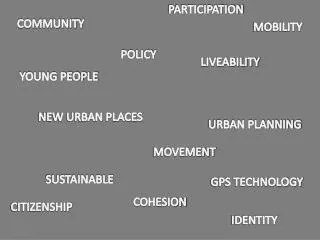
Introduction <br>Spatial technology is changing the way cities are planned and built. This technology helps urban planners make better decisions by using tools like maps, satellite images, and data analysis. It allows planners to understand how people move, where to build new roads, and how to manage resources like water and electricity.<br><br>https://www.gispeople.com.au/geospatial-consulting/

E N D
HOW SPATIAL TECHNOLOGY IS REVOLUTIONIZING URBAN PLANNING? As global leaders, we deliver world-class geospatial technology solutions VISIT OUR WEBSITE www.gispeople.com.au
Introduction Spatial technology is changing the way cities are planned and built. This technology helps urban planners make better decisions by using tools like maps, satellite images, and data analysis. It allows planners to understand how people move, where to build new roads, and how to manage resources like water and electricity.
Housing And Infrastructure One major benefit of spatial technology is its ability to show how land is used. Planners can see which areas are crowded, underdeveloped, or suitable for new housing and infrastructure.
Disaster Management Spatial technology also plays a key role in disaster management. For example, it can predict the impact of natural disasters like floods or earthquakes.
Improve Public Transportation System In addition, spatial technology helps improve public transportation systems. By analyzing traffic patterns and population density, planners can optimize routes, reduce congestion, and ensure that public transport reaches all parts of the city.
Wrap Up In the future, spatial technology will continue to improve making cities safer, greener, and more connected. With these companies like GIS People are helping cities make the best use of spatial technology to build smarter, more livable communities. urban planning, advancements,
Contact Us Telephone 1800 684 543 Website www.gispeople.com.au Email leads@gispeople.com.au