Download
1 / 4
40 likes | 297 Views
Cities are systems of tremendous, ever-evolving complexity. Responsibly guiding an areau2019s development requires spatial information thatu2019s robust, nuanced and constantly updated, as well as the problem-solving skills to apply that information. This challenge has made geographic information science and technology (GIST) invaluable to urban planners.

E N D
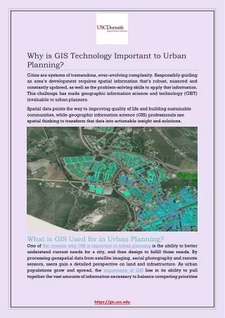
Why is GIS Technology Important to Urban Planning? Cities are systems of tremendous, ever-evolving complexity. Responsibly guiding an area’s development requires spatial information that’s robust, nuanced and constantly updated, as well as the problem-solving skills to apply that information. This challenge has made geographic information science and technology (GIST) invaluable to urban planners. Spatial data points the way to improving quality of life and building sustainable communities, while geographic information science (GIS) professionals use spatial thinking to transform that data into actionable insight and solutions. What is GIS Used for in Urban Planning? One of the reasons why GIS is important in urban planning is the ability to better understand current needs for a city, and then design to fulfill those needs. By processing geospatial data from satellite imaging, aerial photography and remote sensors, users gain a detailed perspective on land and infrastructure. As urban populations grow and spread, the importance of GIS lies in its ability to pull together the vast amounts of information necessary to balance competing priorities https://gis.usc.edu
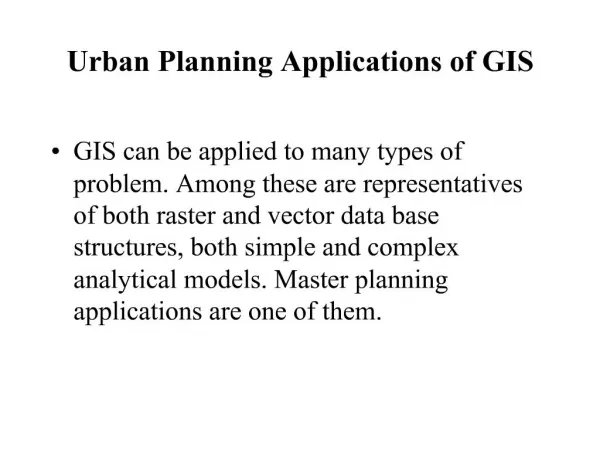
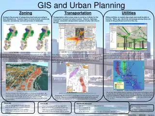
and solve complicated problems, such as optimizing new building placement or determining the feasibility of a waste disposal site. These powerful tools help planners understand the needs of densely populated areas, but they also adapt to examining smaller towns and even informal settlements. The ability to run a variety of queries and analytics on GIS data means experts can evaluate how new construction will fit in with existing infrastructure and meet regulatory demands. Users may spot opportunities for improved resource use, identifying the best locations to harvest solar, wind or geothermal energy. GIS technology empowers urban planners with enhanced visibility into data. They monitor fluctuations over time, evaluate the feasibility of proposed projects and predict their effects on the environment. GIS software can also show all relevant stakeholders exactly what the changes on the ground will look like to help them make better decisions. For example, GIS software may generate visualizations of an area’s current environmental conditions and allow users to draw comparisons between the anticipated results of proposed development plans. Putting GIS to Work in Today’s Cities Urban planners in both the public and private sector employ data-driven methods to address a wide array of issues that have long-term implications for communities and the surrounding landscape. Some of the common applications for GIS include: Review and analysis of plans for development. Checks on regulatory compliance. Review of environmental impact. Preservation of historic sites. Regional planning beyond the borders of a city or town. Mapping the delivery of utilities and planning for service interruptions. By performing land use analyses, planners can guide new developments to areas that are less prone to damage from natural disasters. Synthesizing geographic information with financial data might lead to revitalizing an urban area in need of new businesses. For example, GIS software allowed the City of San Antonio Planning Department to collaborate with other stakeholders in the initial stages of the ongoing efforts to redevelop the Broadway Corridor. GIS Certificate offers the means to synthesize information from a diverse set of sources, model the outcomes of multiple courses of action and share data among the San Antonio Public Works Department, the https://gis.usc.edu
Alamo Area Council of Governments, a group of architects and Environmental Protection Agency staff in Dallas and Washington, D.C. Experts from many different disciplines found common ground and created actionable plans for making services and amenities more accessible and travel easier for bikers and pedestrians. Opportunities for Urban Planners with a GIS Education Urban and regional planning is a rewarding field that’s full of chances to discover fresh insights and make a difference in the futures of communities. According to 2017 data from the U.S. Bureau of Labor Statistics, planners make a median salary of $71,490, and opportunities are expanding. The agency projected 13 percent growth in available positions by 2026—faster than the national average. Urban planners commonly work as independent contractors employed by government agencies, private firms and developers. The professionals who succeed in this role are highly capable problem-solvers with excellent spatial reasoning. They should thoroughly understand how a city’s infrastructure functions and account for all applicable laws and demographic information. Planners should also be proficient communicators who can explain important issues to non-experts. They often must work with stakeholders who may have different priorities, so they should be able to consider multiple perspectives and seek compromises. Urban planners who are experts in GIS can meet these demands with the power expansive data and a vivid look into the possibilities for their projects. https://gis.usc.edu
Join Us: Facebook | Twitter | LinkedIn Phone: (877) 650-9054 Email: gis@usc.edu https://gis.usc.edu