Download
1 / 21
310 likes | 988 Views
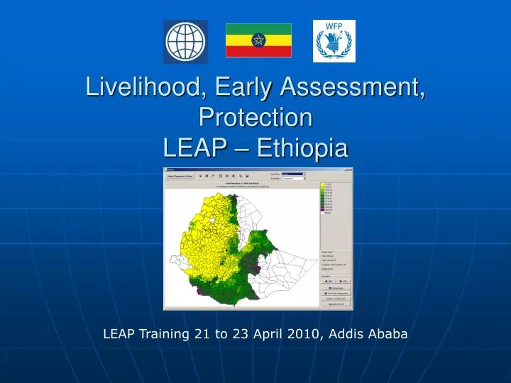
Livelihood, Early Assessment, Protection LEAP – Ethiopia. LEAP Training 21 to 23 April 2010, Addis Ababa. LEAP objective and purpose. Based on 2006 Ethiopia Drought Index project experience

E N D
Livelihood, Early Assessment, Protection LEAP – Ethiopia LEAP Training 21 to 23 April 2010, Addis Ababa
LEAP objective and purpose • Based on 2006 Ethiopia Drought Index project experience • GFDRR Project that links drought and flood monitoring and early warning with the GoE managed risk management framework • Software platform to calculate weather based indices: • Monitoring of drought and other risks • Guide to disbursements for a PSNP scale-up • Integral part of the Ethiopia Risk Management Framework • Ex-ante risk management tool
Ethiopia Risk Management Framework I. IMPROVE INDEX: LEAP II. Develop budgeted contingency plans Early Warning System with reliable baseline and trigger points Contingency Planning for appropriate and timely response Ex-Ante Financing of contingency plans Capacity Building for effective plan implementation IV.Establish timely emergency financing through use of contingency financing III. Build planning and implementation capacity at regional level
LEAP products • WRSI: Water Requirement Satisfaction Index and 19 related parameters (PET, water excess etc.) • Yield reduction estimates • Livelihood parameters (number of beneficiaries, cost for livelihood protection at Woreda level) • Moisture index (rainfall/evapotranspiration comparison)
WRSI Index = intermediate product LPCI Crop and Weather Information Number of Beneficiaries Crop baskets Water Balance Calculation Crop Yields Rangeland Yields WRSI Index Shocks in Livelihood Studies Prices of Food
WHAT DO WE WANT FROM LIVELIHOOD PROTECTION COST INDEX? • Represent cost of intervening early to protect vulnerable livelihoods • Signal amount of financial resources needed for regions to protect vulnerable livelihoods before harvest • Trusted by GoE and donors to trigger timely resources • Provide early warning of livelihood stress levels • Crop and pasture monitoring tool • Easily customizable according to new purposes • Open source and available for free
Yield reduction in % “hot spot” monitoring Developing the LPCI • Target group: vulnerable population • 80 to 90% of Rural Livelihoods directly or indirectly depend on rainfed agriculture Weather data Crop + soil coefficients Water Requirement Satisfaction Index (WRSI) for Crops + Rangelands Number of Beneficiaries for Livelihood Protection Costs (Livelihood Protection Cost Index LPCI)
triggers activates Livelihood Analysis implement • Risk Profiling • Drought Risk Assessment • Drought Impact Assessment • Drought Scenarios • Types of intervention needed • Timing of intervention • Target population • Costs • Implementing partners e.g. SNNPR protects CONTINGENCY PLANNING LPCI Contingent Financing Contingency Plans Appropriate and timely response Livelihoods
Current LEAP phase • Capacity building – LEAP training and study tours • Development of flood and pastoralist indices • Verification of LEAP drought index, stakeholder support • Complete hand over to GoE
LEAP is being developed by • WFP Rome, initiator, insurance based risk financing (NielsBalzer, Ulrich Hess – Vanessa Cardamone, Giuditta De Simone) • MoARD intents to make LEAP corner stone of food security warning system (MattewosHunde) • Local Consultants (Addisu and Girma; crop and needs data) • NMA Ethiopia, provides data and feedback. • CSA and MoARD provide data • Several government bodies provide feedback • International Consultants (SandroCalmanti and Peter Hoefsloot) • WFP/VAM Addis, overall guidance, data delivery and feedback from the field (Elliot Vhurumuku – TeshomeErkineh and Dr MuktarReshid) • World Bank finances through GFDRR Grant (Will Wiseman – WoutSoer)
Data providers • National Met Agency (rainfall and et0) • University of Reading (rainfall) • NOAA (rainfall estimates) • LEWS project (Livestock Early Warning System): Forage Maps • MoARD (crop and production data) • CSA (crop and needs data) • USGS (NDVI) • EUMETSAT Germany : Meteosat NDVI • Almost all provide data for free -> enhances sustainability
What has been done so far • First steps to LEAP three years ago • Now version 2.20 • Software will be updated regularly (next year floods and rangeland) • 100 page manual and 40-page tutorial included • LEAP website : http://vam.wfp.org/leap • Training has been provided in 6 workshops to over 75 Ethiopian professionals. • Users: WFP, World Bank consultants, MoARD, NMA, and YOU!
Recent LEAP developments • NMA provides real-time rainfall through Dr. MuktarReshid • ITHACA (Fabio GiulioTonolo , Franca Disabato): methodology based on MODIS to detect floods • ENEA (SandroCalmanti) works on rangeland production estimates linked to needs • Servers in Addis will be installed at DRMFSS and NMA (MattewosHunde and TeshomeErkineh) • Peter Hoefsloot integrates all above in LEAP
Continuously running LEAP activities • Providing new data to the LEAP community through internet download and mail: • rainfall estimates (also through mail) • NMA data integration (ET0 and rainfall) • NDVI (vegetation greenness) • Monthly LEAP bulletins in cropping season • Technical support through mail
LEAP bulletins • Monthly in Belg and Meher cropping seasons • Maps • Highlights
Still to do • Emphasis on making LEAP operational • Introduce improved needs and beneficiary algorithms into LEAP (based on work by SandroCalmanti) • Training trainers and software developers • Ensure continuous records - some datasets have gaps
LEAP is free! Download from LEAP page • http://vam.wfp.org/leap (program + data = 76MB) If you need data by mail rather than internet update, please send an e-mail to peter.hoefsloot@planet.nl
Drought Index Verification • Correlation against historical production/yield and beneficiary data • FAO/WFP natl cereal crop production, 1999-2003 87% • MoARD natl cereal crop yields, 1995-2003 75% • WFP beneficiary numbers, 1994-2004 81% • DPPA % of drought affected pop 80%
Drought Index Verification II • Field verification • Purpose: (1) Verify accuracy of drought index for rigor in capturing actual performance of dominant staple crops on ground; (2) Generate baseline date for further validation of index • 13 woredas associated with 10 selected weather stations visited • Minor differences emanated from identified gaps in model but comparison against modelled estimates reveal that index fairly captured conditions in most woredas • Recommendation: Improved agro-met data inputs; further improvement and pilot testing
A water balance model drives the index • Index based on just rainfall too crude. • Water balance model: bookkeeping on crop water use