Download
1 / 23
230 likes | 414 Views
The EUMETSAT Polar System GRAS SAF and Data Products. Martin B. Sorensen GRAS SAF Project Atmosphere Space Research Division Danish Meteorological Institute (DMI) Copenhagen. Outline of presentation. Introduction EUMETSAT Polar System The EUMETSAT Satellite Application Facilities

E N D
The EUMETSAT Polar SystemGRAS SAF and Data Products Martin B. Sorensen GRAS SAF Project Atmosphere Space Research Division Danish Meteorological Institute (DMI) Copenhagen
Outline of presentation • Introduction • EUMETSAT Polar System • The EUMETSAT Satellite Application Facilities (the SAF concept) • GRAS Measurement System • The GRAS SAF Operational Centre • GRAS SAF products • GRAS SAF product dissemination and archives • Summary
Introduction • EUMETSAT Polar System (EPS) is the European component of the joint European/US polar satellite system (IJPS) • EPS mission consists of three Metop satellites with a payload of eight meteorological instruments • The first Metop satellite is launched in second half of 2006 • The total duration of the EPS mission is 14 years • GRAS receiver has been developed especially for radio occultation measurements within the EPS framework by ESA and EUMETSAT => NRT products for NWP applications and continuity of radio occultation data for climate monitoring
Blind orbits Global data data dump dump Global data dump NOAA global data METOP blind orbits EPS GS NOAA GS METOP global data NOAA blind orbits Initial Joint Polar System METOP 1 & 2 a.m. NOAA N & N’ p.m. SAF SAF SAF SAF SAF SAF EUMETSAT POLAR SYSTEM NOAA POES SYSTEM
GRAS receiver • 12 bi-frequency channels • Codeless-mode capability • Oven stabilised USO (Allan deviation 10-12) • Directional high gain occultation antennas for minimising local multipath • Onboard DSP => autonomous operations
The EUMETSAT Satellite Application Facilities The SAF concept
Distributed Ground Segment MSG Data Acquisition and Control EPS/Metop Data Processing EUMETSAT HQ Applications Ground Segment GRAS SAF Meteorological Products Extraction Facility (MPEF) EUMETSAT HQ Unified Meteorological Archive & Retrieval Facility (U-MARF) EUMETSAT HQ Satellite Application Facilities (SAFs) Centralised processing and generation of products Decentralised processing and generation of products USERS
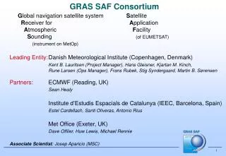
GRAS Satellite Application Facility (SAF) started in 1999 Operational facility for atmosphere products from GRAS instrument on Metop (Launch planned 2006) 7 year developments Partner Institutes Danish Meteorological Institute (Host institute) K.B. Lauritsen, M.B. Sørensen, F. Rubek Met Office, UK D. Offiler, Axel v. Engeln, C. Marquardt, (S. Healy) Institut d’Estudis Espacials de Catalunya (IEEC), Spain A. Rius, S. Oliveras Milestones 2004 System test and verification 2005 Integration test 2006 Commissioning of Metop 2007 Operational products from GRAS SAF GRAS SAF Overview and Plans
NRT Challenge • EPS GRAS is the first RO mission that has been from the beginning designed for operational applications • NRT requirements for GRAS product dissemination are 2 h 15 min for level 1b and 3 h for level 2 from the observation • Analysis of the NRT feasibility has revealed two main risks: • Timely availability of the auxiliary data • NRT Precise Orbit Determination of the LEO satellite • Mitigation of these risks is incorporated in the GRAS Measurement System design • There has been no reason to compromise the occultation data processing due to the NRT requirements
GRAS Measurement System • GRAS Ground Support Network (GSN) provides GPS POD products and ground based measurements • Level 1b products are processed and disseminated by the EPS Core Ground Segment (CGS) • Level 2 products are processed and disseminated by the GRAS Meteorology SAF • Archived products include raw data, level 1b, level 2 and all GSN products • Off-line user access to archived products via EUMETSAT UMARF
GRAS Ground Support Network (GSN) • GRAS GSN is a service to provide GPS state vectors, clock offset estimates, and clock differencing data for GRAS data processing • GSN will contain a network of 25 fiducial stations • GSN coverage for the GPS constellation is > 200 % to ensure service availability via redundancy • The GSN Service is designed to support the GRAS NRT data processing requirements
Data and software products from the GRAS SAF DMI processing center • Data products (Level 2) in NRT (3 hrs) • Refractivity, Temperature, Pressure and Humidity profiles • Surface pressure • Data products Offline • Reprocessed level 2 products • Bending angle (Level 1) • ROP Package • 3/4DVAR Assimilation Software • Pre-processing tools • Forward operators • Error covariance matrix Met Office
NRT Dissemination via RMDCNEUMETCast ? Regional Meteorological Data Communication Network for ECMWF and WMO Region VI
Off-line and reprocessed data via UMARF - or from the local GRAS SAF archive Unified Meteorological Archive and Retrieval Facility
Summary • The objective of the EPS GRAS mission is to provide NWP users operationally radio occultation data products • The EPS mission starts in 2006 and provides data continuously at least for 14 years • GRAS data processing and dissemination are performed by the EPS CGS (level 1b ) and by the GRAS Meteorology SAF (level 2 ) • All archived GRAS products (level 0, level 1b, and level 2) shall be made available via the EUMETSAT UMARF facility • Analysis and study results indicate that the NRT data processing with the required accuracy is feasible for about 92 % of the observations www.eumetsat.int & http://grassaf.dmi.dk