Download

1 / 13
130 likes | 290 Views
Globaal overzicht Inwinning Geo-informatie. Nico de Graaff. Van werkelijkheid naar model. Bron: Longley et al. 2005. Achtergrond: Keuzes maken. Methode van inwinnen is afhankelijk van: eisen aan eindproduct Beschikbare bronnen Beschikbare technologie Beschikbare financiële middelen.

E N D
Globaal overzichtInwinning Geo-informatie Nico de Graaff
Van werkelijkheid naar model Bron: Longley et al. 2005
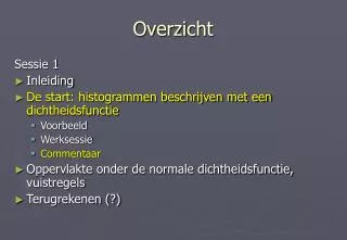
Achtergrond: Keuzes maken • Methode van inwinnen is afhankelijk van: • eisen aan eindproduct • Beschikbare bronnen • Beschikbare technologie • Beschikbare financiële middelen
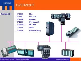
Inwinningsmethoden • Terrestrisch • Fotogrammetrie • Remote sensing • Airborne imagery • Space imagery • Lidar
Terrestrische inwinning • Kaartvervaardiging (GBKA) • Hoogtemeten (NAP) • Deformatiemetingen • Hoogtemodellen (DTM) • Panoramafoto’s
Fotogrammetrie (1) • Proces: • Voorbereiden en maken vluchtplan • Uitvoeren fotovlucht • Inpassen beelden in coördinaatsysteem • Transformeren naar bruikbare vormen gebruikers • Orthofoto’s • ‘Tegels’ • Formaten (ECW, TIFF, JPG)
Fotogrammetrie (2) • Proces vervolg: • Integratie in systeemomgeving • Heads-up digitizing • Opsporen mutaties • Beeldinterpretatie
Remote sensing • opsomming
Globale vergelijking De waarden in de tabel zijn voor de beeldvorming, en niet exact!
Nauwkeurigheid beeldmateriaal Zie afbeeldingen..