Download
1 / 29
300 likes | 443 Views
Ondergrondse Geo-Informatie GIS bij tunnel-engineering. Peter van Capelleveen Witteveen+Bos. Het project De GIS inzet. Opdrachtnemer engineering. De opdracht voor de engineeringsactiviteiten voor de Definitiefase en later ook voor het Voorontwerp

E N D
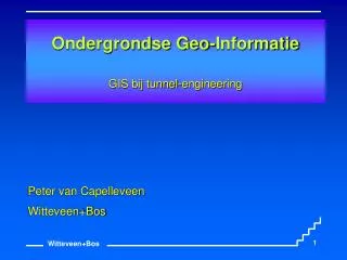
Ondergrondse Geo-InformatieGIS bij tunnel-engineering Peter van Capelleveen Witteveen+Bos
Het project • De GIS inzet
Opdrachtnemer engineering De opdracht voor de engineeringsactiviteiten voor de Definitiefase en later ook voor het Voorontwerp en Definitief Ontwerp is in juli 1994 opgedragen aan het: Adviesbureau Noord/Zuidlijn. Dit is een samenwerking tussen: • Witteveen+Bos, raadgevende ingenieurs bv • De Weger, Architecten- en ingenieursbureau bv • Ingenieursbureau Amsterdam
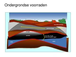
GIS Inzet • Koppeling geotechnische modellen • Geotechnisch Lengte profiel • Risico voorspelling • Vergroten inzicht • Volume berekening • Monitoring • IBBS
GIS Inzet • Koppeling geotechnische modellen • Geotechnisch Lengte profiel • Risico voorspelling • Vergroten inzicht • Volume berekening • Monitoring • IBBS
GIS Inzet • Koppeling geotechnische modellen • Geotechnisch Lengte profiel • Risico voorspelling • Vergroten inzicht • Volume berekening • Monitoring • IBBS
GIS Inzet • Koppeling geotechnische modellen • Geotechnisch Lengte profiel • Risico voorspelling • Vergroten inzicht • Volume berekening • Monitoring • IBBS
GIS Inzet • Koppeling geotechnische modellen • Geotechnisch Lengte profiel • Risico voorspelling • Vergroten inzicht • Volume berekening • Monitoring • IBBS
GIS Inzet • Koppeling geotechnische modellen • Geotechnisch Lengte profiel • Risico voorspelling • Vergroten inzicht • Volume berekening • Monitoring • IBBS
Volume naar grondsoort • Bouwput per onderdeel • tunnel(per ring)
GIS Inzet • Koppeling geotechnische modellen • Geotechnisch Lengte profiel • Risico voorspelling • Vergroten inzicht • Volume berekening • Monitoring • IBBS
GIS Inzet • Koppeling geotechnische modellen • Geotechnisch Lengte profiel • Risico voorspelling • Vergroten inzicht • Volume berekening • Monitoring • IBBS