Download
1 / 23
240 likes | 480 Views
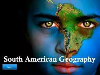
North America Before Columbus & Basic Geography of North America. Answers to the Homework Assignment. Rivers and Bodies of Water. The locations and significance of the bodies of water referenced. . Oceans? Atlantic, Pacific, Arctic.

E N D
North America Before Columbus & Basic Geography of North America Answers to the Homework Assignment
Rivers and Bodies of Water The locations and significance of the bodies of water referenced.
Oceans? Atlantic, Pacific, Arctic The Atlantic and Pacific should be easy enough to find on your map. The Arctic is a bit of a trick question… It is located to the north of Alaska.
The Gulf of Mexico Texas, Louisiana, Mississippi, Alabama, and Florida are all Gulf Coast states. This was Columbus – and many of the Spanish conquistadors first view of “The New World.”
The James River The James River is Virginia’s major waterway. The river starts in the Appalachian Mountains and winds its way east to before emptying into the Chesapeake Bay. The river was essential as a means of facilitating trade for settlers in early Colonial Virginia.
The Hudson River The Hudson River runs from upstate New York into the Atlantic near New York Harbor. Trade between the state capital and New York City ran along this river – and it still does. The Erie Canal, built in the 1820s, allowed trade between New York City and many of the industrial centers of the Great Lakes.
The Ohio River – “The Gateway to the West” The Ohio River begins in Pennsylvania and forms the borders of parts of five states. During the late 18th Century, the Ohio River Valley was contested by Native American groups, the French, and the English, who ultimately took over the territory. The Corps of Discovery – that is, Lewis & Clark’s expedition – embarked upon their journey from the Ohio River.
The Mississippi and the Missouri Rivers The Missouri River, speaking of Lewis and Clark, was the route the Corps of Discovery took to the Far West. The Missouri empties into the Mississippi, and the two rivers combined are the largest river system in the United States.
The Colorado River The Colorado River begins in the Rockies, and winds its way slowly to the Southwest, forming the Grand Canyon as part of its route. It eventually empties into the Gulf of California.
The Rio Grande The Rio Grande forms the border between the United States of America and Mexico. The river actually starts in the Rocky Mountains of Colorado – very close to where the Colorado River begins. However, it is on the opposite side of the Continental Divide; hence, it empties into the Gulf of Mexico instead of the Gulf of California.
The Columbia River The Columbia River begins in Canada, and then descends rapidly through Washington state. The river forms the boundary between Washington and Oregon as it makes its way to the Pacific. The Russian map to the rights shows the entire Columbia River basin, as it merges with the Snake River to the South. Russia once claimed the land of the Pacific Northwest – including Alaska and the “Oregon” Country.
The Great Lakes Huron, Ontario, Michigan, Erie, and Superior – (H.O.M.E.S.) The Great Lakes serve as a boundary between the United States and Canada, as well. Lake Michigan is the only lake exclusively in the United States.
The MacKenzie River The MacKenzie River is the probably the largest of the little known rivers in the World. It runs through isolated portions of Canada and empties into the Arctic Ocean. Canadian geography needed some love.
Mountain Ranges and Geographic Features The Appalachians, the Rockies and the Great Plains
The Appalachian Mountains The Appalachian Mountains run roughly from Canada to northern Georgia. During the 18th Century, they served as a natural barrier to the West. The English actually forbid any settlement West of the Appalachians with the Proclamation of 1763. Nevertheless, trailblazing pioneers flooded into the Ohio River Valley after the French and Indian War and even more so when Americans gained independence.
The Rocky Mountains The Rockies are the largest mountain range in the United States and run from Montana to New Mexico. Indeed, the same chain of Mountains runs from Canada all the way to South America.
The Great Plains Starting around the 100th Meridian and running west to the Rocky Mountains, the Great Plains are a broad, flat high prairie. The grasslands are fertile, but the soil is shall and sensitive. Today, the Great Plains is one of the most productive agricultural regions on Earth – thanks to pesticides, fertilizers, hybrid crops, mechanized farming, and irrigation systems.
Native American Cultures Native Americans were extraordinarily depended upon their physical environments. Thus, cultural changes emerged between the tribes.
Native American Cultural Diversity Pacific Coast Tribes The Great Plains Tribes The Pacific Coast tribes of the present day Northwest were able to live in one place rather than nomadically. The forest of the region provided lumber to construct houses and canoes, and even artistic works of cultural significance like totem poles. Fish and game in the area were reliable food sources. The Plains tribes were people who lived nomadically, and moved from place to place living in cone-shaped tepees. The tribes relied upon the buffalo as a food source, and engaged in agriculture only seasonally. The introduction of the horse to the Sioux tribe after Spanish livestock escaped to the Plains dramatically changed Sioux culture.
The Columbian Exchange Animals, Livestock. There were virtually no domesticated animals used for labor or military reasons in North America when Europeans arrived. Horses, cows, pigs, sheep, and other beasts of burden were brought to the New World, and once released, they found very few natural predators. The animals also brought with them other passengers – notably seeds and germs!
The Columbian Exchange The Columbian Exchange as it applied to vegetation was a different story. Potatoes, sweet potatoes (they’re different), corn, and manioc (cassava), and tomatoes were all crops which easily transferred to European cultures and provided food for livestock and “starvation foods.” Now, during times of famine, Europeans had a backup plan. As a result the population grew dramatically! What was Ireland like with the potato? Or Italy before tomatoes arrived?
The Columbian Exchange By far the most catastrophic and deadly portion of the Columbian exchange was the transference of diseases from Europe to the New World. The introduction of smallpox, influenza, and a variety of other virgin soil epidemics to New World societies that were ill equipped in term of immunities resulted in a genocide unparalleled in world history.
Human Migration From 1492 – the 1700s, the population of North America shrank due to the influence of disease. Immigration came in two forms. First, Europeans – who’s continent had exploded with population growth thanks to the introduction of New World food sources – began moving to North America to escape overcrowding in their own nations. Secondly, imperial powers began the importation of enslaved labor from Africa – and a second genocide began with the introduction of the “Middle Passage.”