Download
1 / 80
800 likes | 820 Views
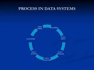
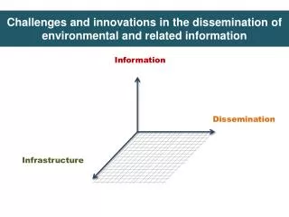
This presentation discusses the importance of 3D applications, spatial data collection, and the use of 3D primitives and topology within a database management system. It also explores 3D cadastres and concludes with the potential of 3D in mainstream GIS.

E N D
Spatial Information Management:attention for the third dimension Oracle Spatial User Conference, 11 November 2005, De Meern, The Netherlands Peter van Oosterom OTB, GIS technology
Overview • Introduction • 3D applications • 3D spatial data (collection) • 3D primitive within DBMS software • 3D topology within the DBMS • 3D cadastres • Conclusion
Introduction • Mainstream GIS use still mainly 2D due to • Limited 3D awareness at the user site • Limited availability of 3D data sets • Limited 3D support in mainstream products • However pressure on space increases • Custom-made systems have shown the potential of 3D applications (within professional organizations) • 3D data collection is getting less and less a problem • R&D to get 3D in the mainstream
Overview • Introduction • 3D applications • 3D spatial data (collection) • 3D primitive within DBMS software • 3D topology within the DBMS • 3D cadastres • Conclusion
3D applications • Taxation/valuation: volume of building • Cadastral registration: 3D volume ‘parcel’ • Telecom: location of antennas • Utility: subsurface networks of pipelines/cables • Geology: (deep) subsurface model: oil, gas, minerals,… • Aviation: 3D airspace management • Planning: new constructions in VR environment • Flooding: Water management: rivers, coastal zones,…
Virtual Reality Advanced 3D visualization +interaction (for planning) Karma: VR en 3D GIS
Overview • Introduction • 3D applications • 3D spatial data (collection) • 3D primitive within DBMS software • 3D topology within the DBMS • 3D cadastres • Conclusion
3D data collection • 3D data collection does not seam to be the problem: no longer separation between horizontal and vertical component in modern surveying (WGS84, ETRS) • GPS (Galileo) based positioning delivers 3D coord’s • Laser altimetry (Lidar) very well suited for obtaining terrain elevation models (surfaces) • Terrestrial rotating laser scanners are suited to create 3D models of objects (in addition to close range photogrammetry) • Multi-beam sonar for river, lake or sea floor mapping
3D (2.5D) data available data sets • Traditional elevation models (contour/breaklines, grid) • Modern laser altimetry based nation wide data: e.g. AHN in the Netherlands (at least 1 point per 16 m^2) • For routes/trace's even 16 point per 1 m^2 (Flymap, helicopter) • Large scale topographic data of infrastrucure (terrestrial surveys of roads, waterways) • 3D deep subsurface models (geology) • Work in progress on: 3D Cadastre and 3D Top10NL
AHN laserscan data 1 point/ 16 m2
‘Future 3D’ topographic data, options (Verbree) TIN+TEN: triangles and tetrahedrons Dual TIN (2 triangle layers)
Tetrahedrons: simple, well-defined, a ‘solid’ modeling foundation
3D data modeling aspects z-value: relative or absolute • Z-value 3D object absolute in (inter)national height reference system, drawback: • The spatial relationship between traditional 2D data sets (on the surface) and the new 3D objects, requires explicit analysis (takes time) • Z-value 3D object relative w.r.t. 2D surface, drawbacks: • absolute coordinates of 3D objects must be converted to relative coordinates • Data-consistency can be a problem (surface change)
2.5D Surfaces traditional approach Delaunay TINs • Dataset: X,Y,Z imbedded in 2.5D space • Each (X,Y)-location has only one Z-value • Construction controlled by empty circum circle criterion • Triangulation equi-angular as possible: ‘fat’ triangle, but has no direct relation with surface to represent
2 1 2 1 2 2 1 2 1 2 # # # # # # # # # # 1 2 1 2 1 1 2 1 2 1 # # # # # # # # # # 2 1 2 1 2 2 1 2 1 2 # # # # # # # # # # 1 2 1 2 1 1 2 1 2 1 # # # # # # # # # # 2 1 2 1 2 2 1 2 1 2 # # # # # # # # # # Problems with Delaunay TINs • Triangulation independent of Z-value: empty circle criterion ‘forgets’ Z-value • More than 3 points on circle: arbitrary choice
Delaunay TINs Possible bad derived results • Derivatives calculated after Z-value is ‘added’ • Contours • Slope / Aspect • Visualization • Volume statistics (view sheds, cut and fill) • These derivatives are important and could be the leading criterion for triangulation • Therefore: Data Dependent Triangulations
Numerous cost functions: Surface area Volume Angle between normals Pure DDT does not perform well on terrain data (Alboul) Large amounts of slivers Steep triangles Surface still embedded in 2.5D space No overhanging cliffs or caves possible (not ‘full’ 3D) Problems with DDTs (Data Dependent Triangulations)
Delauney Tetrahedronised Networks (TENs) • For each of the tetrahedrons in a Delaunay TEN the circumsphere should not contain any other point of the dataset
Better 2.5D Surfaces imbedded in Delaunay TENs • Step 1: Construct Delaunay TEN • Input: Target points • Step 2: Retrieve Surface TIN within this DTEN • Problem: 3D TEN yields many, many possible 2.5D TINs • Solution (Verbree): incorporate observation lines within DTEN as constraints for the surface (TIN), the ‘STIN Method’
Point cloud data type • TU Delft MSc thesis project of Martine Hoefsloot (at Fugro) • More efficient data type data the standard SDO_GEOMETRY (point or multipoint) • Efficient data storage (including meta data) for later altimetry, terrestrial laser scanning, multi-beam echo soundings, etc. • Work in progress…
Overview • Introduction • 3D applications • 3D spatial data (collection) • 3D primitive within DBMS software • 3D topology within the DBMS • 3D cadastres • Conclusion
3D DBMS software • Spatial DBMS foundation for both GIS (presentation, analysis) and CAD (creating models) • 2D data types available in DBMSs similar to OGC Simple Feature Specification (SFS) for SQL • Required 3D extensions of the geo-DBMS: • Support of 3D geometry (spatial data types including functions) • Support of 3D topological structures • 3D Spatial indexing and clustering
State of the Art: example Oracle Spatial • Supported spatial data types: point, lines, polygons (arcs, boxes, sets), that is, the 0D-2D primitives • Topology structure management is not supported (start of 2D topology structure management in 10i) • Z-values can be used to store 3D features; e.g. 3D polygons, 3D lines, 3D points (and ‘multi’ versions) • 3D Spatial indexing is available • But: z-values are not recognized in spatial functions • True 3D volume objects can not be represented
3D modeling example, creating 2D and 3D tables create table geom2d ( shape mdsys.sdo_geometry not null, TAG number(11) not null); create table geom3d ( shape mdsys.sdo_geometry not null, TAG number(11) not null); Note same data type used in 2D and 3D case
3D modeling example, filling 2D and 3D tables /* a 2D box */ insert into geom2d (TAG,shape) values (8, mdsys.SDO_GEOMETRY(2003,…, mdsys.SDO_ORDINATE_ARRAY(0,0, 100,100))); /* a 3D box */ insert into geom3d (TAG,shape) values (9, mdsys.SDO_GEOMETRY(3003,…, mdsys.SDO_ORDINATE_ARRAY(0,0,50, 100,100,50))); Note: different GTYPE and additional z-values, which are not used in the functions (distance, area,…)
Extension with 3D data types:possible 3D primitives • Tetrahedron primitive: simplest 3D primitive: • easy algorithms (volume, area, distance, buffer), • but many primitives needed for real 3D object • Polyhedron: ‘equivalent’ of 2D polygon, boundary defined by flat faces: • both boundary and interior may contain contain concavities (quite complex), • one polyhedron for one real 3D object • Polyhedron with non flat faces (sphere/cylinder): • Close to 2D situation with circular arcs Complex to define, image, compute,…
‘Normal’ Polyhedron Most Realistic Option Cave inside More than 3 vertices in a face. How flat is this face?
Normal encoding in Oracle sdo_geometry (9,24) SDO_GEOMETRY Column = ( SDO_GTYPE = 2003 SDO_SRID = NULL SDO_POINT = NULL SDO_ELEM_INFO = (1,1003,3) SDO_ORDINATES = (6,21, 9,24)) (6,21) GTYPE=2003 indicates: 2D (2xxx) and polygon (xxx3) ELEM_INFO=(1,1003,3) indicates a rectangle
3D data type: encoding proposal polyhedron in Oracle (1) Based on internal topology: first nodes, then faces insert into geom3d (shape, TAG) values ( mdsys.SDO_GEOMETRY(3008,NULL,NULL,-- polyhedron, no ref point, no srid mdsys.SDO_ELEM_INFO_ARRAY(13,1006,1-- first flat face at offset 13, -- because the first twelve positions are used for the coordinates 16,1006,1, 19,1006,1, 22,1006,1),-- others faces at 16, 19 and 22 mdsys.SDO_ORDINATE_ARRAY(0,0,0,-- coordinate triplet of point 1, 1,0,0, 0,1,0, 0,0,1,-- and of points 2, 3 and 4 1,2,3, 1,2,4, 1,3,4, 2,3,4)), -- the 4 faces by refs to the points 1));-- the TAG of example 1 Faces of outer boundary start at offset 13 New GTYPE=3008 Faces refer to the nodes
Oracle storage/ MicroStation editing(after conversion to multi-polygons) Note, the mix of 2D and 3D data
A 3D surface modeling approach • Non Uniform Rational B-Splines (NURBS) • Used for freeform curves and surfaces in CAD • Part of industry standards IGES, STEP, PHIGS • Specified via degree, control points, knots and weights • Types added: GM_NURBSCurve and GM_NURBSSurface • Prototype developed in Oracle by Pu Shi (MSc-thesis project at TU Delft)
SQL Example with NURBS // create a table with spatial column create table test(id number,col GM_NURBSCurve); // insert a NURBS curve insert into test values(2,GM_NURBSCurve(2,GM_PointArray (135,225,346,127,256,336,945,20,30,504,70,698,434,40,4), GM_KnotVector(Vector(-0.5,0,0.5,1,2,3,4,5),NULL),NULL)); //select the convex hull geometry from select a.col.convexHull() from test a;
From MicroStation to Oracle and back (without data loss)
Overview • Introduction • 3D applications • 3D spatial data (collection) • 3D primitive within DBMS software • 3D topology within the DBMS • 3D cadastres • Conclusion
Ford & James, University of Newcastle, Agile 2005 Full 3D modeling:the TEN approach Rigid approach: full volume partition, including earth and air tetrahedrons Advantages: • Air often subject of analysis: modelling noise, odour, air pollution • Model extensible: e.g. air traffic corridors, geology, petroleum reservoirs • Indoor topography (terrestrial laser scanning)
The simplex concept: point, line segment, triangle, tetrahedron, .. Advantages simplexes: • Well defined: a kD-simplex is bounded by k+1 (k-1)D-simplexes; e.g. a 2D-simplex (triangle) is bounded by 3 1D-simplexes (edges) • Flatness of faces: every face can be described by three points • A kD-simplex is convex (simple point-in-polygon tests) Disadvantage simplexes • a 1:n relationship between topographic features and their representations (set of simplexes)
face edge node feature feature feature volume feature Geo-DBMS Full 3D modeling Full portioning of 3D space by a topological tetrahedron network (TEN): model stored in DBMS Interesting concept: define views on TEN to define a TIN (sub-selection of triangles) Advantage: one data source (ensures data integrity)
TEN topology table definitions create table node(nid integer, geom sdo_geometry); create table edge(eid integer, startnode integer, endnode integer, isconstraint integer); create table triangle(trid integer, edge1 integer, edge2 integer, edge3 integer, isconstraint integer, afid integer); create table tetrahedron(tetid integer, triangle1 integer,triangle2 integer, triangle3 integer,triangle4 integer, vfid integer);
Full 3D modeling: Implementation Approach is still triangle-based: • well-defined character • strong computational and analytical capabilities • Start with four initial tetrahedrons: two air, two earth • Refine earth surface by inserting height information from a DEM • Refine air and earth tetrahedrons in case of ill-shaped tetrahedrons • Add real topographic features (in tetrahedronized form)