Download
1 / 25
250 likes | 277 Views
Study results discriminate between river ice events to provide advance warning of ice jams to emergency managers, using simulations and forecasting for ice thickness and breakup timing.

E N D
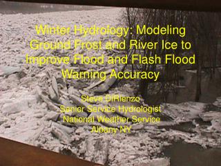
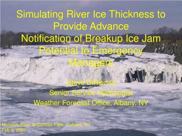
Simulating River Ice Thickness to Provide AdvanceNotification of Breakup Ice Jam Potential to Emergency Managers Steve DiRienzo Senior Service Hydrologist Weather Forecast Office, Albany, NY Mohawk River at Cohoes Falls, Cohoes, NY - Feb 9, 2007
This is Part 2 of 3… • Part 1:Winter Hydrology: Modeling River Ice and Ground Frost to Improve Flood and Flash Flood Warning Accuracy – Presented at NROWVII, Nov 2005, and NOHRSC Cold Regions Workshop Aug 2007. (Study results allow us to discriminate between events with significant river ice and those without) • Part 2: Simulating River Ice Thickness to Provide Advance Notification of Breakup Ice Jam Potentialto Emergency Managers • Part 3: Future Work: Real-Time modeling of Mohawk River near Schenectady, NY to Forecast River Stage Crest Behind Ice Jams.
Part 1: Albany River Ice Studies • When Are Freeze Up Jams Possible • How Thick Does The Ice Need To Be For Break Up Jams? • When Does The Ice Break Up? • Ice Jam Reference (.pdf) – Lists Conditions for Ice Jams and Previous Ice Jam Locations – Post on Web in Winter • Break Up Ice Jams Cause the Biggest Problems in ALY HSA!
Part 2: ALY River Ice Monitoring • During Winter – Continually Simulate Ice Thickness • When Ice is projected to reach Critical Thickness: - Visually inspect ice (Drive by where possible - NOHRSC snow survey flights elsewhere) - Schedule Meetings with County Emergency Managers and First Responders 3. Provide Ice Jam and Ice Jam Mitigation Training to Emergency Management Community 4. Monitor Weather Conditions for Breakup – Issue Watches/Warnings as Necessary
Case Study - Mohawk River Basin Ice Jams occur frequently on the main stem and many tributaries.
Case: Break Up Jam Flood on Mohawk River from Winter of 06-07 • Winter: Unusually Mild early – cold late • Little or no river ice through Mid-January • Consensus among Forecasters in late January was that we were too late in winter to develop significant ice and ice jam issues…
Mohawk River Ice January 29,2007 Little Falls, NY
Schoharie Creek River Ice – January 29, 2007 Burtonsville, NY
Mohawk River Ice January 29,2007 Rexford, NY
Ice Thickness Calculation • Ice thickness in inches is estimated using the modified Stefan equation presented in USACE Manual(2002): ti = C (AFDD)0.5 AFDD = Accumulated Freezing Degree Day • Constant C can range from 0.1 to 0.8 NWS Albany studies show C ~ 0.4 for KALY HSA (Bob Kilpatrick) • Freezing Degree Day (FDD) = 32°F – Daily Average Temp (°F) • ** Must RESET AFDD to zero (0) if/when ice melts or flushed from basin! ** USACE (2002) Engineering and Design: Ice Engineering. U.S. Army Corps of Engineers Engineer Manual 1110-2-1612.
How Thick Does The River Ice Need To Be to Jam? Previous studies showed: • Around a Foot Thick or More – Ice Rigid Enough to Cause Significant Jams • WFO ALY Critical Simulated Ice Thickness is > 11.5 in • ~ 850-900 AFDD
When Does The Ice Break Up? • Basin Daily Average Temperature >=42 °F • Daily Average Temperature = (Max Temp + Min Temp) / 2 • Caveat 1: A quick thaw will result in some ice jams and flooding if ice is thick enough (2006-2007). Long sunny period with diurnal freeze/thaw cycle can rot/weaken ice (2008-2009). • Caveat 2: Rainfall/snowmelt with a thaw will enhance the potential for break up jams as rising water helps to lift and break up the ice. A very short thaw with little or no rain/snowmelt may not be enough to break up thick ice.
Can Use AWIPS Hydroview to Monitor Basin Temperatures Can monitor where and how long temperatures are below/above freezing.
Mohawk River Basin – Data and Ice Jam Flood Location (2006-07) Lost data at KUCA due to ASOS move to KRME (No data mid-January to mid-April).
Mohawk River Ice Thickness Simulations 06-07 ti = 0.4 (AFDD)0.5 - Ice thickness set to zero when average daily temp >= 42°F
Albany Measured Ground Frost Frozen ground indicated high runoff potential.
Timeline • Late February 2007 – Began discussions on ice jam potential with emergency managers/first responders based on simulated river ice thickness, forecast increase in ice due to forecast cold temperatures, deep snow pack, frozen ground and potential for quick thaw. • Early March 2007 – Provided ice jam/ice jam mitigation training to EM Community in areas where ice was forecast to reach critical thickness. • Highlighted threat for ice jam flooding for following week in HWO on Friday March 9th, 2007 based on MENMOS and MEXMOS data. March 14th was forecast breakup date.
Results • Break up occurred on March 14th, 2007 – As predicted. • Ice jam flooding occurred along the Mohawk River in the City of Schenectady on March 15th, 2007. • Ice jams were reported in 10 of our 19 counties. • Flooding due to ice jams was reported in 8 of the 10 counties where ice jams occurred.
Schenectady, NY - March 15, 2007 Schenectady EM
Summary • Previous studies allow WFO ALY to simulate river ice thickness, quantify break up ice jam potential, and determine most likely date for break up. • Coordination with the Emergency Management community and ice jam training for First Responders gets the word out.
Where We Need To Go… • We need capability to forecast river stage crest behind the ice jam (in 2007 event we had to guess). Customers needs not being met… • We need to be able to simulate river crest real-time as severe flooding can develop very rapidly (~2 hours in 2007 Schenectady flood). • Inundation mapping also required (at least static at 1 foot elevations).
The End • Questions?